Adelaide to Perth is 1,317 miles (2,119 km), a flight of about 2 hours 45 minutes.
Right-side seats provide superior views for the majority of the flight. Takeoff offers the dramatic Mount Lofty Ranges, and the westbound routing across South Australia means right-side passengers face the Fleurieu Peninsula, Barossa Valley region, and eventually the Darling Range approach to Perth. Left-side views during takeoff are relatively flat and featureless.
Flight Path
The flight crosses the Barossa Valley wine region (inland from the coast), passes over the Eyre Peninsula's inland plateau, and approaches the Darling Range scarp west of Perth. The route generally follows a westward track at cruise altitude of 28,000-33,000 feet, offering views of South Australia's interior plateau and the transition to Western Australia's terrain. The Nullarbor Plain lies to the south but remains below the typical cruise altitude visibility threshold. Right-side passengers will see the gradual elevation changes as the aircraft approaches the Darling Range foothills.
Great circle distance and headings ›Phase by phase
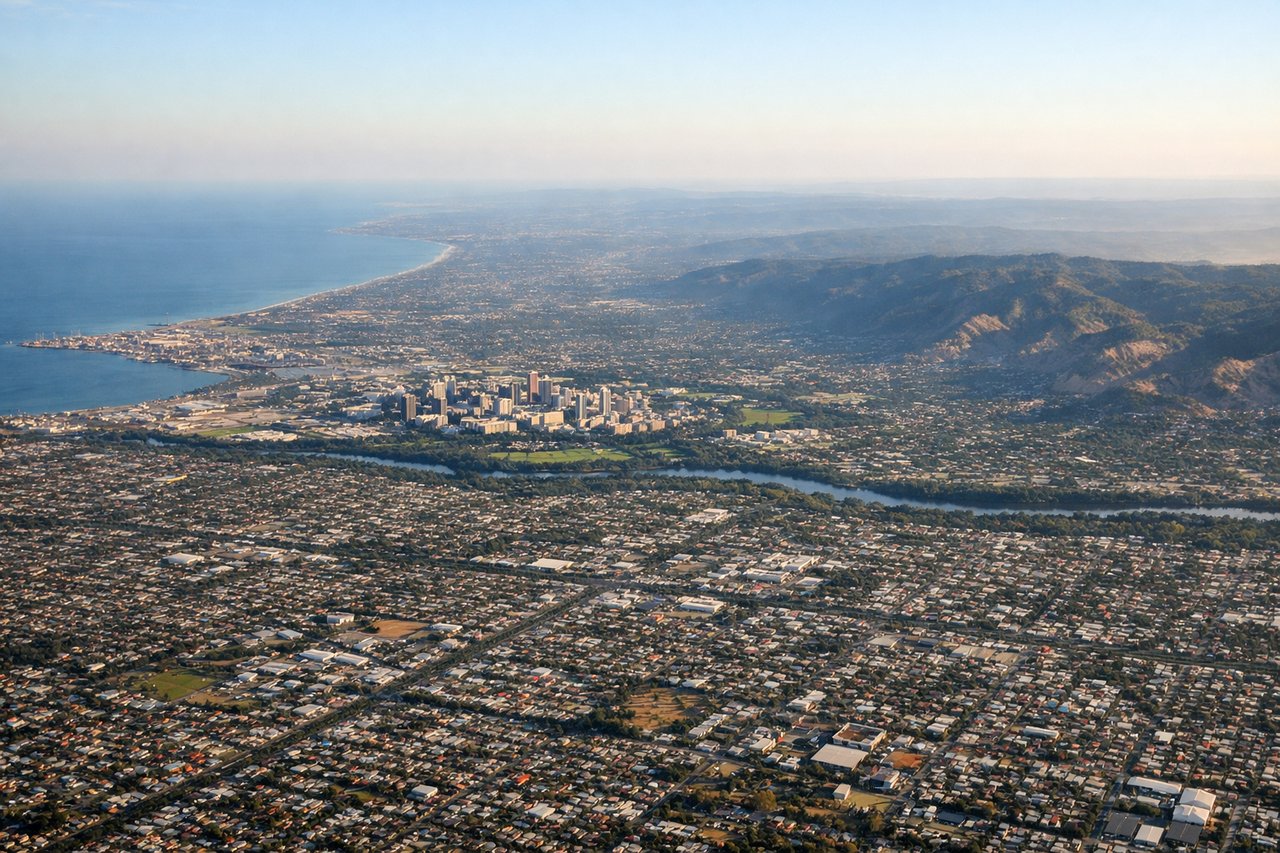
Takeoff from ADL
RIGHTRight-side seats capture the Mount Lofty Ranges as the aircraft climbs westward from Adelaide's primary runways (05/23). The ranges form a dramatic escarpment immediately south of the airport, visible during the initial climb-out before the aircraft turns toward Perth.
Landing at JAD
LEFTLeft-side seats offer views of the Swan River estuary and Perth's western suburbs during approach to Jandakot from the east. Aircraft typically descend over the Darling Range foothills, and left-side passengers see the river system and coastal plain spreading westward toward the Indian Ocean.
Landmarks on this routeAll landmarks →
Will your flight be in sunlight?
Pick a date and time in the Sun Map to watch the sun move across your whole flight.
About This Route
Which side of the plane should I sit on flying from Adelaide International (ADL) to Perth Jandakot (JAD)?
Sit on the Right side of the plane for the best views on flights from Adelaide to Perth. Right-side seats provide superior views for the majority of the flight. Takeoff offers the dramatic Mount Lofty Ranges, and the westbound routing across South Australia means right-side passengers face the Fleurieu Peninsula, Barossa Valley region, and eventually the Darling Range approach to Perth. Left-side views during takeoff are relatively flat and featureless.
What can I see during takeoff from Adelaide International in Adelaide?
During takeoff from Adelaide International (ADL), sit on the Right side for the best views. Right-side seats capture the Mount Lofty Ranges as the aircraft climbs westward from Adelaide's primary runways (05/23). The ranges form a dramatic escarpment immediately south of the airport, visible during the initial climb-out before the aircraft turns toward Perth. Notable sights include: Mount Lofty Ranges (escarpment to the south), Adelaide Hills (forested ridgeline), Gulf St Vincent (water body to the northwest), Adelaide city grid (urban sprawl to the north).
What can I see when landing at Perth Jandakot in Perth?
When landing at Perth Jandakot (JAD), sit on the Left side for the best views. Left-side seats offer views of the Swan River estuary and Perth's western suburbs during approach to Jandakot from the east. Aircraft typically descend over the Darling Range foothills, and left-side passengers see the river system and coastal plain spreading westward toward the Indian Ocean. Notable sights include: Swan River estuary (meandering waterway), Darling Range (forested hills to the east), Perth city skyline (distant urban cluster), Jandakot airfield surroundings (flat terrain with scattered development).
How long is the flight from Adelaide to Perth?
The flight from Adelaide International (ADL) to Perth Jandakot (JAD) takes about 2 hours 45 minutes. The shortest flight path between them is 1,317 miles (2,119 km); winds and air traffic control usually add a few percent.
What does the Adelaide to Perth flight path pass over?
The flight crosses the Barossa Valley wine region (inland from the coast), passes over the Eyre Peninsula's inland plateau, and approaches the Darling Range scarp west of Perth. The route generally follows a westward track at cruise altitude of 28,000-33,000 feet, offering views of South Australia's interior plateau and the transition to Western Australia's terrain. The Nullarbor Plain lies to the south but remains below the typical cruise altitude visibility threshold. Right-side passengers will see the gradual elevation changes as the aircraft approaches the Darling Range foothills.