While the left side offers Auckland's harbour skyline, Tongariro's volcanoes, and the Kaikoura coast, the right side delivers a sustained, dramatic mountain backdrop from the Waitakere Ranges at takeoff through to the Southern Alps and Aoraki/Mount Cook on final approach into Christchurch, giving it more consistent visual payoff across the whole flight.
Flight Path
Route crosses the lower North Island near the central volcanic plateau (Ruapehu, Ngauruhoe, Tongariro), then over Cook Strait, before tracking down the South Island's east coast past the Kaikoura Ranges and onto the Canterbury Plains with the Southern Alps visible inland.
Great circle distance and headings ›Phase by phase
Takeoff from AKL
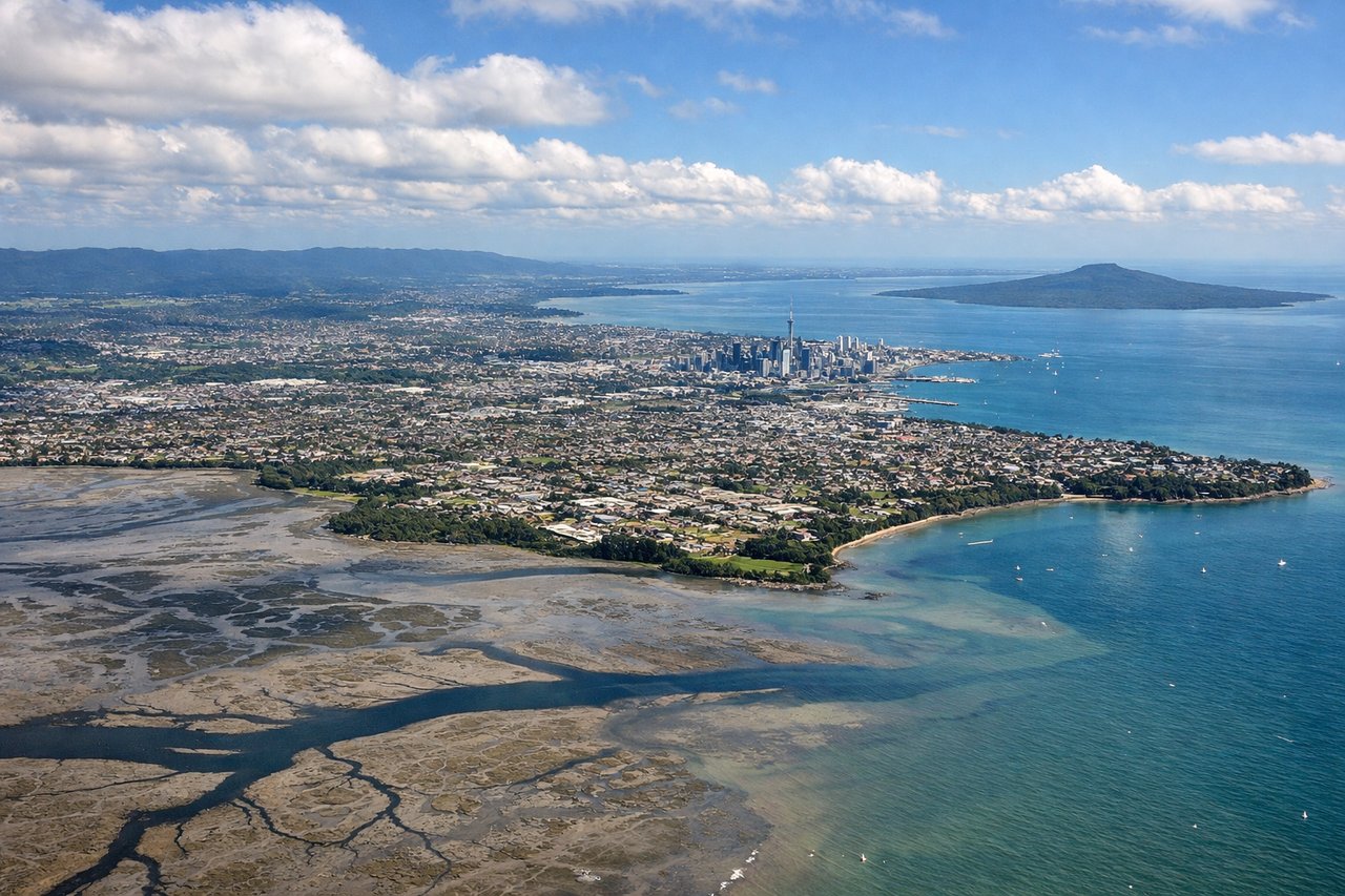
LEFTDeparting AKL on runway 23L, the climb-out curves south with the Auckland CBD and Sky Tower sliding into view over the left shoulder across Manukau Harbour before the city recedes. The right side mostly shows the lower Waitakere Ranges and open Tasman coastline, which is scenic but less distinctive than the harbour city skyline.
Landing at CHC
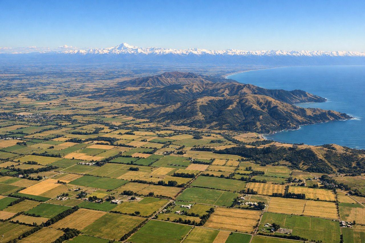
RIGHTOn approach into Christchurch, the aircraft tracks south over the Canterbury Plains with the snow-capped Southern Alps and Torlesse Range foothills filling the western horizon on the right. The left side shows mainly the flat, less distinctive Pegasus Bay coastline.
Will your flight be in sunlight?
See exactly which side of the plane gets sun and shade at your departure time.
About This Route
Which side of the plane should I sit on flying from Auckland International (AKL) to Christchurch International (CHC)?
Sit on the Right side of the plane for the best views on flights from Auckland to Christchurch. While the left side offers Auckland's harbour skyline, Tongariro's volcanoes, and the Kaikoura coast, the right side delivers a sustained, dramatic mountain backdrop from the Waitakere Ranges at takeoff through to the Southern Alps and Aoraki/Mount Cook on final approach into Christchurch, giving it more consistent visual payoff across the whole flight.
What can I see during takeoff from Auckland International in Auckland?
During takeoff from Auckland International (AKL), sit on the Left side for the best views. Departing AKL on runway 23L, the climb-out curves south with the Auckland CBD and Sky Tower sliding into view over the left shoulder across Manukau Harbour before the city recedes. The right side mostly shows the lower Waitakere Ranges and open Tasman coastline, which is scenic but less distinctive than the harbour city skyline. Notable sights include: Auckland CBD skyline and Sky Tower, Manukau Harbour and Mangere Bridge, Rangitoto Island in the distance, Waitemata Harbour glimpse.
What can I see when landing at Christchurch International in Christchurch?
When landing at Christchurch International (CHC), sit on the Right side for the best views. On approach into Christchurch, the aircraft tracks south over the Canterbury Plains with the snow-capped Southern Alps and Torlesse Range foothills filling the western horizon on the right. The left side shows mainly the flat, less distinctive Pegasus Bay coastline. Notable sights include: Southern Alps skyline with distant Aoraki/Mount Cook, Torlesse Range foothills, Canterbury Plains farmland, Waimakariri River braided channels.
How long is the flight from Auckland to Christchurch?
The flight from Auckland International (AKL) to Christchurch International (CHC) takes 1h 35m.
What does the Auckland to Christchurch flight path pass over?
Route crosses the lower North Island near the central volcanic plateau (Ruapehu, Ngauruhoe, Tongariro), then over Cook Strait, before tracking down the South Island's east coast past the Kaikoura Ranges and onto the Canterbury Plains with the Southern Alps visible inland.