While the takeoff offers Ankara's urban and plateau views, the landing provides more dramatic and visually distinctive scenery with Tampa Bay's complex coastal geography, barrier islands, and water features. The landing approach compensates for a less scenic departure.
Flight Path
The flight path crosses the Atlantic Ocean for approximately 6-7 hours over open water with no significant landmarks. The route typically passes south of Greenland and Iceland, then over the North Atlantic. Approaching North America, the eastern seaboard becomes visible with the Appalachian Mountains appearing as a distant ridge on the horizon during descent into Florida. The Bahamas' shallow turquoise waters and island chains may be visible if the approach vector allows.
Great circle distance and headings ›_in_Istanbul.jpg?width=600)
.jpg?width=600)

.jpeg?width=600)
Phase by phase
Takeoff from ANK
LEFTLeft side offers views of the Ankara metropolitan area and the surrounding Anatolian plateau terrain as the aircraft climbs northwestward. The city sprawl and the transition to open steppe landscape provide clear visual reference points during the initial climb phase.
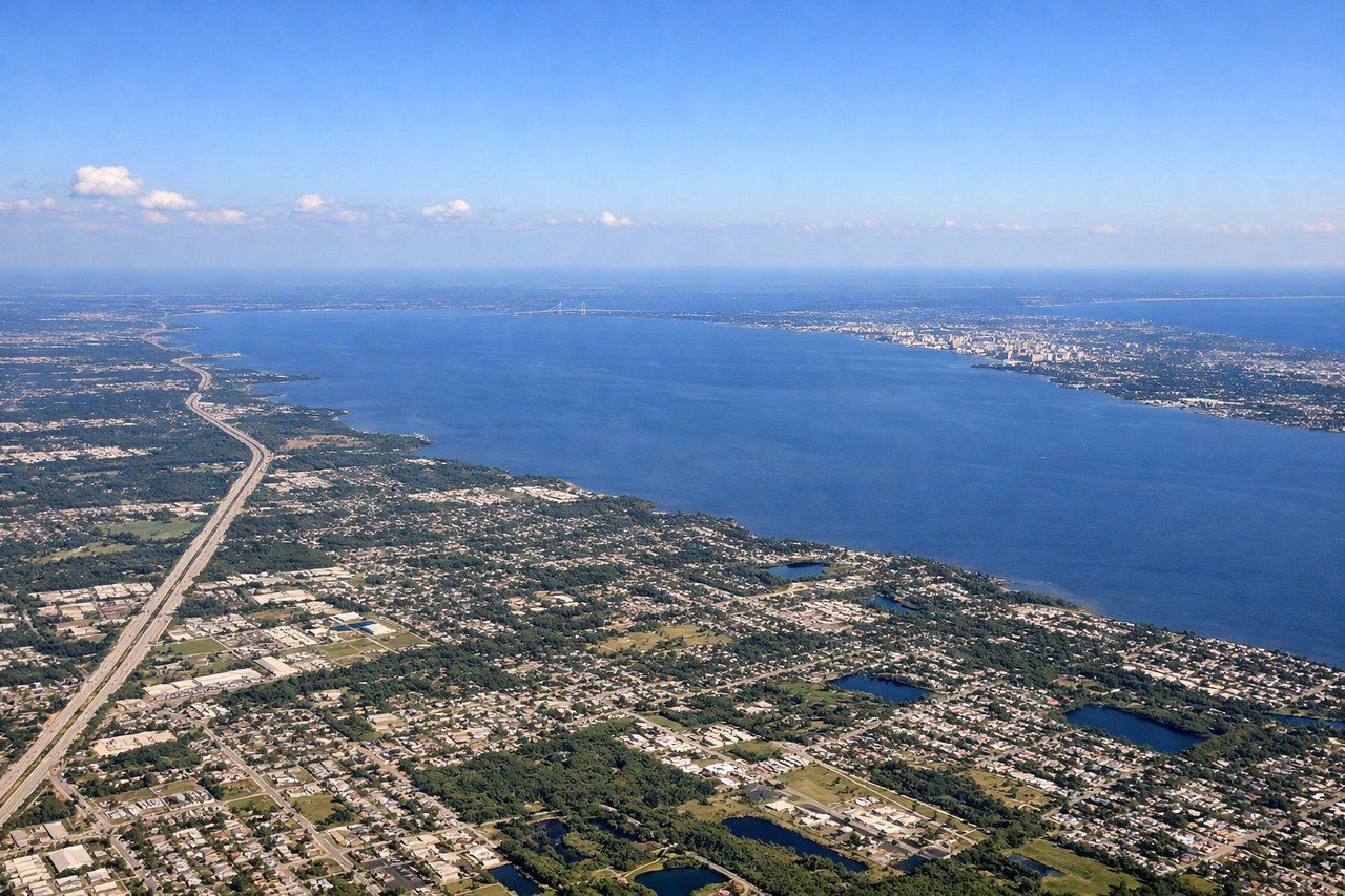
Landing at TPA
RIGHTRight side provides views of the Florida Gulf Coast, Tampa Bay, and the distinctive coastal geography as the aircraft descends for approach. The bay's shape, barrier islands, and the transition from open water to developed coastal areas are striking visual landmarks during final descent.
Landmarks on this routeAll landmarks →
Will your flight be in sunlight?
See exactly which side of the plane gets sun and shade at your departure time.
About This Route
Which side of the plane should I sit on flying from Etimesgut (ANK) to Tampa International (TPA)?
Sit on the Right side of the plane for the best views on flights from Ankara to Tampa. While the takeoff offers Ankara's urban and plateau views, the landing provides more dramatic and visually distinctive scenery with Tampa Bay's complex coastal geography, barrier islands, and water features. The landing approach compensates for a less scenic departure.
What can I see during takeoff from Etimesgut in Ankara?
During takeoff from Etimesgut (ANK), sit on the Left side for the best views. Left side offers views of the Ankara metropolitan area and the surrounding Anatolian plateau terrain as the aircraft climbs northwestward. The city sprawl and the transition to open steppe landscape provide clear visual reference points during the initial climb phase. Notable sights include: Ankara city center and suburbs, Anatolian Plateau terrain, Kızılırmak River valley to the north.
What can I see when landing at Tampa International in Tampa?
When landing at Tampa International (TPA), sit on the Right side for the best views. Right side provides views of the Florida Gulf Coast, Tampa Bay, and the distinctive coastal geography as the aircraft descends for approach. The bay's shape, barrier islands, and the transition from open water to developed coastal areas are striking visual landmarks during final descent. Notable sights include: Tampa Bay and its barrier islands, Gulf of Mexico coastline, Hillsborough River estuary, downtown Tampa waterfront.
How long is the flight from Ankara to Tampa?
The flight from Etimesgut (ANK) to Tampa International (TPA) takes 10h 15m.
What does the Ankara to Tampa flight path pass over?
The flight path crosses the Atlantic Ocean for approximately 6-7 hours over open water with no significant landmarks. The route typically passes south of Greenland and Iceland, then over the North Atlantic. Approaching North America, the eastern seaboard becomes visible with the Appalachian Mountains appearing as a distant ridge on the horizon during descent into Florida. The Bahamas' shallow turquoise waters and island chains may be visible if the approach vector allows.