Oranjestad to Dallas-Fort Worth is 2,213 miles (3,561 km), a flight of about 4 hours 15 minutes.
Right-side seats win for both departure and arrival. You capture Aruba's Caribbean coastline during climb-out and the entire DFW metroplex and Trinity River system during descent—two visually distinct and geographically significant segments of the flight.
Flight Path
Gulf of Mexico (crossing at roughly 27°N, 93°W—visible as open water with no landmarks), Yucatan Peninsula's northern tip (distant, on horizon during mid-flight), Louisiana and Texas coastlines with barrier islands and coastal wetlands, Mississippi River delta region (if visible during descent corridor)
Great circle distance and headings ›

Phase by phase
Takeoff from AUA
RIGHTRight-side seats capture Aruba's distinctive coastline and the Caribbean Sea as you climb out northwestward. You'll see the island's southern shore with its white beaches and turquoise waters receding beneath the aircraft.
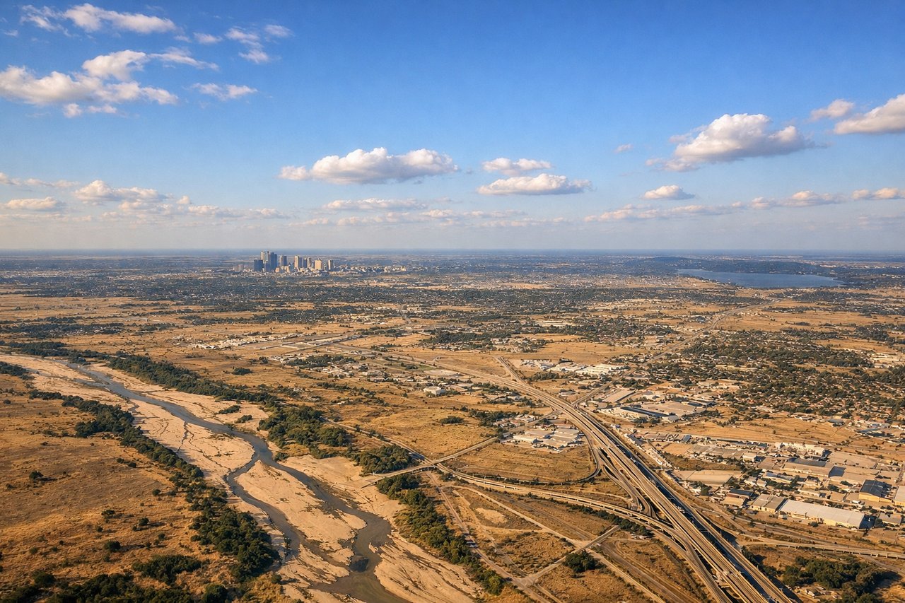
Landing at DFW
RIGHTRight-side seats offer the best views during descent into DFW. You'll see the sprawling Dallas-Fort Worth metroplex, the Trinity River system, and the distinctive grid of highways converging on the airport from the south and east.
Landmarks on this routeAll landmarks →
Will your flight be in sunlight?
Pick a date and time in the Sun Map to watch the sun move across your whole flight.
About This Route
Which side of the plane should I sit on flying from Reina Beatrix International (AUA) to Dallas Fort Worth International (DFW)?
Sit on the Right side of the plane for the best views on flights from Oranjestad to Dallas-Fort Worth. Right-side seats win for both departure and arrival. You capture Aruba's Caribbean coastline during climb-out and the entire DFW metroplex and Trinity River system during descent—two visually distinct and geographically significant segments of the flight.
What can I see during takeoff from Reina Beatrix International in Oranjestad?
During takeoff from Reina Beatrix International (AUA), sit on the Right side for the best views. Right-side seats capture Aruba's distinctive coastline and the Caribbean Sea as you climb out northwestward. You'll see the island's southern shore with its white beaches and turquoise waters receding beneath the aircraft. Notable sights include: Aruba's southern coastline, Caribbean Sea, Oranjestad harbor area, Venezuelan coast (distant, on horizon).
What can I see when landing at Dallas Fort Worth International in Dallas-Fort Worth?
When landing at Dallas Fort Worth International (DFW), sit on the Right side for the best views. Right-side seats offer the best views during descent into DFW. You'll see the sprawling Dallas-Fort Worth metroplex, the Trinity River system, and the distinctive grid of highways converging on the airport from the south and east. Notable sights include: Dallas-Fort Worth urban sprawl, Trinity River, Interstate 35E corridor, Lake Lewisville (north of approach path).
How long is the flight from Oranjestad to Dallas-Fort Worth?
The flight from Reina Beatrix International (AUA) to Dallas Fort Worth International (DFW) takes about 4 hours 15 minutes. The shortest flight path between them is 2,213 miles (3,561 km); winds and air traffic control usually add a few percent.
What does the Oranjestad to Dallas-Fort Worth flight path pass over?
Gulf of Mexico (crossing at roughly 27°N, 93°W—visible as open water with no landmarks), Yucatan Peninsula's northern tip (distant, on horizon during mid-flight), Louisiana and Texas coastlines with barrier islands and coastal wetlands, Mississippi River delta region (if visible during descent corridor)