The right side delivers the more dramatic and geographically interesting takeoff view with Birmingham's ridgeline topography and the Vulcan statue, which is the more memorable moment of this short flight. The landing view on the left is good but Atlanta's sprawl is less visually distinctive than Birmingham's valley-and-ridge geography on departure.
Flown BHM to ATL? Did we get it right?
Flight Path
Birmingham to Atlanta is 134 miles (215 km), a flight of about 50 minutes.
The flight crosses the Talladega National Forest and the Talladega Mountains, a section of the Appalachian Ridge and Valley system. The Coosa River valley is visible below around the midpoint near Talladega. As the aircraft crosses into Georgia, the terrain flattens into the Piedmont plateau. The Anniston area and its surrounding ridges are visible early in the flight before the landscape transitions to rolling Georgia pine forest.
Great circle distance and headings ›Phase by phase
Takeoff from BHM
RIGHTBHM's primary departure runway 24 sends aircraft southwest before turning east toward Atlanta. The right side picks up downtown Birmingham's skyline, Red Mountain with the Vulcan statue, and the broader Jones Valley as the aircraft climbs and banks. The left side faces mostly suburban sprawl to the north.
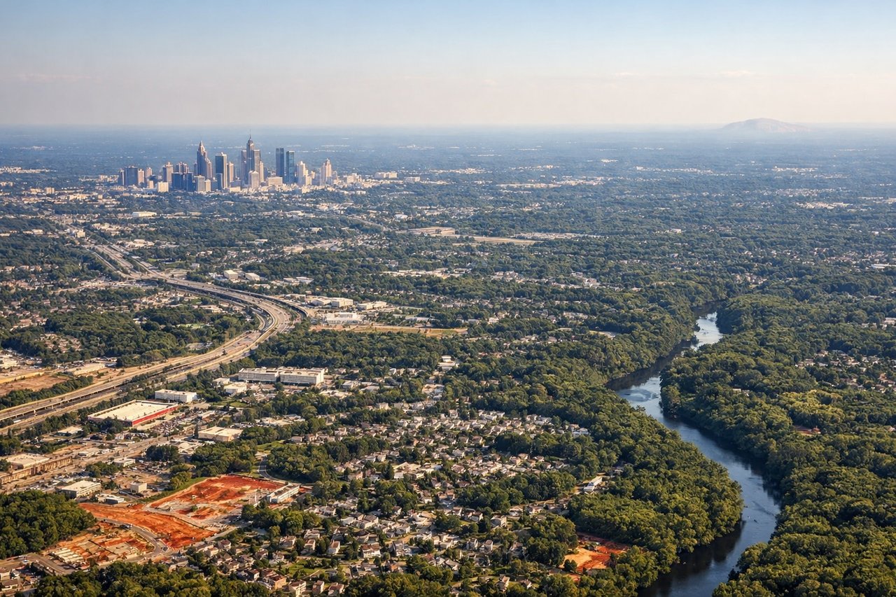
Landing at ATL
LEFTFlights from BHM typically approach ATL from the west on runway 26L or 27R, meaning the aircraft tracks eastward and the left side faces south toward downtown Atlanta and the city's northern suburbs. The left seat gets a clear look at the Atlanta skyline as the aircraft descends through 5,000-8,000 feet on final approach. The right side faces north toward less distinctive suburban terrain.
Will your flight be in sunlight?
Pick a date and time in the Sun Map to watch the sun move across your whole flight.
About This Route
Which side of the plane should I sit on flying from Birmingham International (BHM) to The William B Hartsfield Atlanta International (ATL)?
Sit on the Right side of the plane for the best views on flights from Birmingham to Atlanta. The right side delivers the more dramatic and geographically interesting takeoff view with Birmingham's ridgeline topography and the Vulcan statue, which is the more memorable moment of this short flight. The landing view on the left is good but Atlanta's sprawl is less visually distinctive than Birmingham's valley-and-ridge geography on departure.
What can I see during takeoff from Birmingham International in Birmingham?
During takeoff from Birmingham International (BHM), sit on the Right side for the best views. BHM's primary departure runway 24 sends aircraft southwest before turning east toward Atlanta. The right side picks up downtown Birmingham's skyline, Red Mountain with the Vulcan statue, and the broader Jones Valley as the aircraft climbs and banks. The left side faces mostly suburban sprawl to the north. Notable sights include: Downtown Birmingham skyline, Red Mountain and Vulcan statue, Jones Valley, Shades Mountain ridge to the south.
What can I see when landing at The William B Hartsfield Atlanta International in Atlanta?
When landing at The William B Hartsfield Atlanta International (ATL), sit on the Left side for the best views. Flights from BHM typically approach ATL from the west on runway 26L or 27R, meaning the aircraft tracks eastward and the left side faces south toward downtown Atlanta and the city's northern suburbs. The left seat gets a clear look at the Atlanta skyline as the aircraft descends through 5,000-8,000 feet on final approach. The right side faces north toward less distinctive suburban terrain. Notable sights include: Downtown Atlanta skyline, Stone Mountain (visible to the east on approach), Hartsfield-Jackson airport complex, Chattahoochee River corridor.
How long is the flight from Birmingham to Atlanta?
The flight from Birmingham International (BHM) to The William B Hartsfield Atlanta International (ATL) takes about 50 minutes. The shortest flight path between them is 134 miles (215 km); winds and air traffic control usually add a few percent.
What does the Birmingham to Atlanta flight path pass over?
The flight crosses the Talladega National Forest and the Talladega Mountains, a section of the Appalachian Ridge and Valley system. The Coosa River valley is visible below around the midpoint near Talladega. As the aircraft crosses into Georgia, the terrain flattens into the Piedmont plateau. The Anniston area and its surrounding ridges are visible early in the flight before the landscape transitions to rolling Georgia pine forest.