The left side wins overall thanks to more varied terrain during takeoff near Bangalore's hills, a scenic cruise passing over Myanmar's mountain ridges and the Yunnan Plateau, and a rare Mount Fuji sighting on descent into Tokyo. The right side spends most of the flight over featureless ocean and flat coastal plains.
Flown BLR to NRT? Did we get it right?
Flight Path
Bangalore to Tokyo is 4,164 miles (6,701 km), a flight of about 8 hours 10 minutes.
Bay of Bengal, Myanmar's Shan Hills, Yunnan Plateau ridgelines, and the East China Sea coastline near Shanghai
Great circle distance and headings ›


Phase by phase

Takeoff from BLR
LEFTDeparting BLR and turning northeast toward Japan, the left side faces the city and the rolling terrain toward the Deccan Plateau and Nandi Hills, giving a brief glimpse of Bangalore's sprawl before the climb levels off. The right side mostly shows flat farmland with little contrast.
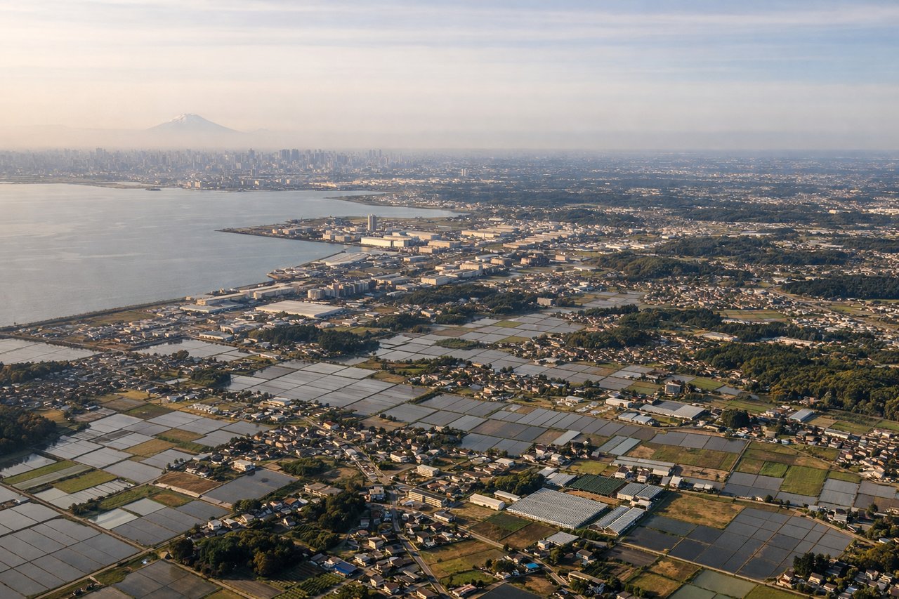
Landing at NRT
LEFTOn approach into NRT from the northwest, the left side typically offers a view over the Chiba countryside and, on clear days, a distant look at Mount Fuji's silhouette to the southwest before the final turn. The right side mainly shows Tokyo Bay's flat industrial coastline with less relief.
Will your flight be in sunlight?
Pick a date and time in the Sun Map to watch the sun move across your whole flight.
About This Route
Which side of the plane should I sit on flying from Kempegowda International Airport Bengaluru (BLR) to New Tokyo International (NRT)?
Sit on the Left side of the plane for the best views on flights from Bangalore to Tokyo. The left side wins overall thanks to more varied terrain during takeoff near Bangalore's hills, a scenic cruise passing over Myanmar's mountain ridges and the Yunnan Plateau, and a rare Mount Fuji sighting on descent into Tokyo. The right side spends most of the flight over featureless ocean and flat coastal plains.
What can I see during takeoff from Kempegowda International Airport Bengaluru in Bangalore?
During takeoff from Kempegowda International Airport Bengaluru (BLR), sit on the Left side for the best views. Departing BLR and turning northeast toward Japan, the left side faces the city and the rolling terrain toward the Deccan Plateau and Nandi Hills, giving a brief glimpse of Bangalore's sprawl before the climb levels off. The right side mostly shows flat farmland with little contrast. Notable sights include: Bangalore urban sprawl, Nandi Hills foothills, Deccan Plateau edge.
What can I see when landing at New Tokyo International in Tokyo?
When landing at New Tokyo International (NRT), sit on the Left side for the best views. On approach into NRT from the northwest, the left side typically offers a view over the Chiba countryside and, on clear days, a distant look at Mount Fuji's silhouette to the southwest before the final turn. The right side mainly shows Tokyo Bay's flat industrial coastline with less relief. Notable sights include: Mount Fuji (distant), Chiba rice fields and rivers, Tokyo Bay coastline.
How long is the flight from Bangalore to Tokyo?
The flight from Kempegowda International Airport Bengaluru (BLR) to New Tokyo International (NRT) takes about 8 hours 10 minutes. The shortest flight path between them is 4,164 miles (6,701 km); winds and air traffic control usually add a few percent.
What does the Bangalore to Tokyo flight path pass over?
Bay of Bengal, Myanmar's Shan Hills, Yunnan Plateau ridgelines, and the East China Sea coastline near Shanghai