Bogota to San Andres Island is 750 miles (1,208 km), a flight of about 2 hours 10 minutes.
While landing favors the left, the takeoff view of the Cordillera Oriental is more geographically dramatic and distinctive. The climb-out provides extended views of major Andean peaks that are genuinely impressive from altitude, whereas the landing approach, though scenic, is relatively brief and the island itself is small.
Flight Path
The flight path crosses from the high Andean plateau (2,600m elevation at Bogota) northeastward over progressively lower terrain. You'll pass over the Magdalena River valley and its tributaries, transitioning from mountainous terrain to the Caribbean lowlands. The landscape shifts from green mountain slopes to flatter agricultural and forested areas. Around the midpoint, you cross from Colombian mainland toward the Caribbean basin. The Caribbean Sea becomes visible with its characteristic deep blue color contrasting with shallow bank areas. No major cities are directly on this route, but the terrain transition from Andes to coastal plain is the dominant geographical feature of the flight.
Great circle distance and headings ›.jpg?width=600)

Phase by phase
Takeoff from BOG
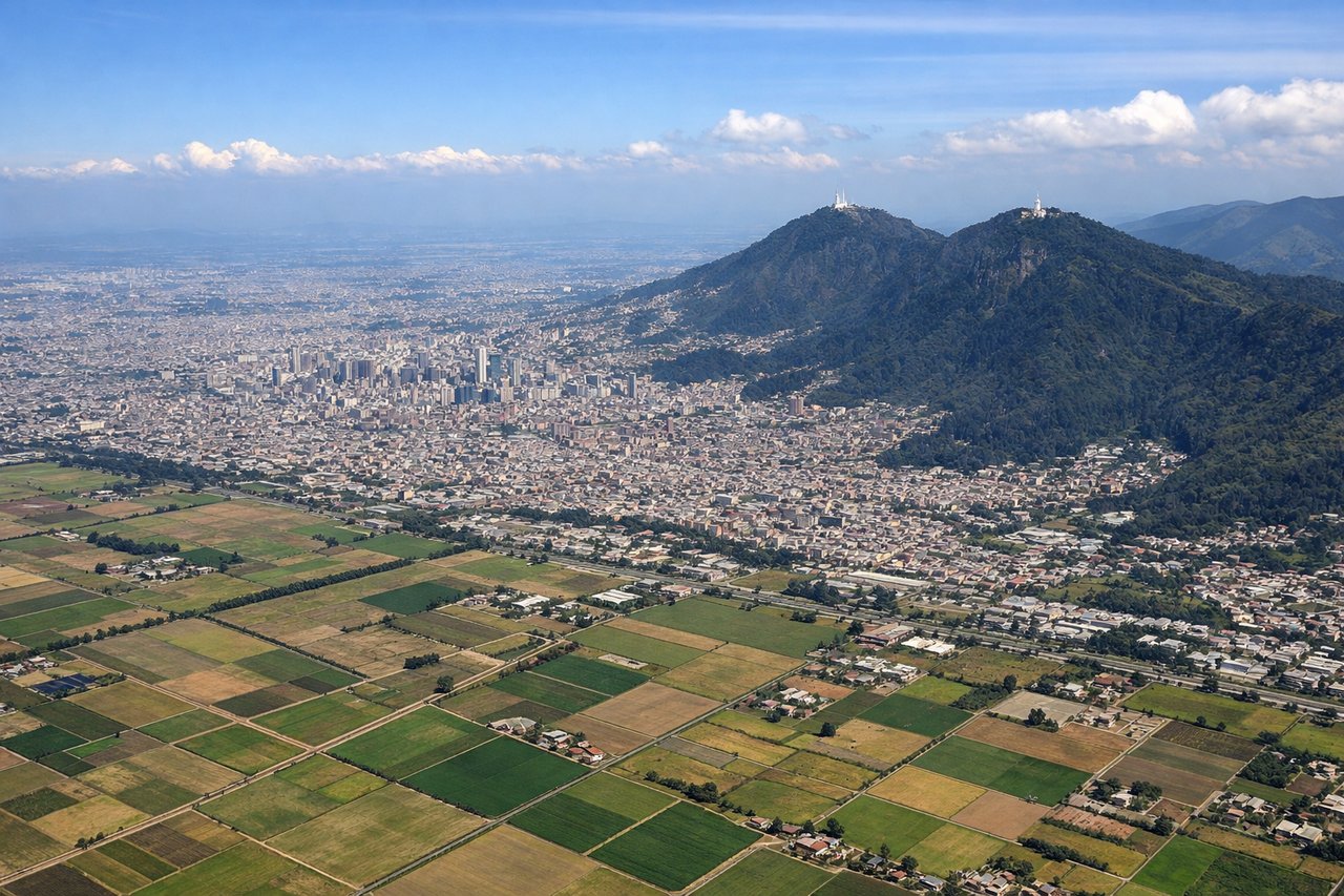
RIGHTEldorado typically departs to the north or northeast. Right-side seats offer views of the Cordillera Oriental (Eastern Range) of the Colombian Andes as you climb out, with the high peaks becoming progressively more visible. Left side faces the urban sprawl of Bogota and surrounding valleys with less dramatic terrain.
Landing at ADZ
LEFTApproaching San Andres from the southwest (typical approach vector), left-side seats provide direct views of the Caribbean Sea, the island's distinctive shape, and the surrounding shallow turquoise waters and reef systems. Right side faces open ocean with less visual interest during final approach.
Landmarks on this routeAll landmarks →
Will your flight be in sunlight?
Pick a date and time in the Sun Map to watch the sun move across your whole flight.
About This Route
Which side of the plane should I sit on flying from Eldorado International (BOG) to Gustavo Rojas Pinilla (ADZ)?
Sit on the Right side of the plane for the best views on flights from Bogota to San Andres Island. While landing favors the left, the takeoff view of the Cordillera Oriental is more geographically dramatic and distinctive. The climb-out provides extended views of major Andean peaks that are genuinely impressive from altitude, whereas the landing approach, though scenic, is relatively brief and the island itself is small.
What can I see during takeoff from Eldorado International in Bogota?
During takeoff from Eldorado International (BOG), sit on the Right side for the best views. Eldorado typically departs to the north or northeast. Right-side seats offer views of the Cordillera Oriental (Eastern Range) of the Colombian Andes as you climb out, with the high peaks becoming progressively more visible. Left side faces the urban sprawl of Bogota and surrounding valleys with less dramatic terrain. Notable sights include: Cordillera Oriental peaks (including Monserrate at 3,152m visible near the airport), Bogota urban grid and surrounding high-altitude plateau (Sabana de Bogota), Tequendama Falls area to the southwest, Rio Magdalena valley beginning to open northward.
What can I see when landing at Gustavo Rojas Pinilla in San Andres Island?
When landing at Gustavo Rojas Pinilla (ADZ), sit on the Left side for the best views. Approaching San Andres from the southwest (typical approach vector), left-side seats provide direct views of the Caribbean Sea, the island's distinctive shape, and the surrounding shallow turquoise waters and reef systems. Right side faces open ocean with less visual interest during final approach. Notable sights include: San Andres Island's curved coastline and town, Caribbean Sea with visible reef patterns in shallow water (turquoise coloration), Old Providence Island visible to the south, Providencia Bank shallow water features.
How long is the flight from Bogota to San Andres Island?
The flight from Eldorado International (BOG) to Gustavo Rojas Pinilla (ADZ) takes about 2 hours 10 minutes. The shortest flight path between them is 750 miles (1,208 km); winds and air traffic control usually add a few percent.
What does the Bogota to San Andres Island flight path pass over?
The flight path crosses from the high Andean plateau (2,600m elevation at Bogota) northeastward over progressively lower terrain. You'll pass over the Magdalena River valley and its tributaries, transitioning from mountainous terrain to the Caribbean lowlands. The landscape shifts from green mountain slopes to flatter agricultural and forested areas. Around the midpoint, you cross from Colombian mainland toward the Caribbean basin. The Caribbean Sea becomes visible with its characteristic deep blue color contrasting with shallow bank areas. No major cities are directly on this route, but the terrain transition from Andes to coastal plain is the dominant geographical feature of the flight.