While the right side wins at takeoff for the Andes views, the left side captures the Toronto waterfront and skyline on approach, which is the more iconic and memorable single view of the flight. Over the Caribbean and Gulf of Mexico portions, neither side has a decisive advantage, but the left side also picks up better views of the Colombian llanos and Venezuelan coast during the early cruise phase.
Flight Path
After departing Bogota, the route tracks northeast over the Colombian Llanos (vast flat savanna east of the Andes), crosses the Venezuelan coast and the southern Caribbean Sea, passes over or near the island of Hispaniola and Cuba, crosses the Florida Straits, then tracks north over the eastern United States through the Appalachian highlands of the Carolinas and Virginia, over Pennsylvania, and into southern Ontario. The Caribbean island chain and the Appalachian ridgeline are the most visually distinctive midpoint features.
Great circle distance and headings ›.jpg?width=600)

.jpeg?width=600)

Phase by phase
Takeoff from BOG
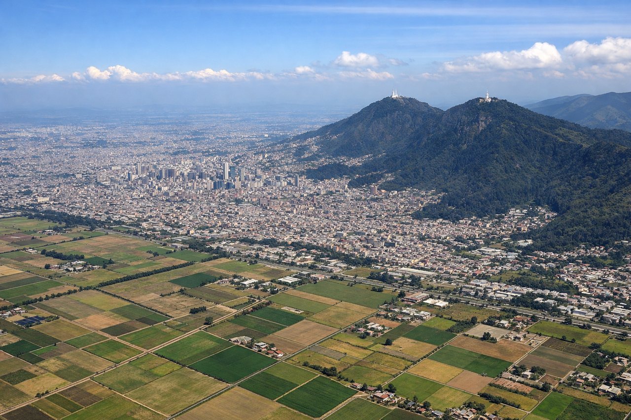
RIGHTBogota's El Dorado airport primarily uses runways oriented roughly east-west (13/31 and 14/32). On a northbound departure climbing out to the right (east side), you get a clear view of the Eastern Cordillera of the Andes rising immediately east of the city, including the iconic flat-topped cerros of Monserrate and Guadalupe directly overlooking Bogota's urban grid. The city itself spreads across the Sabana de Bogota plateau at 8,600 feet, making the surrounding terrain dramatically visible even at low altitude.
Landing at YYZ
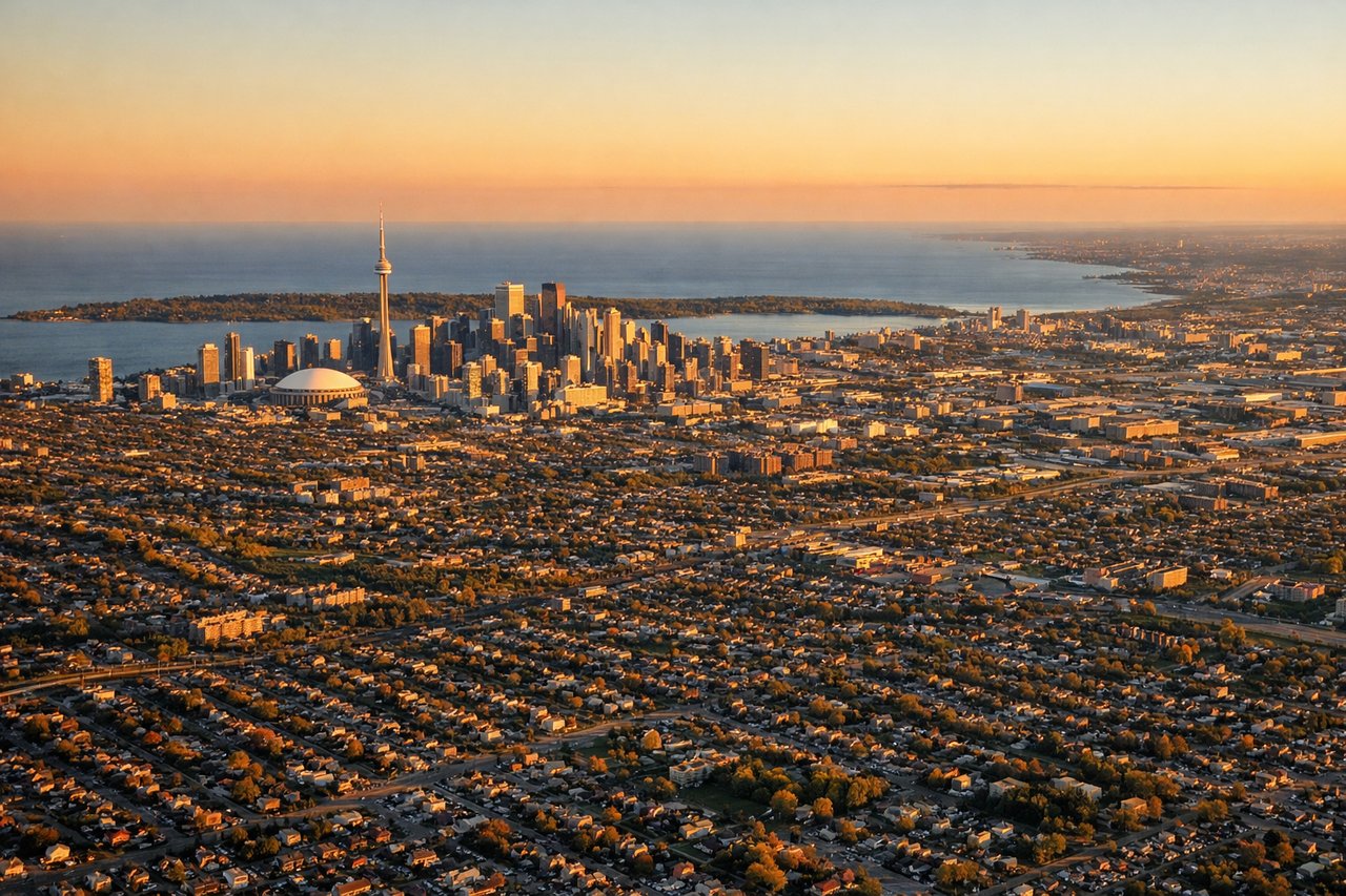
LEFTPearson's primary arrival runways for traffic from the south are typically 23 or 24L/24R, meaning aircraft approach from the southeast over Lake Ontario. On the left side, you get a clear view of the Toronto skyline including the CN Tower, the downtown waterfront, and the expanse of Lake Ontario stretching south. This is one of the most recognizable urban approaches in North America.
Landmarks on this routeAll landmarks →
Will your flight be in sunlight?
See exactly which side of the plane gets sun and shade at your departure time.
About This Route
Which side of the plane should I sit on flying from Eldorado International (BOG) to Lester B Pearson International (YYZ)?
Sit on the Left side of the plane for the best views on flights from Bogota to Toronto. While the right side wins at takeoff for the Andes views, the left side captures the Toronto waterfront and skyline on approach, which is the more iconic and memorable single view of the flight. Over the Caribbean and Gulf of Mexico portions, neither side has a decisive advantage, but the left side also picks up better views of the Colombian llanos and Venezuelan coast during the early cruise phase.
What can I see during takeoff from Eldorado International in Bogota?
During takeoff from Eldorado International (BOG), sit on the Right side for the best views. Bogota's El Dorado airport primarily uses runways oriented roughly east-west (13/31 and 14/32). On a northbound departure climbing out to the right (east side), you get a clear view of the Eastern Cordillera of the Andes rising immediately east of the city, including the iconic flat-topped cerros of Monserrate and Guadalupe directly overlooking Bogota's urban grid. The city itself spreads across the Sabana de Bogota plateau at 8,600 feet, making the surrounding terrain dramatically visible even at low altitude. Notable sights include: Cerro Monserrate and Cerro Guadalupe (the twin peaks east of the city with visible church/shrine structures), the Sabana de Bogota plateau stretching south, the dense urban grid of central Bogota below, and the Sumapaz Paramo highlands to the south.
What can I see when landing at Lester B Pearson International in Toronto?
When landing at Lester B Pearson International (YYZ), sit on the Left side for the best views. Pearson's primary arrival runways for traffic from the south are typically 23 or 24L/24R, meaning aircraft approach from the southeast over Lake Ontario. On the left side, you get a clear view of the Toronto skyline including the CN Tower, the downtown waterfront, and the expanse of Lake Ontario stretching south. This is one of the most recognizable urban approaches in North America. Notable sights include: CN Tower and Toronto downtown skyline, Lake Ontario's northern shoreline, Toronto Islands and Billy Bishop Airport, and the suburban sprawl of the Greater Toronto Area spreading north.
How long is the flight from Bogota to Toronto?
The flight from Eldorado International (BOG) to Lester B Pearson International (YYZ) takes Approximately 6 hours 30 minutes to 7 hours.
What does the Bogota to Toronto flight path pass over?
After departing Bogota, the route tracks northeast over the Colombian Llanos (vast flat savanna east of the Andes), crosses the Venezuelan coast and the southern Caribbean Sea, passes over or near the island of Hispaniola and Cuba, crosses the Florida Straits, then tracks north over the eastern United States through the Appalachian highlands of the Carolinas and Virginia, over Pennsylvania, and into southern Ontario. The Caribbean island chain and the Appalachian ridgeline are the most visually distinctive midpoint features.