While takeoff offers good foothills views on the right, the landing approach into Anchorage with the Chugach Mountains and Turnagain Arm on the left provides the most dramatic and geographically significant scenery. The left side captures the defining geography of the entire approach corridor.
Flown BOI to ANC? Did we get it right?
Flight Path
Boise to Anchorage is 1,838 miles (2,957 km), a flight of about 3 hours 15 minutes.
The flight path crosses the Salmon River Mountains and central Idaho wilderness, then transitions into the Alaska Range foothills. You'll pass over the Matanuska-Susitna Valley before descending toward Anchorage. The Alaska Range itself remains visible to the north and west throughout the latter half of the flight, with Denali potentially visible on clear days from cruising altitude, though it sits north of the direct flight path.
Great circle distance and headings ›

Phase by phase
Takeoff from BOI
RIGHTBoise typically departs to the north or northeast. Right-side seats capture the Boise Foothills and the initial climb over the Boise Valley, with the Owyhee Mountains visible to the south as you gain altitude.
Landing at ANC
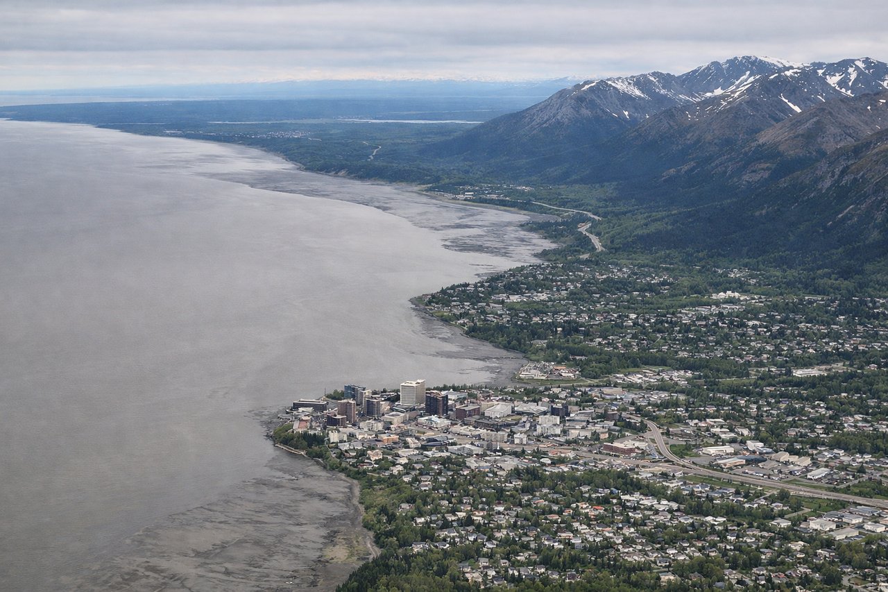
LEFTApproaching Anchorage from the southeast, left-side seats offer views of the Chugach Mountains and Turnagain Arm as you descend into the valley. The water body and dramatic peaks provide the most striking visual approach.
Will your flight be in sunlight?
Pick a date and time in the Sun Map to watch the sun move across your whole flight.
About This Route
Which side of the plane should I sit on flying from Boise Air Terminal (BOI) to Ted Stevens Anchorage International (ANC)?
Sit on the Left side of the plane for the best views on flights from Boise to Anchorage. While takeoff offers good foothills views on the right, the landing approach into Anchorage with the Chugach Mountains and Turnagain Arm on the left provides the most dramatic and geographically significant scenery. The left side captures the defining geography of the entire approach corridor.
What can I see during takeoff from Boise Air Terminal in Boise?
During takeoff from Boise Air Terminal (BOI), sit on the Right side for the best views. Boise typically departs to the north or northeast. Right-side seats capture the Boise Foothills and the initial climb over the Boise Valley, with the Owyhee Mountains visible to the south as you gain altitude. Notable sights include: Boise Foothills (immediate east), Boise Valley floor, Owyhee Mountains (southern horizon), Payette National Forest (northeast distance).
What can I see when landing at Ted Stevens Anchorage International in Anchorage?
When landing at Ted Stevens Anchorage International (ANC), sit on the Left side for the best views. Approaching Anchorage from the southeast, left-side seats offer views of the Chugach Mountains and Turnagain Arm as you descend into the valley. The water body and dramatic peaks provide the most striking visual approach. Notable sights include: Chugach Mountains (dominant), Turnagain Arm (water body), Anchorage coastal plain, Cook Inlet (distant).
How long is the flight from Boise to Anchorage?
The flight from Boise Air Terminal (BOI) to Ted Stevens Anchorage International (ANC) takes about 3 hours 15 minutes. The shortest flight path between them is 1,838 miles (2,957 km); winds and air traffic control usually add a few percent.
What does the Boise to Anchorage flight path pass over?
The flight path crosses the Salmon River Mountains and central Idaho wilderness, then transitions into the Alaska Range foothills. You'll pass over the Matanuska-Susitna Valley before descending toward Anchorage. The Alaska Range itself remains visible to the north and west throughout the latter half of the flight, with Denali potentially visible on clear days from cruising altitude, though it sits north of the direct flight path.