The left side tracks closer to the highest, most dramatic terrain on this route — the Uinta-adjacent Wyoming ranges and, most notably, the Front Range and Rocky Mountain National Park peaks near the end of the flight — giving it a slight edge over the right side's flatter high-desert and prairie views.
Flown BOI to DEN? Did we get it right?
Flight Path
Boise to Denver is 648 miles (1,042 km), a flight of about 1 hour 35 minutes.
Bear Lake on the Idaho-Utah border, the high desert of the Snake River Plain, the Uinta Mountains to the south, and the Flat Tops Wilderness in northwest Colorado as the route approaches the Rockies
Great circle distance and headings ›Phase by phase
Takeoff from BOI
RIGHTDeparting on runway 28 sends the aircraft northwest directly toward the Boise Front, so the climbing right side view catches the foothills and the edge of the Boise Mountains rising above the city. The left side mostly shows the flat Treasure Valley and Snake River Plain.
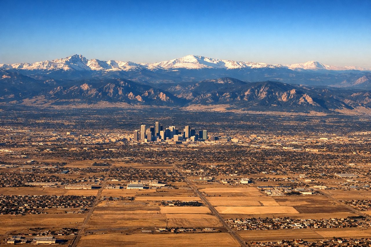
Landing at DEN
LEFTOn the descent into Denver the aircraft crosses the northern Colorado Rockies before turning onto final approach, and the left side keeps the high peaks of the Front Range and Rocky Mountain National Park in view a bit longer. The right side by this point faces mostly flat prairie east of the mountains.
Will your flight be in sunlight?
Pick a date and time in the Sun Map to watch the sun move across your whole flight.
About This Route
Which side of the plane should I sit on flying from Boise Air Terminal (BOI) to Denver International (DEN)?
Sit on the Left side of the plane for the best views on flights from Boise to Denver. The left side tracks closer to the highest, most dramatic terrain on this route — the Uinta-adjacent Wyoming ranges and, most notably, the Front Range and Rocky Mountain National Park peaks near the end of the flight — giving it a slight edge over the right side's flatter high-desert and prairie views.
What can I see during takeoff from Boise Air Terminal in Boise?
During takeoff from Boise Air Terminal (BOI), sit on the Right side for the best views. Departing on runway 28 sends the aircraft northwest directly toward the Boise Front, so the climbing right side view catches the foothills and the edge of the Boise Mountains rising above the city. The left side mostly shows the flat Treasure Valley and Snake River Plain. Notable sights include: Boise Front foothills, Boise River valley, downtown Boise, edge of the Idaho Batholith highlands.
What can I see when landing at Denver International in Denver?
When landing at Denver International (DEN), sit on the Left side for the best views. On the descent into Denver the aircraft crosses the northern Colorado Rockies before turning onto final approach, and the left side keeps the high peaks of the Front Range and Rocky Mountain National Park in view a bit longer. The right side by this point faces mostly flat prairie east of the mountains. Notable sights include: Rocky Mountain National Park peaks (Longs Peak area), Front Range foothills, Boulder/Golden foothill towns, Denver skyline in the distance.
How long is the flight from Boise to Denver?
The flight from Boise Air Terminal (BOI) to Denver International (DEN) takes about 1 hour 35 minutes. The shortest flight path between them is 648 miles (1,042 km); winds and air traffic control usually add a few percent.
What does the Boise to Denver flight path pass over?
Bear Lake on the Idaho-Utah border, the high desert of the Snake River Plain, the Uinta Mountains to the south, and the Flat Tops Wilderness in northwest Colorado as the route approaches the Rockies