The left side wins overall. The Boston departure view is spectacular with the full harbor and skyline, and through the cruise the left side tracks closer to the coastline — offering glimpses of Long Island Sound, the New Jersey shore, Delaware Bay, and the Virginia and Carolina coastlines. The right side has a slight edge only on final into Charleston, but the left dominates the majority of the flight.
Flown BOS to CHS? Did we get it right?
Flight Path
Boston to Charleston is 819 miles (1,317 km), a flight of about 2 hours 25 minutes.
The flight tracks southwest along the Eastern Seaboard. Notable features include Long Island Sound and the Connecticut shoreline early in the flight, then the New York metro area visible to the right at distance, the Delaware Peninsula and Delaware Bay at roughly the midpoint, the Chesapeake Bay mouth and Hampton Roads area in Virginia, and the broad flat coastal plain of the Carolinas with its river systems and pine forests in the final descent phase.
Great circle distance and headings ›

Phase by phase

Takeoff from BOS
LEFTLogan's primary southbound departures (runway 22L/22R) swing aircraft over Boston Harbor and the city. The left side gets Boston's downtown skyline, the Charles River, and a clear look back at the harbor islands as you climb out heading southwest.
Landing at CHS
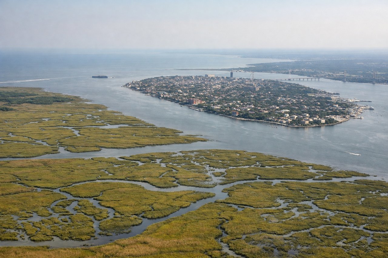
RIGHTCharleston approaches from the northeast typically use runway 33, bringing aircraft in over the ACE basin and the broad tidal marshes of the Lowcountry. The right side gives you the Charleston peninsula, the confluence of the Ashley and Cooper Rivers, and Fort Sumter in the harbor mouth.
Will your flight be in sunlight?
Pick a date and time in the Sun Map to watch the sun move across your whole flight.
About This Route
Which side of the plane should I sit on flying from General Edward Lawrence Logan International (BOS) to Charleston Afb International (CHS)?
Sit on the Left side of the plane for the best views on flights from Boston to Charleston. The left side wins overall. The Boston departure view is spectacular with the full harbor and skyline, and through the cruise the left side tracks closer to the coastline — offering glimpses of Long Island Sound, the New Jersey shore, Delaware Bay, and the Virginia and Carolina coastlines. The right side has a slight edge only on final into Charleston, but the left dominates the majority of the flight.
What can I see during takeoff from General Edward Lawrence Logan International in Boston?
During takeoff from General Edward Lawrence Logan International (BOS), sit on the Left side for the best views. Logan's primary southbound departures (runway 22L/22R) swing aircraft over Boston Harbor and the city. The left side gets Boston's downtown skyline, the Charles River, and a clear look back at the harbor islands as you climb out heading southwest. Notable sights include: Boston downtown skyline, Boston Harbor and harbor islands, Charles River and Cambridge, Quincy Bay.
What can I see when landing at Charleston Afb International in Charleston?
When landing at Charleston Afb International (CHS), sit on the Right side for the best views. Charleston approaches from the northeast typically use runway 33, bringing aircraft in over the ACE basin and the broad tidal marshes of the Lowcountry. The right side gives you the Charleston peninsula, the confluence of the Ashley and Cooper Rivers, and Fort Sumter in the harbor mouth. Notable sights include: Charleston peninsula and historic district, Fort Sumter in Charleston Harbor, Ashley and Cooper River confluence, ACE Basin tidal marshes.
How long is the flight from Boston to Charleston?
The flight from General Edward Lawrence Logan International (BOS) to Charleston Afb International (CHS) takes about 2 hours 25 minutes. The shortest flight path between them is 819 miles (1,317 km); winds and air traffic control usually add a few percent.
What does the Boston to Charleston flight path pass over?
The flight tracks southwest along the Eastern Seaboard. Notable features include Long Island Sound and the Connecticut shoreline early in the flight, then the New York metro area visible to the right at distance, the Delaware Peninsula and Delaware Bay at roughly the midpoint, the Chesapeake Bay mouth and Hampton Roads area in Virginia, and the broad flat coastal plain of the Carolinas with its river systems and pine forests in the final descent phase.