Neither side offers dramatic terrain on this short inland route, but the left side edges ahead thanks to glimpses of the Berkshire and Appalachian foothill ridgelines during cruise over western Massachusetts and New York, plus the downtown Indianapolis view on final approach.
Flown BOS to IND? Did we get it right?
Flight Path
Boston to Indianapolis is 816 miles (1,313 km), a flight of about 2 hours 15 minutes.
Rolling Appalachian foothills and ridgelines of western New York and northern Pennsylvania, followed by the flat farmland of Ohio and Indiana as the route levels out over the Midwest
Great circle distance and headings ›Phase by phase

Takeoff from BOS
RIGHTDepartures from Boston typically climb out over the harbor before turning west toward Indianapolis, and that initial turn puts Boston Harbor, the Inner Harbor islands, and the downtown skyline on the right side of the aircraft. It's a brief but genuinely scenic urban/coastal moment before the flight settles onto its inland heading.
Landing at IND
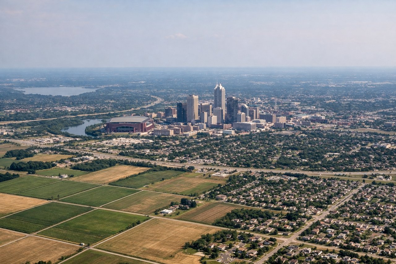
LEFTOn approach into Indianapolis from the northeast, arrivals descending toward runway 23 typically bank left over the northeastern suburbs, giving a brief view of downtown Indianapolis's modest skyline and the White River before touchdown. The right side during this turn mostly faces open farmland with no distinguishing features.
Will your flight be in sunlight?
Pick a date and time in the Sun Map to watch the sun move across your whole flight.
About This Route
Which side of the plane should I sit on flying from General Edward Lawrence Logan International (BOS) to Indianapolis International (IND)?
Sit on the Left side of the plane for the best views on flights from Boston to Indianapolis. Neither side offers dramatic terrain on this short inland route, but the left side edges ahead thanks to glimpses of the Berkshire and Appalachian foothill ridgelines during cruise over western Massachusetts and New York, plus the downtown Indianapolis view on final approach.
What can I see during takeoff from General Edward Lawrence Logan International in Boston?
During takeoff from General Edward Lawrence Logan International (BOS), sit on the Right side for the best views. Departures from Boston typically climb out over the harbor before turning west toward Indianapolis, and that initial turn puts Boston Harbor, the Inner Harbor islands, and the downtown skyline on the right side of the aircraft. It's a brief but genuinely scenic urban/coastal moment before the flight settles onto its inland heading. Notable sights include: Boston Harbor Islands, Downtown Boston skyline, Logan Airport peninsula, Massachusetts Bay.
What can I see when landing at Indianapolis International in Indianapolis?
When landing at Indianapolis International (IND), sit on the Left side for the best views. On approach into Indianapolis from the northeast, arrivals descending toward runway 23 typically bank left over the northeastern suburbs, giving a brief view of downtown Indianapolis's modest skyline and the White River before touchdown. The right side during this turn mostly faces open farmland with no distinguishing features. Notable sights include: Downtown Indianapolis skyline, White River, Indianapolis suburbs, checkerboard Midwest farmland.
How long is the flight from Boston to Indianapolis?
The flight from General Edward Lawrence Logan International (BOS) to Indianapolis International (IND) takes about 2 hours 15 minutes. The shortest flight path between them is 816 miles (1,313 km); winds and air traffic control usually add a few percent.
What does the Boston to Indianapolis flight path pass over?
Rolling Appalachian foothills and ridgelines of western New York and northern Pennsylvania, followed by the flat farmland of Ohio and Indiana as the route levels out over the Midwest