The right side strings together the two most photogenic moments of this short hop: Boston Harbor and the downtown skyline during climb-out, and the Lake Ontario crossing into the Toronto skyline on approach, while the left side mostly shows interior New York farmland and rolling hills with less distinct landmarks.
Flown BOS to YYZ? Did we get it right?
Flight Path
Boston to Toronto is 445 miles (716 km), a flight of about 1 hour 45 minutes.
Mohawk Valley lowlands, Adirondack foothills to the north, Finger Lakes region, and the southern shoreline of Lake Ontario before the Toronto approach
Great circle distance and headings ›

Phase by phase
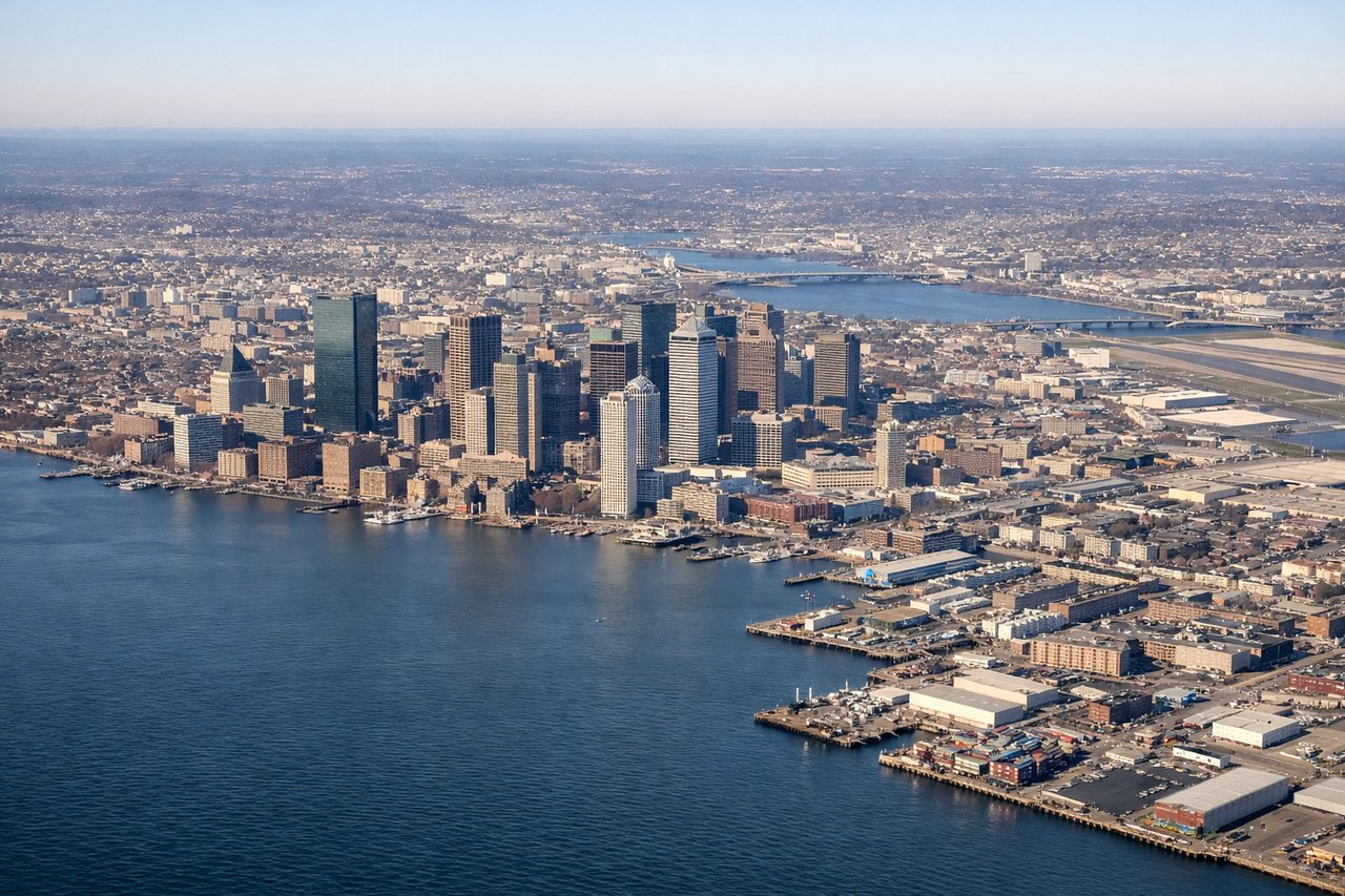
Takeoff from BOS
RIGHTLogan's noise-abatement departures climb out over Boston Harbor before turning west, putting the harbor islands, the airport's own runway complex, and the downtown Boston skyline (Back Bay, Financial District) on the right side of the aircraft during the initial climb.

Landing at YYZ
RIGHTArrivals into Pearson commonly cross Lake Ontario from the east before turning onto final for the 24-series runways, giving right-side passengers a sustained view of the lake's shoreline and the Toronto skyline, including the CN Tower, as the city passes beneath during descent.
Will your flight be in sunlight?
Pick a date and time in the Sun Map to watch the sun move across your whole flight.
About This Route
Which side of the plane should I sit on flying from General Edward Lawrence Logan International (BOS) to Lester B Pearson International (YYZ)?
Sit on the Right side of the plane for the best views on flights from Boston to Toronto. The right side strings together the two most photogenic moments of this short hop: Boston Harbor and the downtown skyline during climb-out, and the Lake Ontario crossing into the Toronto skyline on approach, while the left side mostly shows interior New York farmland and rolling hills with less distinct landmarks.
What can I see during takeoff from General Edward Lawrence Logan International in Boston?
During takeoff from General Edward Lawrence Logan International (BOS), sit on the Right side for the best views. Logan's noise-abatement departures climb out over Boston Harbor before turning west, putting the harbor islands, the airport's own runway complex, and the downtown Boston skyline (Back Bay, Financial District) on the right side of the aircraft during the initial climb. Notable sights include: Boston Harbor Islands, Logan Airport peninsula, Boston skyline (Prudential/Hancock towers), Charles River mouth.
What can I see when landing at Lester B Pearson International in Toronto?
When landing at Lester B Pearson International (YYZ), sit on the Right side for the best views. Arrivals into Pearson commonly cross Lake Ontario from the east before turning onto final for the 24-series runways, giving right-side passengers a sustained view of the lake's shoreline and the Toronto skyline, including the CN Tower, as the city passes beneath during descent. Notable sights include: Lake Ontario shoreline, CN Tower, Toronto downtown skyline, Toronto Islands.
How long is the flight from Boston to Toronto?
The flight from General Edward Lawrence Logan International (BOS) to Lester B Pearson International (YYZ) takes about 1 hour 45 minutes. The shortest flight path between them is 445 miles (716 km); winds and air traffic control usually add a few percent.
What does the Boston to Toronto flight path pass over?
Mohawk Valley lowlands, Adirondack foothills to the north, Finger Lakes region, and the southern shoreline of Lake Ontario before the Toronto approach