While the Budapest departure offers the Danube's scenic curves, the landing approach into RDU provides more sustained visual interest—the Piedmont's rolling topography, river valleys, and the visible transition from rural to urban landscape offer richer variety across the descent phase. The right side captures this transition most effectively.
Flown BUD to RDU? Did we get it right?
Flight Path
Budapest to Raleigh-Durham is 4,782 miles (7,696 km), a flight of about 9 hours 15 minutes.
The flight path crosses the Atlantic over the North Atlantic shipping lanes and Greenland's southern tip (weather permitting), then descends over eastern Canada and the northeastern United States. Notable features include the Appalachian Mountains visible during descent into the Carolinas, the Atlantic coastline near the Outer Banks of North Carolina, and the transition from coastal plains to Piedmont terrain in the final approach corridor.
Great circle distance and headings ›

Phase by phase
Takeoff from BUD
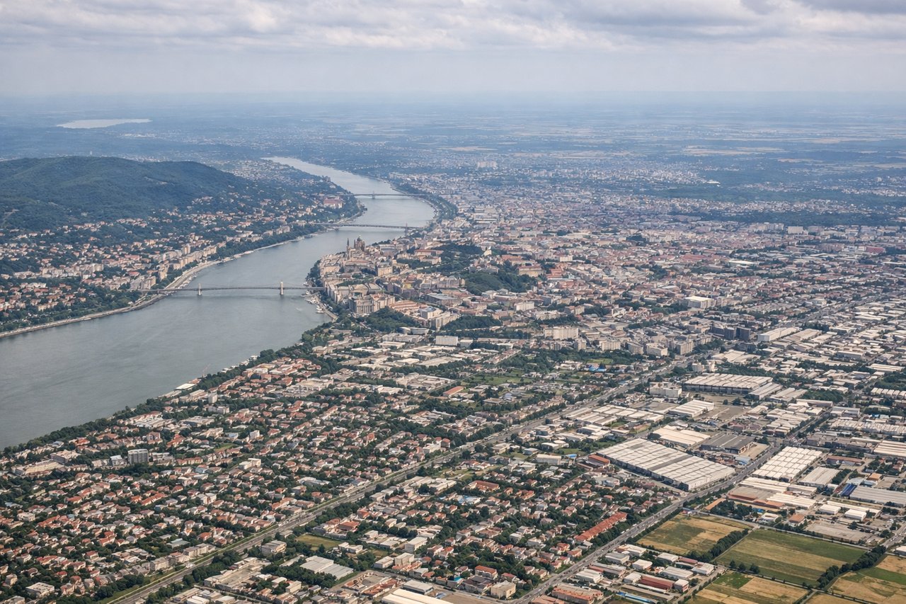
LEFTLeft side offers views of the Danube River as it curves through Budapest and the surrounding Hungarian plains. The river's distinctive meanders and the city's layout along both banks are clearly visible during climb-out heading northwest.
Landing at RDU
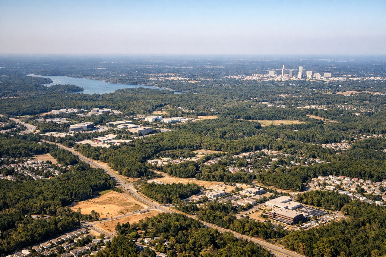
RIGHTRight side provides excellent views of the Piedmont region's terrain as the aircraft descends into RDU. The rolling hills, forested areas, and the transition from rural North Carolina to the Research Triangle urban area are all visible on approach from the east.
Will your flight be in sunlight?
Pick a date and time in the Sun Map to watch the sun move across your whole flight.
About This Route
Which side of the plane should I sit on flying from Ferihegy (BUD) to Raleigh Durham International (RDU)?
Sit on the Right side of the plane for the best views on flights from Budapest to Raleigh-Durham. While the Budapest departure offers the Danube's scenic curves, the landing approach into RDU provides more sustained visual interest—the Piedmont's rolling topography, river valleys, and the visible transition from rural to urban landscape offer richer variety across the descent phase. The right side captures this transition most effectively.
What can I see during takeoff from Ferihegy in Budapest?
During takeoff from Ferihegy (BUD), sit on the Left side for the best views. Left side offers views of the Danube River as it curves through Budapest and the surrounding Hungarian plains. The river's distinctive meanders and the city's layout along both banks are clearly visible during climb-out heading northwest. Notable sights include: Danube River (multiple bends through city center), Margaret Island, Buda Hills to the west, flat Hungarian plains extending eastward.
What can I see when landing at Raleigh Durham International in Raleigh-Durham?
When landing at Raleigh Durham International (RDU), sit on the Right side for the best views. Right side provides excellent views of the Piedmont region's terrain as the aircraft descends into RDU. The rolling hills, forested areas, and the transition from rural North Carolina to the Research Triangle urban area are all visible on approach from the east. Notable sights include: Piedmont foothills (rolling terrain), Neuse River valley, Research Triangle Park urban development, Durham and Raleigh city lights.
How long is the flight from Budapest to Raleigh-Durham?
The flight from Ferihegy (BUD) to Raleigh Durham International (RDU) takes about 9 hours 15 minutes. The shortest flight path between them is 4,782 miles (7,696 km); winds and air traffic control usually add a few percent.
What does the Budapest to Raleigh-Durham flight path pass over?
The flight path crosses the Atlantic over the North Atlantic shipping lanes and Greenland's southern tip (weather permitting), then descends over eastern Canada and the northeastern United States. Notable features include the Appalachian Mountains visible during descent into the Carolinas, the Atlantic coastline near the Outer Banks of North Carolina, and the transition from coastal plains to Piedmont terrain in the final approach corridor.