The right side delivers a stronger full-flight package: Baltimore's skyline at departure, a cruise track that passes near the Rocky Mountain Front and Glacier National Park's peaks in Montana, and the northern Cascade volcanoes (Mount St. Helens, Adams, and Rainier) visible on the descent into Portland, giving more variety and dramatic terrain than the left side's flatter plains route, even though the left side gets the standout Mount Hood view at landing.
Flight Path
The route's great-circle path arcs north through the Dakotas and Montana, passing near the Missouri River, the North Dakota Badlands, and the Rocky Mountain Front close to Glacier National Park before crossing into Idaho and Oregon.
Great circle distance and headings ›.jpeg?width=600)

.jpg?width=600)
Phase by phase
Takeoff from BWI
RIGHTDeparting BWI westbound on runway 28, the initial climb puts Baltimore's downtown skyline, Inner Harbor, and the Patapsco River off the north (right) side of the aircraft, with Chesapeake Bay briefly visible behind. The south side mostly shows flat Maryland suburbs and farmland with no comparable landmark.
Landing at PDX
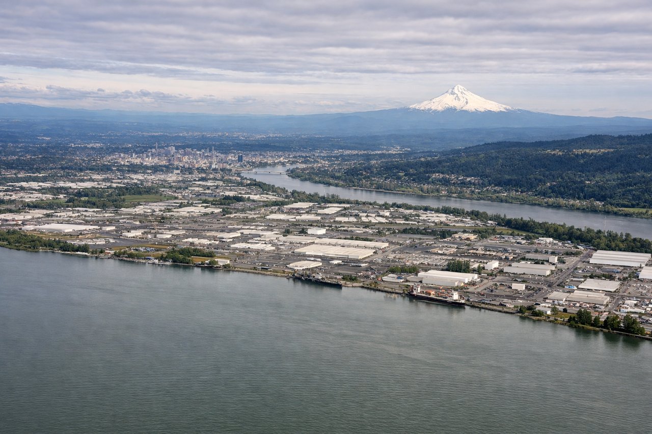
LEFTOn approach into PDX from the east, the descent path keeps snow-capped Mount Hood visible off the south (left) side of the aircraft, one of the most recognizable volcanic peaks in the Cascades and much closer to the flight path than the Washington volcanoes to the north. The Willamette Valley's patchwork farmland fills the middle ground as the plane descends.
Landmarks on this routeAll landmarks →
Will your flight be in sunlight?
See exactly which side of the plane gets sun and shade at your departure time.
About This Route
Which side of the plane should I sit on flying from Baltimore Washington International (BWI) to Portland International (PDX)?
Sit on the Right side of the plane for the best views on flights from Baltimore to Portland. The right side delivers a stronger full-flight package: Baltimore's skyline at departure, a cruise track that passes near the Rocky Mountain Front and Glacier National Park's peaks in Montana, and the northern Cascade volcanoes (Mount St. Helens, Adams, and Rainier) visible on the descent into Portland, giving more variety and dramatic terrain than the left side's flatter plains route, even though the left side gets the standout Mount Hood view at landing.
What can I see during takeoff from Baltimore Washington International in Baltimore?
During takeoff from Baltimore Washington International (BWI), sit on the Right side for the best views. Departing BWI westbound on runway 28, the initial climb puts Baltimore's downtown skyline, Inner Harbor, and the Patapsco River off the north (right) side of the aircraft, with Chesapeake Bay briefly visible behind. The south side mostly shows flat Maryland suburbs and farmland with no comparable landmark. Notable sights include: Baltimore Inner Harbor and downtown skyline, Patapsco River, Chesapeake Bay in the distance.
What can I see when landing at Portland International in Portland?
When landing at Portland International (PDX), sit on the Left side for the best views. On approach into PDX from the east, the descent path keeps snow-capped Mount Hood visible off the south (left) side of the aircraft, one of the most recognizable volcanic peaks in the Cascades and much closer to the flight path than the Washington volcanoes to the north. The Willamette Valley's patchwork farmland fills the middle ground as the plane descends. Notable sights include: Mount Hood, Willamette Valley farmland, Columbia River, distant Cascade foothills.
How long is the flight from Baltimore to Portland?
The flight from Baltimore Washington International (BWI) to Portland International (PDX) takes 5h 35m.
What does the Baltimore to Portland flight path pass over?
The route's great-circle path arcs north through the Dakotas and Montana, passing near the Missouri River, the North Dakota Badlands, and the Rocky Mountain Front close to Glacier National Park before crossing into Idaho and Oregon.