Left side wins both ends of the flight. During the cruise over the northern Rockies and Cascades, the left side also tends to offer better views of the mountain terrain as the flight tracks northwest. The Mount Rainier view on approach alone makes left the clear overall choice.
Flown BWI to SEA? Did we get it right?
Flight Path
Baltimore to Seattle is 2,329 miles (3,748 km), a flight of about 5 hours 45 minutes.
The flight tracks northwest over Pennsylvania, then across the Great Lakes region or southern Ontario, continuing over the northern Great Plains of South Dakota and Montana, crossing the Continental Divide over the northern Rockies near Glacier National Park or the Bitterroot Range, then descending over the Columbia Plateau and Cascade Range into Seattle. The Missouri River and its reservoirs in Montana are visible on clear days, as are the snow-capped peaks of the northern Rockies and the broad flat Columbia Basin in eastern Washington.
Great circle distance and headings ›


Phase by phase
Takeoff from BWI
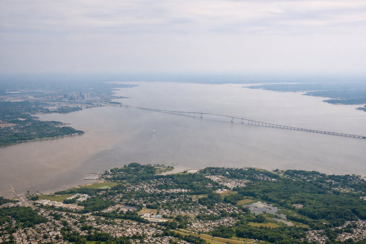
LEFTBWI's primary departure runway 28 sends aircraft northwest, putting the left side facing south over the Chesapeake Bay and Baltimore's Inner Harbor. You get a clear view of the bay's broad expanse and the Francis Scott Key Bridge area before climbing out over Maryland.
Landing at SEA
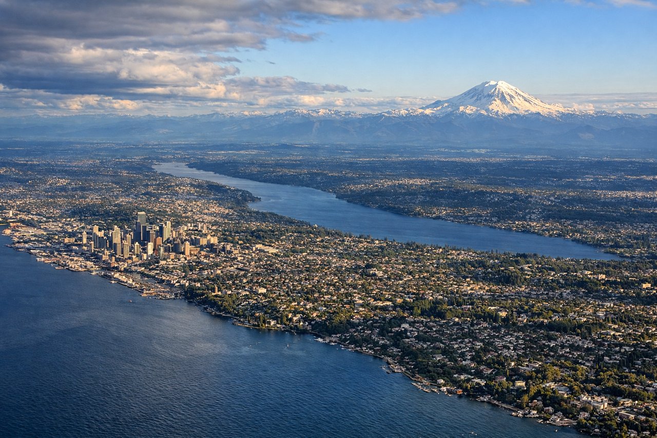
LEFTSEA-TAC primarily lands on runways 16L/16R heading south, meaning the aircraft approaches from the north. The left side faces east toward the Cascade Range and Mount Rainier, which is one of the most dramatic mountain views in North American aviation. Mount Rainier's massive glaciated summit dominates the eastern horizon on final approach.
Will your flight be in sunlight?
Pick a date and time in the Sun Map to watch the sun move across your whole flight.
About This Route
Which side of the plane should I sit on flying from Baltimore Washington International (BWI) to Seattle Tacoma International (SEA)?
Sit on the Left side of the plane for the best views on flights from Baltimore to Seattle. Left side wins both ends of the flight. During the cruise over the northern Rockies and Cascades, the left side also tends to offer better views of the mountain terrain as the flight tracks northwest. The Mount Rainier view on approach alone makes left the clear overall choice.
What can I see during takeoff from Baltimore Washington International in Baltimore?
During takeoff from Baltimore Washington International (BWI), sit on the Left side for the best views. BWI's primary departure runway 28 sends aircraft northwest, putting the left side facing south over the Chesapeake Bay and Baltimore's Inner Harbor. You get a clear view of the bay's broad expanse and the Francis Scott Key Bridge area before climbing out over Maryland. Notable sights include: Chesapeake Bay, Baltimore Inner Harbor, Patapsco River estuary, Annapolis peninsula.
What can I see when landing at Seattle Tacoma International in Seattle?
When landing at Seattle Tacoma International (SEA), sit on the Left side for the best views. SEA-TAC primarily lands on runways 16L/16R heading south, meaning the aircraft approaches from the north. The left side faces east toward the Cascade Range and Mount Rainier, which is one of the most dramatic mountain views in North American aviation. Mount Rainier's massive glaciated summit dominates the eastern horizon on final approach. Notable sights include: Mount Rainier, Cascade Range, Lake Washington, Puget Sound.
How long is the flight from Baltimore to Seattle?
The flight from Baltimore Washington International (BWI) to Seattle Tacoma International (SEA) takes about 5 hours 45 minutes. The shortest flight path between them is 2,329 miles (3,748 km); winds and air traffic control usually add a few percent.
What does the Baltimore to Seattle flight path pass over?
The flight tracks northwest over Pennsylvania, then across the Great Lakes region or southern Ontario, continuing over the northern Great Plains of South Dakota and Montana, crossing the Continental Divide over the northern Rockies near Glacier National Park or the Bitterroot Range, then descending over the Columbia Plateau and Cascade Range into Seattle. The Missouri River and its reservoirs in Montana are visible on clear days, as are the snow-capped peaks of the northern Rockies and the broad flat Columbia Basin in eastern Washington.