The left side captures Canberra's lake and parliamentary precinct on departure, the snow-capped Australian Alps near Kosciuszko during cruise, and Melbourne's skyline and bay on arrival — a strong combination of urban and alpine scenery for a short domestic hop. The right side shows only the flat Riverina plains with no comparable landmarks.
Flight Path
The flight path passes just north of the Snowy Mountains and Kosciuszko National Park, where Australia's highest peaks and alpine lakes like Lake Eucumbene are visible to the south, before the terrain flattens into Victoria's high country and farmland approaching Melbourne.
Great circle distance and headings ›Phase by phase
Takeoff from CBR
LEFTDeparting Canberra on runway 35, aircraft typically bank left onto a southwesterly heading toward Melbourne, putting Lake Burley Griffin, Parliament House, and the city's ceremonial axis directly below left-side windows. The Brindabella Ranges rise on the horizon as the plane climbs away from the capital.
Landing at MEL
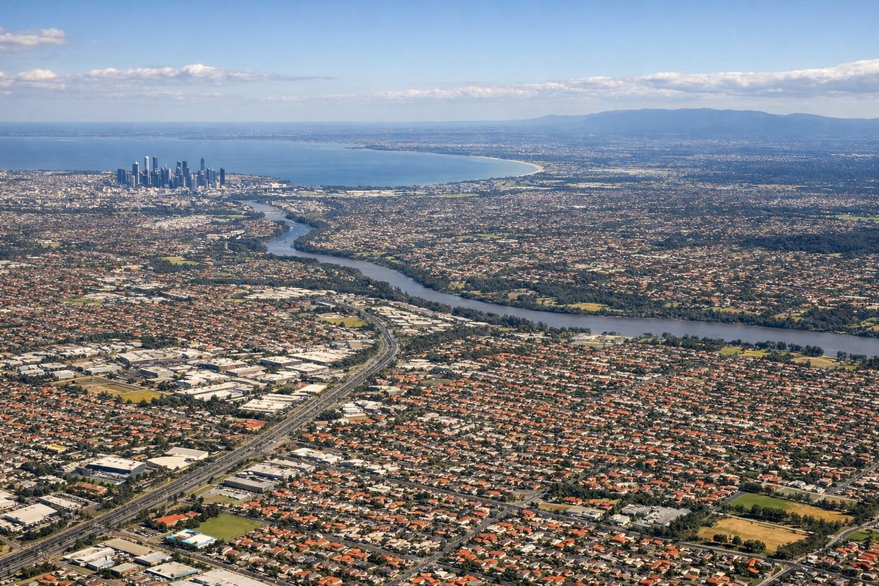
LEFTOn final approach into Melbourne's runway 16, the flight path passes just west of the city center, giving left-side passengers a clear view of Port Phillip Bay, the Melbourne CBD skyline, and the mouth of the Yarra River as the plane descends over the northern suburbs.
Will your flight be in sunlight?
See exactly which side of the plane gets sun and shade at your departure time.
About This Route
Which side of the plane should I sit on flying from Canberra (CBR) to Melbourne International (MEL)?
Sit on the Left side of the plane for the best views on flights from Canberra to Melbourne. The left side captures Canberra's lake and parliamentary precinct on departure, the snow-capped Australian Alps near Kosciuszko during cruise, and Melbourne's skyline and bay on arrival — a strong combination of urban and alpine scenery for a short domestic hop. The right side shows only the flat Riverina plains with no comparable landmarks.
What can I see during takeoff from Canberra in Canberra?
During takeoff from Canberra (CBR), sit on the Left side for the best views. Departing Canberra on runway 35, aircraft typically bank left onto a southwesterly heading toward Melbourne, putting Lake Burley Griffin, Parliament House, and the city's ceremonial axis directly below left-side windows. The Brindabella Ranges rise on the horizon as the plane climbs away from the capital. Notable sights include: Lake Burley Griffin, Parliament House and the Old/New Parliament axis, Brindabella Ranges.
What can I see when landing at Melbourne International in Melbourne?
When landing at Melbourne International (MEL), sit on the Left side for the best views. On final approach into Melbourne's runway 16, the flight path passes just west of the city center, giving left-side passengers a clear view of Port Phillip Bay, the Melbourne CBD skyline, and the mouth of the Yarra River as the plane descends over the northern suburbs. Notable sights include: Port Phillip Bay, Melbourne CBD skyline, Yarra River mouth, Westgate Bridge.
How long is the flight from Canberra to Melbourne?
The flight from Canberra (CBR) to Melbourne International (MEL) takes 1h 15m.
What does the Canberra to Melbourne flight path pass over?
The flight path passes just north of the Snowy Mountains and Kosciuszko National Park, where Australia's highest peaks and alpine lakes like Lake Eucumbene are visible to the south, before the terrain flattens into Victoria's high country and farmland approaching Melbourne.