While the right side offers a nice glimpse of Sri Lanka's hill country at takeoff, the left side provides more consistent scenic value across the flight, combining Colombo's coastal skyline at departure with the Western Ghats' foothills and Deccan plateau textures on the approach into Bangalore.
Flown CMB to BLR? Did we get it right?
Flight Path
Colombo to Bangalore is 441 miles (710 km), a flight of about 1 hour 50 minutes.
Open waters of the Gulf of Mannar and Laccadive Sea between Sri Lanka and the Indian mainland, with no land visible for much of the crossing
Great circle distance and headings ›Phase by phase
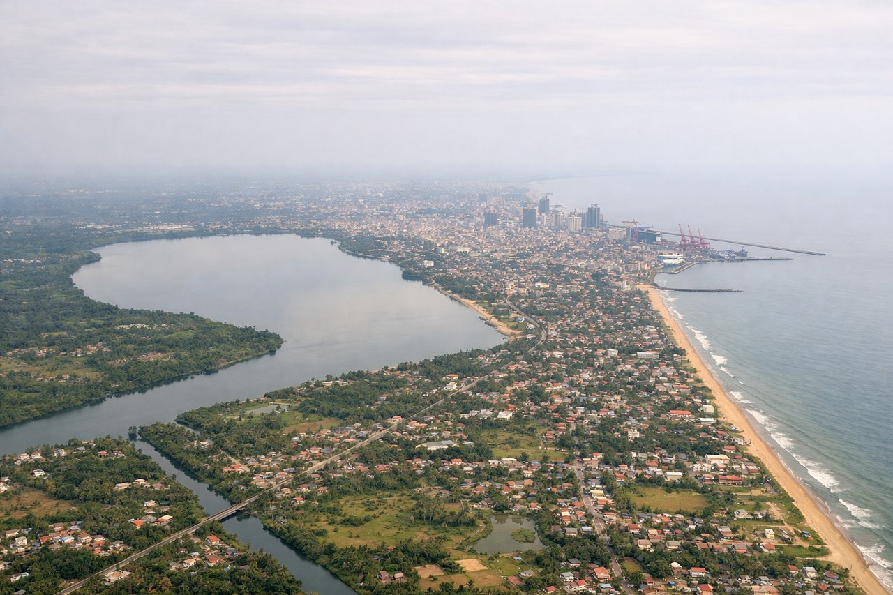
Takeoff from CMB
RIGHTAs the aircraft climbs out from Colombo and turns north toward India, the right side offers a brief glimpse of Sri Lanka's central highlands, including the tea-covered hills near Kandy and the distinctive peak of Adam's Peak rising above the coastal plain. This hill country adds real topographic interest that the flatter coastal side lacks during the climb.
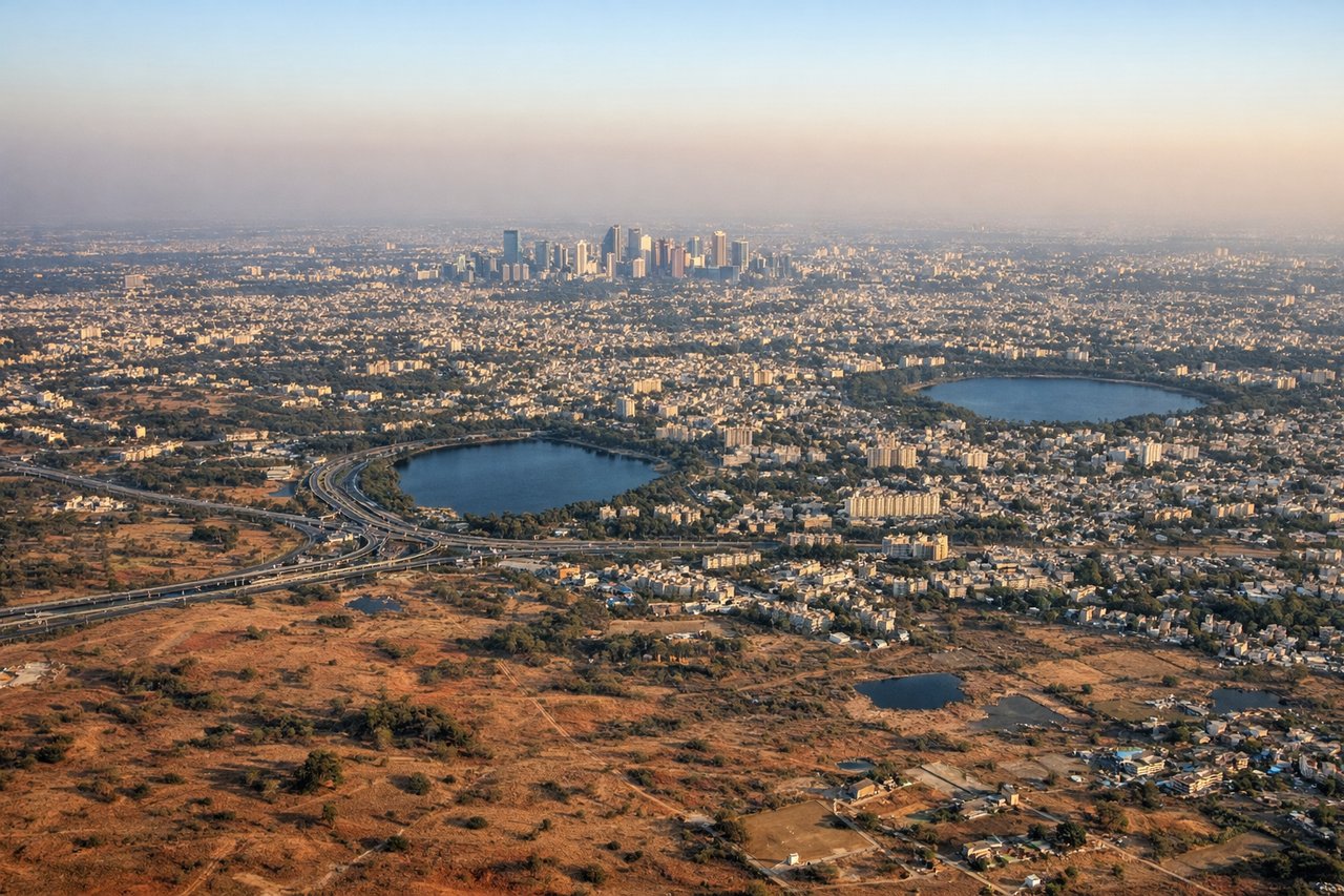
Landing at BLR
LEFTOn approach into Bangalore, the aircraft descends over the Deccan Plateau's southern edge, and the left side reveals the tail end of the Western Ghats' rolling hills near Mysore before the terrain flattens into Bangalore's plateau farmland. This gives a sense of transitioning terrain that the flatter right-side plains during descent don't offer.
Will your flight be in sunlight?
Pick a date and time in the Sun Map to watch the sun move across your whole flight.
About This Route
Which side of the plane should I sit on flying from Bandaranaike International (CMB) to Kempegowda International Airport Bengaluru (BLR)?
Sit on the Left side of the plane for the best views on flights from Colombo to Bangalore. While the right side offers a nice glimpse of Sri Lanka's hill country at takeoff, the left side provides more consistent scenic value across the flight, combining Colombo's coastal skyline at departure with the Western Ghats' foothills and Deccan plateau textures on the approach into Bangalore.
What can I see during takeoff from Bandaranaike International in Colombo?
During takeoff from Bandaranaike International (CMB), sit on the Right side for the best views. As the aircraft climbs out from Colombo and turns north toward India, the right side offers a brief glimpse of Sri Lanka's central highlands, including the tea-covered hills near Kandy and the distinctive peak of Adam's Peak rising above the coastal plain. This hill country adds real topographic interest that the flatter coastal side lacks during the climb. Notable sights include: Colombo suburbs, Sri Lankan central highlands, Adam's Peak (Sri Pada), coastal plain rivers.
What can I see when landing at Kempegowda International Airport Bengaluru in Bangalore?
When landing at Kempegowda International Airport Bengaluru (BLR), sit on the Left side for the best views. On approach into Bangalore, the aircraft descends over the Deccan Plateau's southern edge, and the left side reveals the tail end of the Western Ghats' rolling hills near Mysore before the terrain flattens into Bangalore's plateau farmland. This gives a sense of transitioning terrain that the flatter right-side plains during descent don't offer. Notable sights include: Western Ghats foothills, Mysore plateau farmland, Bangalore's outer suburbs, reservoirs and tanks dotting the plateau.
How long is the flight from Colombo to Bangalore?
The flight from Bandaranaike International (CMB) to Kempegowda International Airport Bengaluru (BLR) takes about 1 hour 50 minutes. The shortest flight path between them is 441 miles (710 km); winds and air traffic control usually add a few percent.
What does the Colombo to Bangalore flight path pass over?
Open waters of the Gulf of Mannar and Laccadive Sea between Sri Lanka and the Indian mainland, with no land visible for much of the crossing