The right side offers a stronger cumulative experience: a glimpse of the Cincinnati skyline and Ohio River at departure, occasional views of the northern Rockies near Montana during cruise, and a scenic Puget Sound and Seattle skyline arrival, all of which outweigh the flatter, less distinctive scenery on the left.
Flown CVG to SEA? Did we get it right?
Flight Path
Cincinnati to Seattle is 1,960 miles (3,154 km), a flight of about 4 hours 45 minutes.
Great Plains of the Dakotas, the Missouri River, and the northern Rocky Mountains near Montana before the route descends toward the Cascade Range and Puget Sound lowlands approaching Seattle.
Great circle distance and headings ›

Phase by phase
Takeoff from CVG
RIGHTCVG departures typically climb north before turning west toward Seattle, putting the Ohio River and the Cincinnati downtown skyline across the river into view on the right side. The left side mostly shows rolling Kentucky farmland with little distinction.
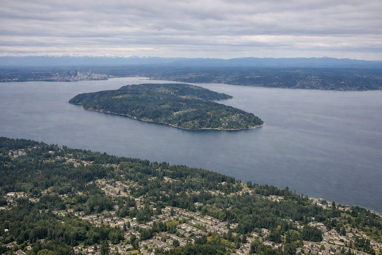
Landing at SEA
RIGHTOn approach to SEA's north-south runways, the right side of the aircraft faces west toward Puget Sound, giving passengers views of Elliott Bay, the Seattle skyline, and the Olympic Mountains on the horizon. The left side instead looks toward Lake Washington and the Cascade foothills, which are pleasant but less dramatic.
Will your flight be in sunlight?
Pick a date and time in the Sun Map to watch the sun move across your whole flight.
About This Route
Which side of the plane should I sit on flying from Cincinnati Northern Kentucky International (CVG) to Seattle Tacoma International (SEA)?
Sit on the Right side of the plane for the best views on flights from Cincinnati to Seattle. The right side offers a stronger cumulative experience: a glimpse of the Cincinnati skyline and Ohio River at departure, occasional views of the northern Rockies near Montana during cruise, and a scenic Puget Sound and Seattle skyline arrival, all of which outweigh the flatter, less distinctive scenery on the left.
What can I see during takeoff from Cincinnati Northern Kentucky International in Cincinnati?
During takeoff from Cincinnati Northern Kentucky International (CVG), sit on the Right side for the best views. CVG departures typically climb north before turning west toward Seattle, putting the Ohio River and the Cincinnati downtown skyline across the river into view on the right side. The left side mostly shows rolling Kentucky farmland with little distinction. Notable sights include: Ohio River, Cincinnati downtown skyline, Northern Kentucky hills.
What can I see when landing at Seattle Tacoma International in Seattle?
When landing at Seattle Tacoma International (SEA), sit on the Right side for the best views. On approach to SEA's north-south runways, the right side of the aircraft faces west toward Puget Sound, giving passengers views of Elliott Bay, the Seattle skyline, and the Olympic Mountains on the horizon. The left side instead looks toward Lake Washington and the Cascade foothills, which are pleasant but less dramatic. Notable sights include: Puget Sound, Elliott Bay, downtown Seattle skyline, Olympic Mountains.
How long is the flight from Cincinnati to Seattle?
The flight from Cincinnati Northern Kentucky International (CVG) to Seattle Tacoma International (SEA) takes about 4 hours 45 minutes. The shortest flight path between them is 1,960 miles (3,154 km); winds and air traffic control usually add a few percent.
What does the Cincinnati to Seattle flight path pass over?
Great Plains of the Dakotas, the Missouri River, and the northern Rocky Mountains near Montana before the route descends toward the Cascade Range and Puget Sound lowlands approaching Seattle.