Dallas-Fort Worth to Aguascalientes is 838 miles (1,349 km), a flight of about 2 hours 15 minutes.
The right side captures the Fort Worth skyline and Texas urban sprawl on departure, and during the cruise over central Mexico offers views of the high plateau terrain and scattered sierra ridgelines. The left side has a slight edge on landing but the takeoff view from the right is the more dramatic overall experience.
Flight Path
The flight crosses the Rio Grande near Laredo/Nuevo Laredo, then tracks over the semi-arid Tamaulipan scrubland of northeastern Mexico before climbing onto the Sierra Madre Oriental foothills. The route passes over the high central Mexican plateau (Altiplano) at around 6,000 feet elevation, with scattered volcanic peaks and dry basin-and-range topography visible below before descending into the Aguascalientes valley.
Great circle distance and headings ›Phase by phase
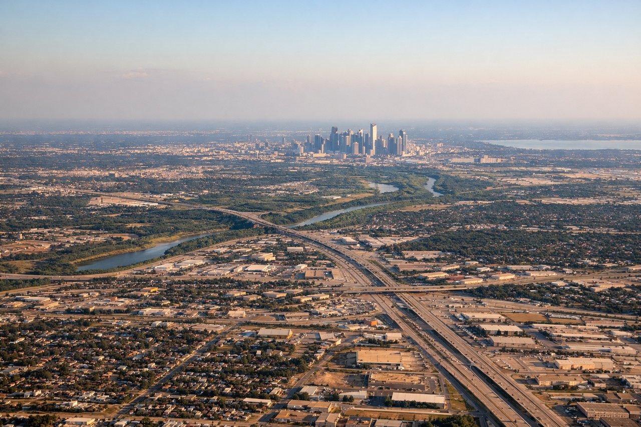
Takeoff from DFW
RIGHTDFW's primary south-facing departures on runways 17L/17R/18L/18R put the Dallas-Fort Worth metroplex sprawl to the right (west side). You get a clear view of Fort Worth's downtown skyline and the dense suburban grid of Tarrant County spreading out below.
Landing at AGU
LEFTAGU's runway 07/25 means arrivals typically come in from the east heading west. On a westbound approach, the left (south) side gives you a view toward the Sierra Fría range and the broader Aguascalientes valley floor with the city center visible ahead and to the left.
Will your flight be in sunlight?
Pick a date and time in the Sun Map to watch the sun move across your whole flight.
About This Route
Which side of the plane should I sit on flying from Dallas Fort Worth International (DFW) to Jesus Teran International (AGU)?
Sit on the Right side of the plane for the best views on flights from Dallas-Fort Worth to Aguascalientes. The right side captures the Fort Worth skyline and Texas urban sprawl on departure, and during the cruise over central Mexico offers views of the high plateau terrain and scattered sierra ridgelines. The left side has a slight edge on landing but the takeoff view from the right is the more dramatic overall experience.
What can I see during takeoff from Dallas Fort Worth International in Dallas-Fort Worth?
During takeoff from Dallas Fort Worth International (DFW), sit on the Right side for the best views. DFW's primary south-facing departures on runways 17L/17R/18L/18R put the Dallas-Fort Worth metroplex sprawl to the right (west side). You get a clear view of Fort Worth's downtown skyline and the dense suburban grid of Tarrant County spreading out below. Notable sights include: Fort Worth downtown skyline, Eagle Mountain Lake to the northwest, the dense DFW suburban grid of Tarrant County, Texas Motor Speedway visible to the north.
What can I see when landing at Jesus Teran International in Aguascalientes?
When landing at Jesus Teran International (AGU), sit on the Left side for the best views. AGU's runway 07/25 means arrivals typically come in from the east heading west. On a westbound approach, the left (south) side gives you a view toward the Sierra Fría range and the broader Aguascalientes valley floor with the city center visible ahead and to the left. Notable sights include: Aguascalientes city center and urban grid, Sierra Fría range to the southwest, the flat agricultural valley floor of the Aguascalientes basin, the Rio San Pedro corridor.
How long is the flight from Dallas-Fort Worth to Aguascalientes?
The flight from Dallas Fort Worth International (DFW) to Jesus Teran International (AGU) takes about 2 hours 15 minutes. The shortest flight path between them is 838 miles (1,349 km); winds and air traffic control usually add a few percent.
What does the Dallas-Fort Worth to Aguascalientes flight path pass over?
The flight crosses the Rio Grande near Laredo/Nuevo Laredo, then tracks over the semi-arid Tamaulipan scrubland of northeastern Mexico before climbing onto the Sierra Madre Oriental foothills. The route passes over the high central Mexican plateau (Altiplano) at around 6,000 feet elevation, with scattered volcanic peaks and dry basin-and-range topography visible below before descending into the Aguascalientes valley.