Dallas-Fort Worth to Belize City is 1,192 miles (1,918 km), a flight of about 2 hours 50 minutes.
The left (east-facing) side tracks the Gulf of Mexico coastline near Texas, catches glimpses of the Yucatan Peninsula's Caribbean shore, and finishes with the vivid Belize Barrier Reef on approach — giving it clear variety and drama over the right side's largely featureless Gulf and interior jungle views.
Flight Path
Gulf of Mexico open water, the Yucatan Peninsula coastline near Cancun and Cozumel, and the Caribbean Sea approaching Belize's barrier reef system
Great circle distance and headings ›Phase by phase
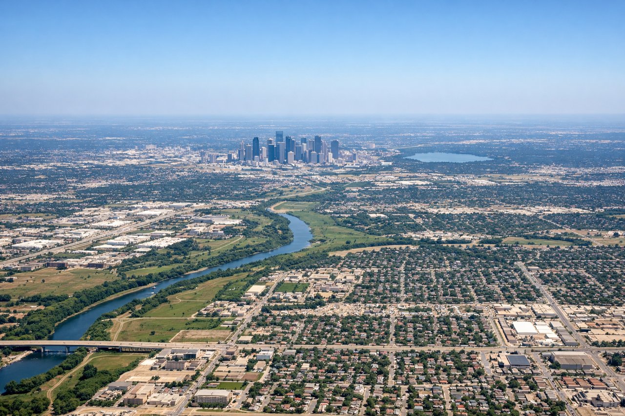
Takeoff from DFW
LEFTAs the aircraft climbs out of DFW heading south, a left-side view offers a glimpse of downtown Dallas' skyline and the White Rock Lake area before the plains take over. It's a modest advantage, but it's the only distinguishing feature during this flat-terrain departure.
Landing at BZE
LEFTOn approach to Belize City from the Caribbean side, the left side of the aircraft reveals the turquoise shallows of the Belize Barrier Reef and scattered cayes just before touchdown. This is one of the most visually striking reef systems visible from a commercial aircraft in the region.
Will your flight be in sunlight?
Pick a date and time in the Sun Map to watch the sun move across your whole flight.
About This Route
Which side of the plane should I sit on flying from Dallas Fort Worth International (DFW) to Philip S W Goldson International (BZE)?
Sit on the Left side of the plane for the best views on flights from Dallas-Fort Worth to Belize City. The left (east-facing) side tracks the Gulf of Mexico coastline near Texas, catches glimpses of the Yucatan Peninsula's Caribbean shore, and finishes with the vivid Belize Barrier Reef on approach — giving it clear variety and drama over the right side's largely featureless Gulf and interior jungle views.
What can I see during takeoff from Dallas Fort Worth International in Dallas-Fort Worth?
During takeoff from Dallas Fort Worth International (DFW), sit on the Left side for the best views. As the aircraft climbs out of DFW heading south, a left-side view offers a glimpse of downtown Dallas' skyline and the White Rock Lake area before the plains take over. It's a modest advantage, but it's the only distinguishing feature during this flat-terrain departure. Notable sights include: Downtown Dallas skyline, White Rock Lake, Trinity River bends.
What can I see when landing at Philip S W Goldson International in Belize City?
When landing at Philip S W Goldson International (BZE), sit on the Left side for the best views. On approach to Belize City from the Caribbean side, the left side of the aircraft reveals the turquoise shallows of the Belize Barrier Reef and scattered cayes just before touchdown. This is one of the most visually striking reef systems visible from a commercial aircraft in the region. Notable sights include: Belize Barrier Reef, Turneffe Atoll, coastal mangrove cayes, Belize City coastline.
How long is the flight from Dallas-Fort Worth to Belize City?
The flight from Dallas Fort Worth International (DFW) to Philip S W Goldson International (BZE) takes about 2 hours 50 minutes. The shortest flight path between them is 1,192 miles (1,918 km); winds and air traffic control usually add a few percent.
What does the Dallas-Fort Worth to Belize City flight path pass over?
Gulf of Mexico open water, the Yucatan Peninsula coastline near Cancun and Cozumel, and the Caribbean Sea approaching Belize's barrier reef system