Dallas-Fort Worth to San Antonio is 244 miles (393 km), a flight of about 50 minutes.
The right side wins overall primarily for the dramatic Dallas skyline view on departure, which is the most visually compelling moment of this short flight. The midpoint terrain is flat ranchland with limited features on either side, and the landing views are modest regardless of seat choice.
Flight Path
The flight crosses the Balcones Escarpment transition zone roughly over Waco and the Brazos River valley, then the flat Post Oak Savanna and Blackland Prairie of central Texas. The Lampasas and Leon River drainages are visible as faint green corridors in an otherwise brown-tan agricultural landscape. No significant elevation changes — terrain stays below 1,000 feet throughout.
Great circle distance and headings ›Phase by phase
Takeoff from DFW
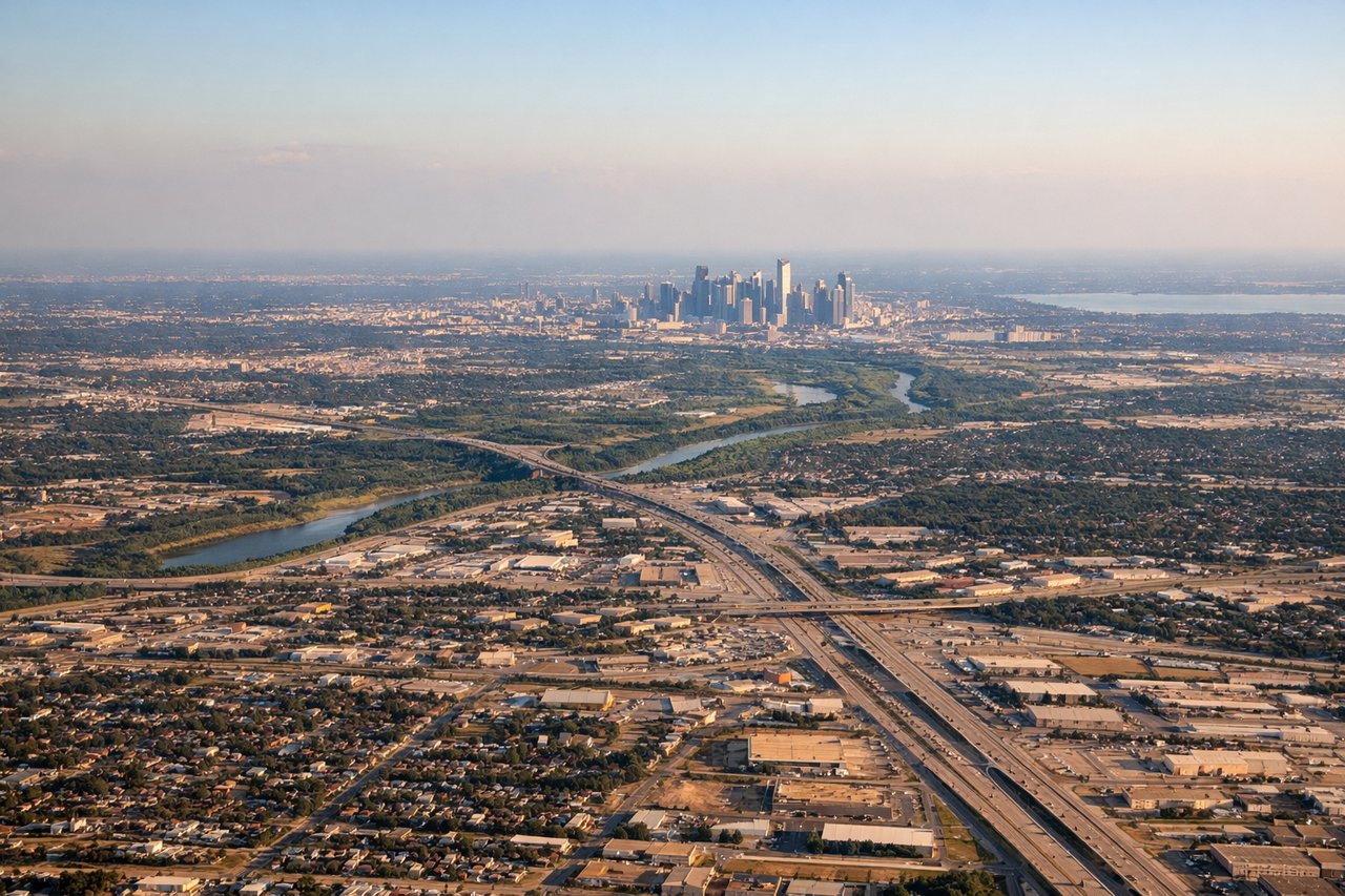
RIGHTDFW typically departs southbound on runways 17L/17R or 18L/18R, heading toward San Antonio. The right side gives you a clear view of downtown Dallas skyline to the northwest as you climb out, plus the sprawling DFW metroplex spreading east. Left side faces west toward Fort Worth which is less visually dramatic at altitude.
Landing at RND
LEFTRandolph AFB sits northeast of San Antonio and aircraft typically approach from the north or northwest. On final approach, the left side gives a view over the San Antonio urban area including the downtown core and the broad flat Hill Country transition zone to the northwest. Right side faces east toward open ranchland with little of interest.
Will your flight be in sunlight?
Pick a date and time in the Sun Map to watch the sun move across your whole flight.
About This Route
Which side of the plane should I sit on flying from Dallas Fort Worth International (DFW) to Randolph Afb (RND)?
Sit on the Right side of the plane for the best views on flights from Dallas-Fort Worth to San Antonio. The right side wins overall primarily for the dramatic Dallas skyline view on departure, which is the most visually compelling moment of this short flight. The midpoint terrain is flat ranchland with limited features on either side, and the landing views are modest regardless of seat choice.
What can I see during takeoff from Dallas Fort Worth International in Dallas-Fort Worth?
During takeoff from Dallas Fort Worth International (DFW), sit on the Right side for the best views. DFW typically departs southbound on runways 17L/17R or 18L/18R, heading toward San Antonio. The right side gives you a clear view of downtown Dallas skyline to the northwest as you climb out, plus the sprawling DFW metroplex spreading east. Left side faces west toward Fort Worth which is less visually dramatic at altitude. Notable sights include: Downtown Dallas skyline to the northeast, Lake Lewisville to the north, Irving and Las Colinas urban corridor below, Texas Stadium site area near Irving.
What can I see when landing at Randolph Afb in San Antonio?
When landing at Randolph Afb (RND), sit on the Left side for the best views. Randolph AFB sits northeast of San Antonio and aircraft typically approach from the north or northwest. On final approach, the left side gives a view over the San Antonio urban area including the downtown core and the broad flat Hill Country transition zone to the northwest. Right side faces east toward open ranchland with little of interest. Notable sights include: San Antonio downtown skyline, Joint Base San Antonio-Fort Sam Houston, Salado Creek corridor, northeastern San Antonio suburban sprawl.
How long is the flight from Dallas-Fort Worth to San Antonio?
The flight from Dallas Fort Worth International (DFW) to Randolph Afb (RND) takes about 50 minutes. The shortest flight path between them is 244 miles (393 km); winds and air traffic control usually add a few percent.
What does the Dallas-Fort Worth to San Antonio flight path pass over?
The flight crosses the Balcones Escarpment transition zone roughly over Waco and the Brazos River valley, then the flat Post Oak Savanna and Blackland Prairie of central Texas. The Lampasas and Leon River drainages are visible as faint green corridors in an otherwise brown-tan agricultural landscape. No significant elevation changes — terrain stays below 1,000 feet throughout.