While takeoff from Beef Island favors the right side, the landing approach into Miami from the left provides more sustained scenic value. The descent into Miami offers extended views of Biscayne Bay, the Keys, and the Everglades—a more visually rewarding final 30 minutes of flight.
Flown EIS to MIA? Did we get it right?
Flight Path
Tortola to Miami is 1,127 miles (1,814 km), a flight of about 3 hours 15 minutes.
The flight path crosses the open Atlantic and Caribbean waters northwest from the BVI. You'll pass over the Bahamas archipelago (if visible at altitude, appearing as low islands and shallow banks with turquoise water patterns). The midpoint offers mostly open ocean with occasional cloud formations. As you approach Florida, the Bahamas' northern islands and the Florida Strait become visible, with the mainland coast appearing on the horizon roughly 45 minutes before landing.
Great circle distance and headings ›Phase by phase
Takeoff from EIS
RIGHTRight-side seats capture the British Virgin Islands archipelago as you climb northwestward. You'll see Tortola's mountainous spine, surrounding smaller islands, and the Sir Francis Drake Channel—all dramatic and immediate off the wing.
Landing at MIA
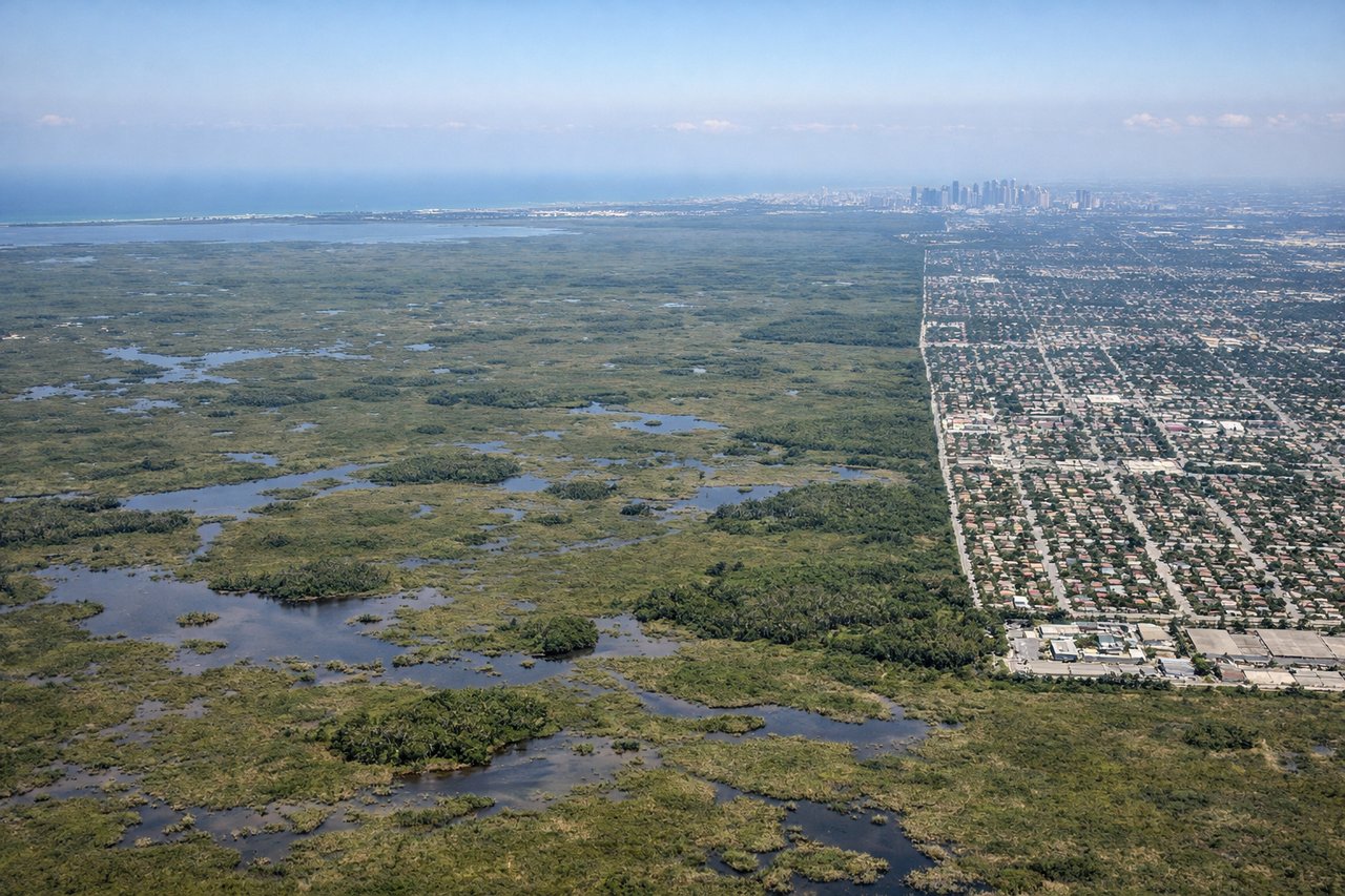
LEFTLeft-side seats offer the best approach views into Miami. As you descend from the northwest, you'll see Biscayne Bay, the Florida Keys stretching south, and the Miami metropolitan area's distinctive urban sprawl along the coast.
Will your flight be in sunlight?
Pick a date and time in the Sun Map to watch the sun move across your whole flight.
About This Route
Which side of the plane should I sit on flying from Terrance B Lettsome International (EIS) to Miami International (MIA)?
Sit on the Left side of the plane for the best views on flights from Tortola to Miami. While takeoff from Beef Island favors the right side, the landing approach into Miami from the left provides more sustained scenic value. The descent into Miami offers extended views of Biscayne Bay, the Keys, and the Everglades—a more visually rewarding final 30 minutes of flight.
What can I see during takeoff from Terrance B Lettsome International in Tortola?
During takeoff from Terrance B Lettsome International (EIS), sit on the Right side for the best views. Right-side seats capture the British Virgin Islands archipelago as you climb northwestward. You'll see Tortola's mountainous spine, surrounding smaller islands, and the Sir Francis Drake Channel—all dramatic and immediate off the wing. Notable sights include: Tortola (largest island with central ridge), Virgin Gorda (distinctive granite boulders visible at altitude), Jost Van Dyke (northwestern island), Sir Francis Drake Channel (deep blue water between islands).
What can I see when landing at Miami International in Miami?
When landing at Miami International (MIA), sit on the Left side for the best views. Left-side seats offer the best approach views into Miami. As you descend from the northwest, you'll see Biscayne Bay, the Florida Keys stretching south, and the Miami metropolitan area's distinctive urban sprawl along the coast. Notable sights include: Biscayne Bay (large shallow bay with visible sandbars and reef patterns), Florida Keys (chain of islands extending southwest toward the horizon), Miami Beach and downtown Miami skyline (high-rise clusters on the mainland), Everglades (vast wetland expanse to the west appearing as flat, vegetation-covered terrain).
How long is the flight from Tortola to Miami?
The flight from Terrance B Lettsome International (EIS) to Miami International (MIA) takes about 3 hours 15 minutes. The shortest flight path between them is 1,127 miles (1,814 km); winds and air traffic control usually add a few percent.
What does the Tortola to Miami flight path pass over?
The flight path crosses the open Atlantic and Caribbean waters northwest from the BVI. You'll pass over the Bahamas archipelago (if visible at altitude, appearing as low islands and shallow banks with turquoise water patterns). The midpoint offers mostly open ocean with occasional cloud formations. As you approach Florida, the Bahamas' northern islands and the Florida Strait become visible, with the mainland coast appearing on the horizon roughly 45 minutes before landing.