While takeoff favors right seats for the Keys, the landing view of Philadelphia's rivers and skyline is more visually rewarding and geographically distinctive. The Delaware and Schuylkill rivers with Center City provide a memorable urban geography experience that outweighs the Keys departure.
Flown EYW to PHL? Did we get it right?
Flight Path
Key West to Philadelphia is 1,124 miles (1,809 km), a flight of about 2 hours 50 minutes.
The flight path crosses the Atlantic coast near Cape Hatteras, North Carolina (visible from altitude as a distinctive sandy hook), then proceeds over the Outer Banks and inland toward the Appalachian foothills. The Chesapeake Bay is passed to the west during the approach phase. Cruising altitude provides views of the Atlantic coastline, the Mid-Atlantic piedmont, and scattered cumulus formations typical of the corridor.
Great circle distance and headings ›

Phase by phase
Takeoff from EYW
RIGHTKey West typically departs runway 09 (westbound) or 27 (eastbound). Right-side seats offer views of the Florida Keys archipelago stretching northeast, the shallow turquoise waters of the Gulf of Mexico, and the contrast between the narrow island chain and open water. Left seats see only open ocean and the Straits of Florida.
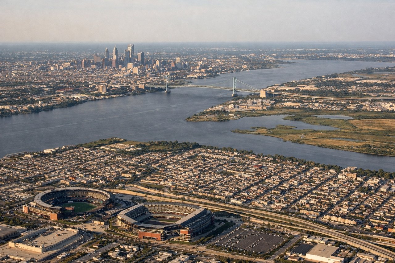
Landing at PHL
LEFTPhiladelphia typically lands runway 09L/09R (eastbound) or 27L/27R (westbound). Left-side seats during approach offer views of the Delaware River, the Schuylkill River confluence, Center City Philadelphia's skyline, and the urban grid of the city. Right seats see suburban sprawl and industrial areas west of the airport.
Will your flight be in sunlight?
Pick a date and time in the Sun Map to watch the sun move across your whole flight.
About This Route
Which side of the plane should I sit on flying from Key West International (EYW) to Philadelphia International (PHL)?
Sit on the Left side of the plane for the best views on flights from Key West to Philadelphia. While takeoff favors right seats for the Keys, the landing view of Philadelphia's rivers and skyline is more visually rewarding and geographically distinctive. The Delaware and Schuylkill rivers with Center City provide a memorable urban geography experience that outweighs the Keys departure.
What can I see during takeoff from Key West International in Key West?
During takeoff from Key West International (EYW), sit on the Right side for the best views. Key West typically departs runway 09 (westbound) or 27 (eastbound). Right-side seats offer views of the Florida Keys archipelago stretching northeast, the shallow turquoise waters of the Gulf of Mexico, and the contrast between the narrow island chain and open water. Left seats see only open ocean and the Straits of Florida. Notable sights include: Florida Keys chain extending northeast toward Marathon and Big Pine Key, Dry Tortugas National Park visible as shallow banks 70 miles west, Gulf of Mexico's distinctive turquoise shallows transitioning to deep blue, Atlantic Ocean to the south.
What can I see when landing at Philadelphia International in Philadelphia?
When landing at Philadelphia International (PHL), sit on the Left side for the best views. Philadelphia typically lands runway 09L/09R (eastbound) or 27L/27R (westbound). Left-side seats during approach offer views of the Delaware River, the Schuylkill River confluence, Center City Philadelphia's skyline, and the urban grid of the city. Right seats see suburban sprawl and industrial areas west of the airport. Notable sights include: Delaware River running north-south with visible bends and bridges, Schuylkill River joining from the west, Center City Philadelphia skyline with William Penn statue visible atop City Hall, Benjamin Franklin Bridge spanning the Delaware.
How long is the flight from Key West to Philadelphia?
The flight from Key West International (EYW) to Philadelphia International (PHL) takes about 2 hours 50 minutes. The shortest flight path between them is 1,124 miles (1,809 km); winds and air traffic control usually add a few percent.
What does the Key West to Philadelphia flight path pass over?
The flight path crosses the Atlantic coast near Cape Hatteras, North Carolina (visible from altitude as a distinctive sandy hook), then proceeds over the Outer Banks and inland toward the Appalachian foothills. The Chesapeake Bay is passed to the west during the approach phase. Cruising altitude provides views of the Atlantic coastline, the Mid-Atlantic piedmont, and scattered cumulus formations typical of the corridor.