Florianopolis to San Francisco is 6,567 miles (10,569 km), a flight of about 12 hours.
The right side wins overall due to the spectacular Florianópolis island departure view, which is one of the most visually distinctive urban island departures in South America. The landing views on the left at SFO are excellent but more familiar to frequent travelers. The right side also captures the Amazon basin and Caribbean coastline during the long northbound transit.
Flight Path
The flight path typically tracks north over southern Brazil passing the Paraná and São Paulo states, then over the Amazon basin with its vast river network visible on clear days, across the Caribbean Sea, over Central America or the Gulf of Mexico, and up the Pacific coast or over northern Mexico before descending into the Bay Area. The Amazon River mouth and its sediment plume into the Atlantic are visible if routing goes northeast, and the Sierra Madre Occidental in Mexico may appear on the right side during the final northward leg.
Great circle distance and headings ›


Phase by phase
Takeoff from FLN
RIGHTFLN's primary runway 14/32 means northbound departures head roughly northwest, putting the right side facing northeast toward the island of Florianópolis itself. The island's lagoons, beaches, and the distinctive Lagoa da Conceição are clearly visible on the right as the aircraft climbs out over the Atlantic.
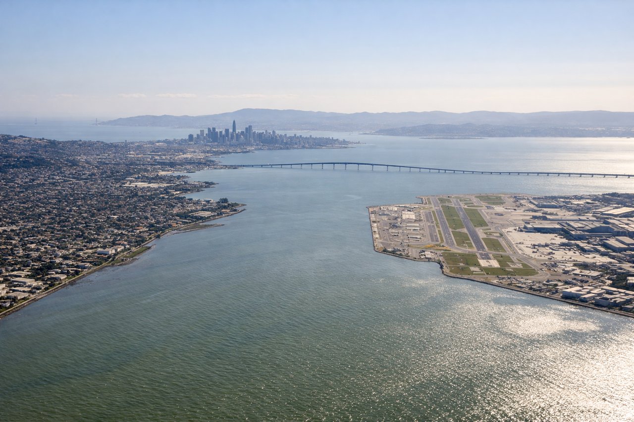
Landing at SFO
LEFTSFO's runways 28L/28R are the primary landing configuration for westerly winds, meaning aircraft approach from the east over the Bay Area. The left side faces south, giving a clear view of the San Francisco Bay, the San Mateo Bridge, and the Santa Cruz Mountains beyond. Right side faces north toward the city but is partially obscured by the fuselage angle on approach.
Landmarks on this routeAll landmarks →
Will your flight be in sunlight?
Pick a date and time in the Sun Map to watch the sun move across your whole flight.
About This Route
Which side of the plane should I sit on flying from Hercilio Luz (FLN) to San Francisco International (SFO)?
Sit on the Right side of the plane for the best views on flights from Florianopolis to San Francisco. The right side wins overall due to the spectacular Florianópolis island departure view, which is one of the most visually distinctive urban island departures in South America. The landing views on the left at SFO are excellent but more familiar to frequent travelers. The right side also captures the Amazon basin and Caribbean coastline during the long northbound transit.
What can I see during takeoff from Hercilio Luz in Florianopolis?
During takeoff from Hercilio Luz (FLN), sit on the Right side for the best views. FLN's primary runway 14/32 means northbound departures head roughly northwest, putting the right side facing northeast toward the island of Florianópolis itself. The island's lagoons, beaches, and the distinctive Lagoa da Conceição are clearly visible on the right as the aircraft climbs out over the Atlantic. Notable sights include: San Francisco Bay, San Mateo Bridge, Santa Cruz Mountains, South Bay wetlands and salt evaporation ponds.
What can I see when landing at San Francisco International in San Francisco?
When landing at San Francisco International (SFO), sit on the Left side for the best views. SFO's runways 28L/28R are the primary landing configuration for westerly winds, meaning aircraft approach from the east over the Bay Area. The left side faces south, giving a clear view of the San Francisco Bay, the San Mateo Bridge, and the Santa Cruz Mountains beyond. Right side faces north toward the city but is partially obscured by the fuselage angle on approach. Notable sights include: the city and surrounding area.
How long is the flight from Florianopolis to San Francisco?
The flight from Hercilio Luz (FLN) to San Francisco International (SFO) takes about 12 hours. The shortest flight path between them is 6,567 miles (10,569 km); winds and air traffic control usually add a few percent.
What does the Florianopolis to San Francisco flight path pass over?
The flight path typically tracks north over southern Brazil passing the Paraná and São Paulo states, then over the Amazon basin with its vast river network visible on clear days, across the Caribbean Sea, over Central America or the Gulf of Mexico, and up the Pacific coast or over northern Mexico before descending into the Bay Area. The Amazon River mouth and its sediment plume into the Atlantic are visible if routing goes northeast, and the Sierra Madre Occidental in Mexico may appear on the right side during the final northward leg.