The left side strings together the only real terrain highlights on this route: distant Vietnamese highlands at takeoff, a possible Mount Fuji sighting near the end of cruise, and Tokyo Bay/skyline on the descent into Narita. The right side spends more time over featureless delta and open sea with a plainer Pacific coastline at the end.
Flown HAN to NRT? Did we get it right?
Flight Path
Hanoi to Tokyo is 2,312 miles (3,720 km), a flight of about 4 hours 50 minutes.
Southern China's Fujian coastal hills near Fuzhou, followed by a long crossing of the East China Sea before landfall over southwestern Japan near the Kii Peninsula/Shikoku approach corridor.
Great circle distance and headings ›


Phase by phase
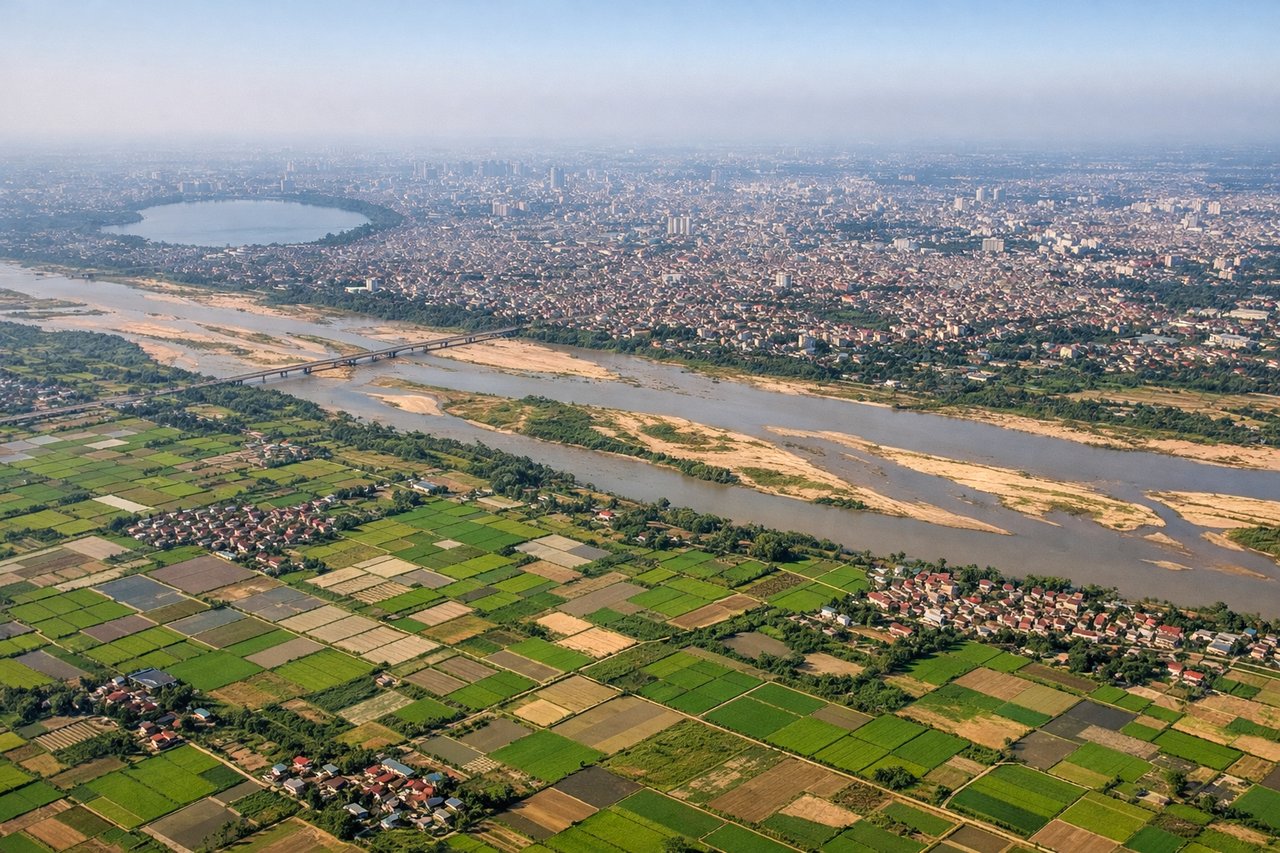
Takeoff from HAN
LEFTDeparting HAN toward the northeast, the left side faces the Red River Delta's patchwork fields with the Tam Dao ridge and, on a clear day, the higher Hoang Lien Son range (including Fansipan, Indochina's tallest peak) visible as a distant backdrop. The right side mostly shows flat delta terrain fading toward the Gulf of Tonkin with little definition.
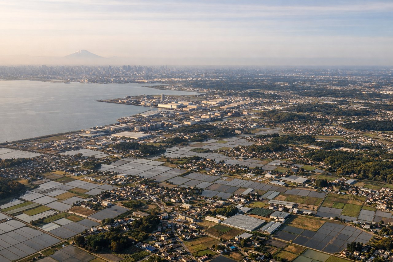
Landing at NRT
LEFTOn the descent into Narita from the southwest, the great-circle path passes just south of Mount Fuji, putting it on the left side along with glimpses of Tokyo Bay and the city skyline as the aircraft turns north toward the airport. The right side mainly shows the flatter Pacific-facing Kujukuri coastline of Chiba, which is scenic but less distinctive.
Will your flight be in sunlight?
Pick a date and time in the Sun Map to watch the sun move across your whole flight.
About This Route
Which side of the plane should I sit on flying from Noibai International (HAN) to New Tokyo International (NRT)?
Sit on the Left side of the plane for the best views on flights from Hanoi to Tokyo. The left side strings together the only real terrain highlights on this route: distant Vietnamese highlands at takeoff, a possible Mount Fuji sighting near the end of cruise, and Tokyo Bay/skyline on the descent into Narita. The right side spends more time over featureless delta and open sea with a plainer Pacific coastline at the end.
What can I see during takeoff from Noibai International in Hanoi?
During takeoff from Noibai International (HAN), sit on the Left side for the best views. Departing HAN toward the northeast, the left side faces the Red River Delta's patchwork fields with the Tam Dao ridge and, on a clear day, the higher Hoang Lien Son range (including Fansipan, Indochina's tallest peak) visible as a distant backdrop. The right side mostly shows flat delta terrain fading toward the Gulf of Tonkin with little definition. Notable sights include: Red River Delta rice paddies, Tam Dao mountain ridge, distant Hoang Lien Son range (Fansipan peak).
What can I see when landing at New Tokyo International in Tokyo?
When landing at New Tokyo International (NRT), sit on the Left side for the best views. On the descent into Narita from the southwest, the great-circle path passes just south of Mount Fuji, putting it on the left side along with glimpses of Tokyo Bay and the city skyline as the aircraft turns north toward the airport. The right side mainly shows the flatter Pacific-facing Kujukuri coastline of Chiba, which is scenic but less distinctive. Notable sights include: Mount Fuji silhouette on the horizon, Tokyo Bay and Tokyo skyline, Boso Peninsula hills, Chiba farmland and suburbs.
How long is the flight from Hanoi to Tokyo?
The flight from Noibai International (HAN) to New Tokyo International (NRT) takes about 4 hours 50 minutes. The shortest flight path between them is 2,312 miles (3,720 km); winds and air traffic control usually add a few percent.
What does the Hanoi to Tokyo flight path pass over?
Southern China's Fujian coastal hills near Fuzhou, followed by a long crossing of the East China Sea before landfall over southwestern Japan near the Kii Peninsula/Shikoku approach corridor.