Takeoff views are superior on the right (Red River Delta and Tam Dao Mountains are more visually distinctive than flat delta on left). Landing favors left (Taipei 101 and basin views). Right edges out left overall due to the dramatic takeoff sequence over the delta and mountains.
Flown HAN to TSA? Did we get it right?
Flight Path
Hanoi to Taipei is 1,034 miles (1,665 km), a flight of about 2 hours 40 minutes.
Flight path crosses the Gulf of Tonkin (Bac Bo Gulf) heading northeast. At cruise altitude (around 30,000 feet), the gulf appears as open water with occasional fishing vessel clusters visible. The Hainan Island coastline may be visible to the right (east) as a distant landmass. As the aircraft approaches Taiwan, the Taiwan Strait widens below, and the northern tip of Taiwan becomes visible on the horizon around 30 minutes before landing. The Keelung area and northern Taiwan coast gradually resolve as the descent continues.
Great circle distance and headings ›Phase by phase
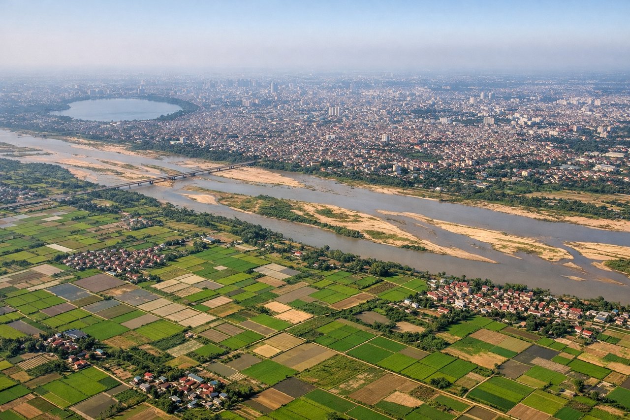
Takeoff from HAN
RIGHTNoibai typically departs on runway 01L/01R (northbound). Right-side seats face west across the Red River Delta and toward the Tam Dao Mountains. Left seats see only the flat delta and industrial areas.

Landing at TSA
LEFTSungshan (TSA) sits on Taipei's northern edge and uses runways 10/28. Approach from the southwest means left-side seats face northeast toward Taipei 101, the Taipei Basin, and the Keelung River. Right seats see only the Taiwan Strait and distant coast.
Will your flight be in sunlight?
Pick a date and time in the Sun Map to watch the sun move across your whole flight.
About This Route
Which side of the plane should I sit on flying from Noibai International (HAN) to Sungshan (TSA)?
Sit on the Right side of the plane for the best views on flights from Hanoi to Taipei. Takeoff views are superior on the right (Red River Delta and Tam Dao Mountains are more visually distinctive than flat delta on left). Landing favors left (Taipei 101 and basin views). Right edges out left overall due to the dramatic takeoff sequence over the delta and mountains.
What can I see during takeoff from Noibai International in Hanoi?
During takeoff from Noibai International (HAN), sit on the Right side for the best views. Noibai typically departs on runway 01L/01R (northbound). Right-side seats face west across the Red River Delta and toward the Tam Dao Mountains. Left seats see only the flat delta and industrial areas. Notable sights include: Red River Delta (extensive agricultural patchwork directly below), Tam Dao Mountains (distant western ridge), Hanoi city sprawl (south and southeast), Thai Nguyen industrial region (southwest on horizon).
What can I see when landing at Sungshan in Taipei?
When landing at Sungshan (TSA), sit on the Left side for the best views. Sungshan (TSA) sits on Taipei's northern edge and uses runways 10/28. Approach from the southwest means left-side seats face northeast toward Taipei 101, the Taipei Basin, and the Keelung River. Right seats see only the Taiwan Strait and distant coast. Notable sights include: Taipei 101 (distinctive supertall structure in city center), Taipei Basin urban grid (dense development), Keelung River (winding through city), Yangmingshan National Park (forested mountains north of basin).
How long is the flight from Hanoi to Taipei?
The flight from Noibai International (HAN) to Sungshan (TSA) takes about 2 hours 40 minutes. The shortest flight path between them is 1,034 miles (1,665 km); winds and air traffic control usually add a few percent.
What does the Hanoi to Taipei flight path pass over?
Flight path crosses the Gulf of Tonkin (Bac Bo Gulf) heading northeast. At cruise altitude (around 30,000 feet), the gulf appears as open water with occasional fishing vessel clusters visible. The Hainan Island coastline may be visible to the right (east) as a distant landmass. As the aircraft approaches Taiwan, the Taiwan Strait widens below, and the northern tip of Taiwan becomes visible on the horizon around 30 minutes before landing. The Keelung area and northern Taiwan coast gradually resolve as the descent continues.