The right side offers a brief but genuine skyline view on departure and, more importantly, the dramatic volcanic peaks framing the final approach into Mexico City, while the left side mostly shows flat coastal plain and hazy Gulf lowlands.
Flown IAH to MEX? Did we get it right?
Flight Path
Houston to Mexico City is 765 miles (1,232 km), a flight of about 2 hours 20 minutes.
Gulf of Mexico coastline near Tampico, eastern foothills of the Sierra Madre Oriental, and the high central plateau approaching the Valley of Mexico
Great circle distance and headings ›


Phase by phase

Takeoff from IAH
RIGHTIAH departures headed toward Mexico typically lift off to the south and bank west onto the outbound heading, briefly swinging the Houston skyline and refinery complexes along the Ship Channel into view on the right side before leveling out over flat farmland.
Landing at MEX
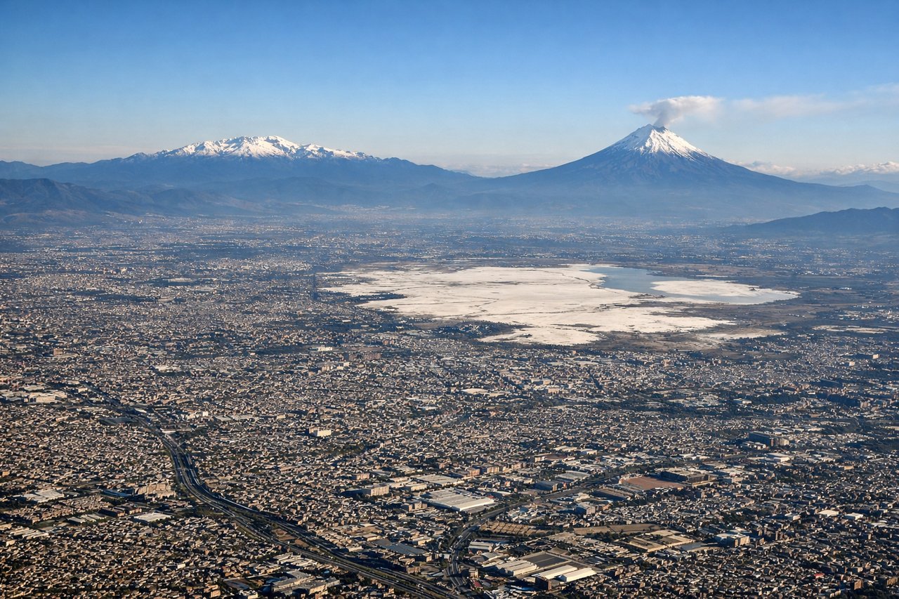
RIGHTOn approach into Mexico City's high-altitude basin, arrivals from the north commonly curve around the eastern side of the valley, putting the snow-streaked volcanic peaks of Popocatépetl and Iztaccíhuatl into view on the right side as the aircraft descends toward the runway.
Will your flight be in sunlight?
Pick a date and time in the Sun Map to watch the sun move across your whole flight.
About This Route
Which side of the plane should I sit on flying from George Bush Intcntl Houston (IAH) to Licenciado Benito Juarez International (MEX)?
Sit on the Right side of the plane for the best views on flights from Houston to Mexico City. The right side offers a brief but genuine skyline view on departure and, more importantly, the dramatic volcanic peaks framing the final approach into Mexico City, while the left side mostly shows flat coastal plain and hazy Gulf lowlands.
What can I see during takeoff from George Bush Intcntl Houston in Houston?
During takeoff from George Bush Intcntl Houston (IAH), sit on the Right side for the best views. IAH departures headed toward Mexico typically lift off to the south and bank west onto the outbound heading, briefly swinging the Houston skyline and refinery complexes along the Ship Channel into view on the right side before leveling out over flat farmland. Notable sights include: Houston downtown skyline, Ship Channel refineries, Addicks/Barker reservoirs, flat Texas coastal plain.
What can I see when landing at Licenciado Benito Juarez International in Mexico City?
When landing at Licenciado Benito Juarez International (MEX), sit on the Right side for the best views. On approach into Mexico City's high-altitude basin, arrivals from the north commonly curve around the eastern side of the valley, putting the snow-streaked volcanic peaks of Popocatépetl and Iztaccíhuatl into view on the right side as the aircraft descends toward the runway. Notable sights include: Popocatépetl volcano, Iztaccíhuatl volcano, Valley of Mexico basin, sprawling Mexico City urban grid.
How long is the flight from Houston to Mexico City?
The flight from George Bush Intcntl Houston (IAH) to Licenciado Benito Juarez International (MEX) takes about 2 hours 20 minutes. The shortest flight path between them is 765 miles (1,232 km); winds and air traffic control usually add a few percent.
What does the Houston to Mexico City flight path pass over?
Gulf of Mexico coastline near Tampico, eastern foothills of the Sierra Madre Oriental, and the high central plateau approaching the Valley of Mexico