The right side tracks closer to the string of named desert ranges and cities along the route - the Guadalupe and Franklin Mountains near El Paso, the Santa Catalina Mountains around Tucson, and the Salton Sea basin - giving the cruise phase, which makes up most of the flight, far more visual variety and drama than the flatter, less distinct scenery on the left.
Flown IAH to SAN? Did we get it right?
Flight Path
Houston to San Diego is 1,301 miles (2,093 km), a flight of about 3 hours 30 minutes.
Chihuahuan Desert and the Franklin/Guadalupe Mountains near El Paso, followed by the Sonoran Desert and Santa Catalina Mountains around Tucson, then the Colorado Desert and Salton Sea basin before the Laguna Mountains east of San Diego
Great circle distance and headings ›Phase by phase
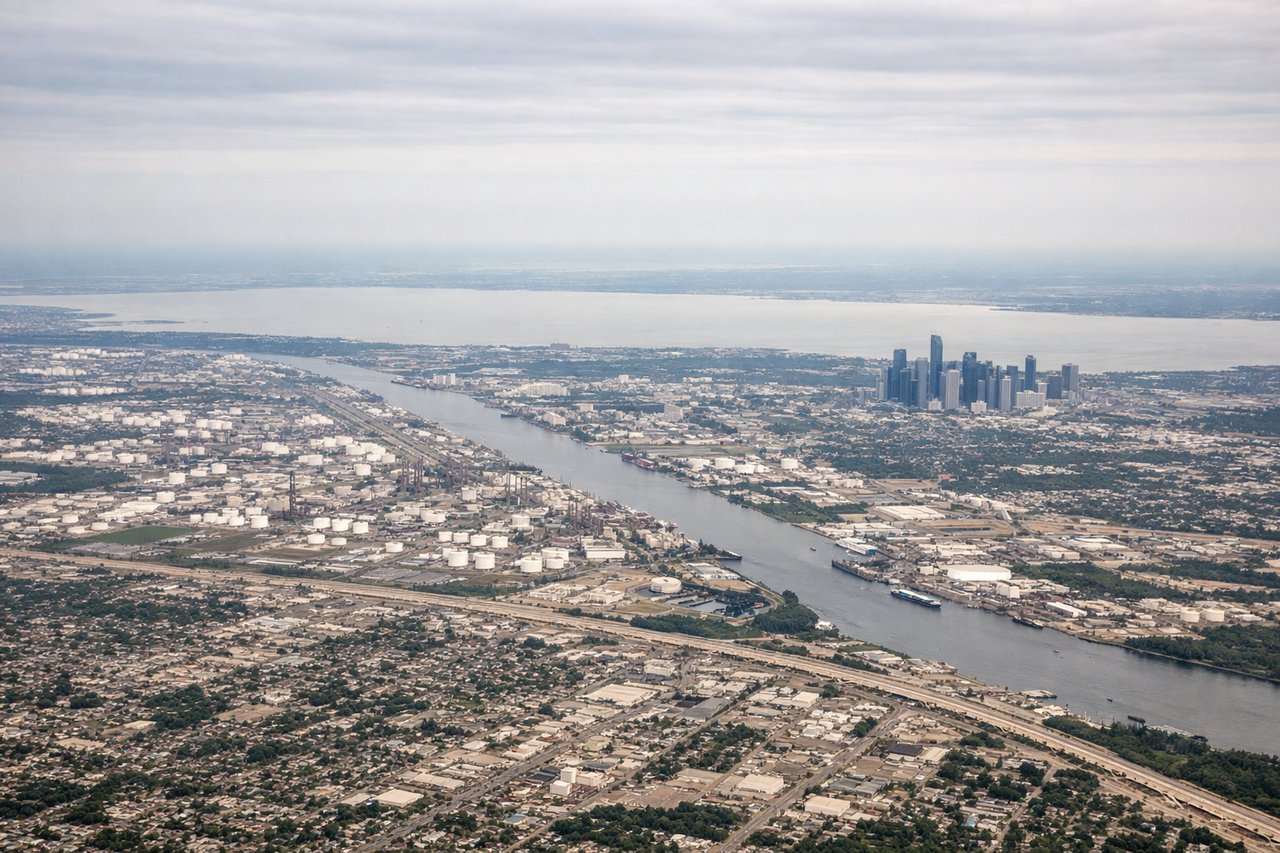
Takeoff from IAH
LEFTIAH sits north of downtown Houston, so a westbound departure puts the skyline in view to the south (left side) during the initial climb, giving a brief urban skyline moment before the flat Gulf Coast plain takes over. The right side only sees featureless suburban sprawl.

Landing at SAN
LEFTOn the standard westbound approach to Runway 27, the aircraft passes just north of the downtown core, putting the San Diego skyline, harbor, and Coronado Bay Bridge squarely in view on the left side just before touchdown. This is one of the most photographed urban landing sequences in the US.
Will your flight be in sunlight?
Pick a date and time in the Sun Map to watch the sun move across your whole flight.
About This Route
Which side of the plane should I sit on flying from George Bush Intcntl Houston (IAH) to San Diego International Lindbergh Fld (SAN)?
Sit on the Right side of the plane for the best views on flights from Houston to San Diego. The right side tracks closer to the string of named desert ranges and cities along the route - the Guadalupe and Franklin Mountains near El Paso, the Santa Catalina Mountains around Tucson, and the Salton Sea basin - giving the cruise phase, which makes up most of the flight, far more visual variety and drama than the flatter, less distinct scenery on the left.
What can I see during takeoff from George Bush Intcntl Houston in Houston?
During takeoff from George Bush Intcntl Houston (IAH), sit on the Left side for the best views. IAH sits north of downtown Houston, so a westbound departure puts the skyline in view to the south (left side) during the initial climb, giving a brief urban skyline moment before the flat Gulf Coast plain takes over. The right side only sees featureless suburban sprawl. Notable sights include: Downtown Houston skyline, Sam Houston Tollway loop, Buffalo Bayou, flat suburban grid.
What can I see when landing at San Diego International Lindbergh Fld in San Diego?
When landing at San Diego International Lindbergh Fld (SAN), sit on the Left side for the best views. On the standard westbound approach to Runway 27, the aircraft passes just north of the downtown core, putting the San Diego skyline, harbor, and Coronado Bay Bridge squarely in view on the left side just before touchdown. This is one of the most photographed urban landing sequences in the US. Notable sights include: Downtown San Diego skyline, San Diego Bay, Coronado Bay Bridge, Point Loma peninsula.
How long is the flight from Houston to San Diego?
The flight from George Bush Intcntl Houston (IAH) to San Diego International Lindbergh Fld (SAN) takes about 3 hours 30 minutes. The shortest flight path between them is 1,301 miles (2,093 km); winds and air traffic control usually add a few percent.
What does the Houston to San Diego flight path pass over?
Chihuahuan Desert and the Franklin/Guadalupe Mountains near El Paso, followed by the Sonoran Desert and Santa Catalina Mountains around Tucson, then the Colorado Desert and Salton Sea basin before the Laguna Mountains east of San Diego