The right side wins overall. While the left side has a decent Houston departure view, the right side delivers the payoff: the Guadalupe Mountains and Sacramento Mountains of New Mexico in the mid-flight, and then the spectacular SNA approach over the Orange County coast with Catalina Island and Newport Bay. The coastal arrival alone makes right the clear choice.
Flown IAH to SNA? Did we get it right?
Flight Path
Houston to Santa Ana is 1,344 miles (2,163 km), a flight of about 3 hours 15 minutes.
The flight tracks northwest over the Texas Hill Country, then crosses the Guadalupe Mountains near El Paso (visible as a distinct ridge rising from the Chihuahuan Desert), continues over the Sacramento Mountains and White Sands region of New Mexico, crosses the Sonoran Desert of Arizona, passes north of the Phoenix metro area, then descends over the Mojave Desert and San Bernardino Mountains before dropping into the LA Basin and Orange County coast
Great circle distance and headings ›


Phase by phase
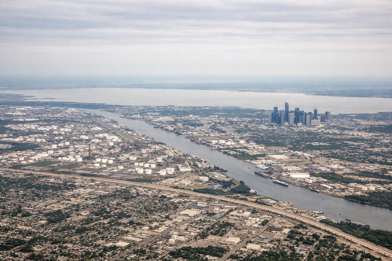
Takeoff from IAH
LEFTIAH primarily departs westbound on runways 26L/26R or northbound on 15L/15R. On a westbound departure, the left (south) side gives you a clear view over downtown Houston's skyline as the aircraft climbs and turns northwest. You can pick out the cluster of glass towers in the central business district and the sprawl of the Energy Corridor to the west.
Landing at SNA
RIGHTSNA typically lands on runway 20R, approaching from the north over the Santa Ana Mountains and Orange County suburbs. The right (west) side gives you the Pacific Ocean coastline from Newport Beach down through Laguna Beach, plus the sweep of the OC coastline and Catalina Island on the horizon. This is a dramatically more scenic approach than the inland left side.
Will your flight be in sunlight?
Pick a date and time in the Sun Map to watch the sun move across your whole flight.
About This Route
Which side of the plane should I sit on flying from George Bush Intcntl Houston (IAH) to John Wayne Arpt Orange Co (SNA)?
Sit on the Right side of the plane for the best views on flights from Houston to Santa Ana. The right side wins overall. While the left side has a decent Houston departure view, the right side delivers the payoff: the Guadalupe Mountains and Sacramento Mountains of New Mexico in the mid-flight, and then the spectacular SNA approach over the Orange County coast with Catalina Island and Newport Bay. The coastal arrival alone makes right the clear choice.
What can I see during takeoff from George Bush Intcntl Houston in Houston?
During takeoff from George Bush Intcntl Houston (IAH), sit on the Left side for the best views. IAH primarily departs westbound on runways 26L/26R or northbound on 15L/15R. On a westbound departure, the left (south) side gives you a clear view over downtown Houston's skyline as the aircraft climbs and turns northwest. You can pick out the cluster of glass towers in the central business district and the sprawl of the Energy Corridor to the west. Notable sights include: Downtown Houston skyline, Buffalo Bayou greenway corridor, Hobby Airport to the southeast, Lake Houston to the east.
What can I see when landing at John Wayne Arpt Orange Co in Santa Ana?
When landing at John Wayne Arpt Orange Co (SNA), sit on the Right side for the best views. SNA typically lands on runway 20R, approaching from the north over the Santa Ana Mountains and Orange County suburbs. The right (west) side gives you the Pacific Ocean coastline from Newport Beach down through Laguna Beach, plus the sweep of the OC coastline and Catalina Island on the horizon. This is a dramatically more scenic approach than the inland left side. Notable sights include: Pacific Ocean coastline from Newport Beach to Laguna Beach, Catalina Island on the horizon, Newport Bay and Back Bay estuary, Disneyland resort complex.
How long is the flight from Houston to Santa Ana?
The flight from George Bush Intcntl Houston (IAH) to John Wayne Arpt Orange Co (SNA) takes about 3 hours 15 minutes. The shortest flight path between them is 1,344 miles (2,163 km); winds and air traffic control usually add a few percent.
What does the Houston to Santa Ana flight path pass over?
The flight tracks northwest over the Texas Hill Country, then crosses the Guadalupe Mountains near El Paso (visible as a distinct ridge rising from the Chihuahuan Desert), continues over the Sacramento Mountains and White Sands region of New Mexico, crosses the Sonoran Desert of Arizona, passes north of the Phoenix metro area, then descends over the Mojave Desert and San Bernardino Mountains before dropping into the LA Basin and Orange County coast