Left wins at takeoff for the Manhattan and Jamaica Bay views, but right side delivers the more dramatic payoff on arrival with the entire British Virgin Islands chain, St. John, and Charlotte Amalie harbor visible. The Caribbean arrival scenery is genuinely exceptional and tips the balance to the right side overall.
Flown JFK to STT? Did we get it right?
Flight Path
New York to St. Thomas is 1,627 miles (2,619 km), a flight of about 3 hours 40 minutes.
The flight tracks southeast over the open Atlantic for most of its duration, passing east of the Bahamas chain around the midpoint. The Turks and Caicos Islands may be visible as low flat white-rimmed atolls in the deep blue water roughly 2.5 hours into the flight. As the aircraft descends toward the Caribbean, Puerto Rico's mountainous interior — the Cordillera Central reaching over 4,000 feet — appears to the west, and the passage between Puerto Rico and the Virgin Islands, the Virgin Passage, marks the final approach corridor.
Great circle distance and headings ›Phase by phase
Takeoff from JFK
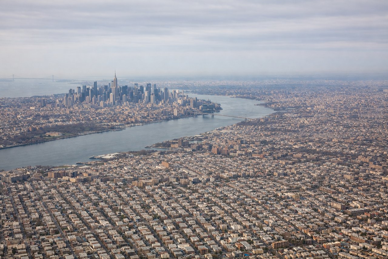
LEFTJFK's primary departure runways 31L/31R send aircraft northwest then curving south over Jamaica Bay and the Atlantic. The left side gets a clear view of Manhattan's skyline receding to the north, plus the full sweep of Jamaica Bay's wetlands directly below. Right side faces south toward the open Atlantic with little of interest.
Landing at STT
RIGHTSt. Thomas's runway 10 is the primary arrival direction, meaning aircraft approach from the west over open water and touch down heading east. The right side faces south toward St. John and the British Virgin Islands, giving a spectacular view of the island chain, Pillsbury Sound, and the green hillsides of St. Thomas itself on final approach. Left side faces north toward open Atlantic.
Will your flight be in sunlight?
Pick a date and time in the Sun Map to watch the sun move across your whole flight.
About This Route
Which side of the plane should I sit on flying from John F Kennedy International (JFK) to Cyril E King (STT)?
Sit on the Right side of the plane for the best views on flights from New York to St. Thomas. Left wins at takeoff for the Manhattan and Jamaica Bay views, but right side delivers the more dramatic payoff on arrival with the entire British Virgin Islands chain, St. John, and Charlotte Amalie harbor visible. The Caribbean arrival scenery is genuinely exceptional and tips the balance to the right side overall.
What can I see during takeoff from John F Kennedy International in New York?
During takeoff from John F Kennedy International (JFK), sit on the Left side for the best views. JFK's primary departure runways 31L/31R send aircraft northwest then curving south over Jamaica Bay and the Atlantic. The left side gets a clear view of Manhattan's skyline receding to the north, plus the full sweep of Jamaica Bay's wetlands directly below. Right side faces south toward the open Atlantic with little of interest. Notable sights include: Manhattan skyline to the north, Jamaica Bay and its barrier islands directly below, Verrazano-Narrows Bridge spanning the harbor entrance, Coney Island beachfront to the northwest.
What can I see when landing at Cyril E King in St. Thomas?
When landing at Cyril E King (STT), sit on the Right side for the best views. St. Thomas's runway 10 is the primary arrival direction, meaning aircraft approach from the west over open water and touch down heading east. The right side faces south toward St. John and the British Virgin Islands, giving a spectacular view of the island chain, Pillsbury Sound, and the green hillsides of St. Thomas itself on final approach. Left side faces north toward open Atlantic. Notable sights include: St. John island across Pillsbury Sound to the southeast, Tortola and the British Virgin Islands chain on the southern horizon, Charlotte Amalie harbor and its cruise ship anchorage below, the green volcanic ridgeline of St. Thomas running east-west.
How long is the flight from New York to St. Thomas?
The flight from John F Kennedy International (JFK) to Cyril E King (STT) takes about 3 hours 40 minutes. The shortest flight path between them is 1,627 miles (2,619 km); winds and air traffic control usually add a few percent.
What does the New York to St. Thomas flight path pass over?
The flight tracks southeast over the open Atlantic for most of its duration, passing east of the Bahamas chain around the midpoint. The Turks and Caicos Islands may be visible as low flat white-rimmed atolls in the deep blue water roughly 2.5 hours into the flight. As the aircraft descends toward the Caribbean, Puerto Rico's mountainous interior — the Cordillera Central reaching over 4,000 feet — appears to the west, and the passage between Puerto Rico and the Virgin Islands, the Virgin Passage, marks the final approach corridor.