Juliaca to Lima is 524 miles (843 km), a flight of about 1 hour 25 minutes.
The right side wins overall because the departure and much of the cruise phase track along the dramatic high Andes and volcanic cordillera near Arequipa, offering sustained mountain drama, while the left side's ocean and coastal views during landing are shorter in duration and less varied.
Flight Path
High Andean cordillera and volcanic peaks near Arequipa region, including Coropuna and Ampato, followed by descent toward the arid Peruvian coastal desert near Lima
Great circle distance and headings ›Phase by phase
Takeoff from JUL
RIGHTDeparting Juliaca on the Altiplano, the right side offers views of the snow-capped Andean cordillera and volcanic peaks near Arequipa (Chachani, Ampato) as the aircraft climbs away from the high plateau. The left side mostly shows the flatter Altiplano grasslands near Lake Titicaca's basin.
Landing at LIM
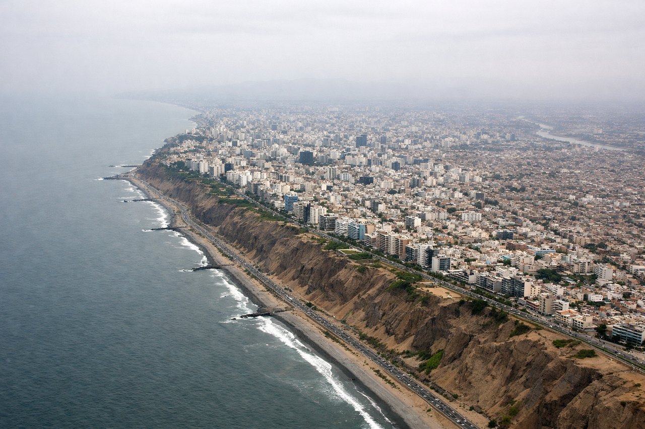
LEFTOn approach into Lima, the aircraft descends toward the coast and the left side offers views of the Pacific Ocean, the desert coastal cliffs, and the sprawl of Lima's coastal districts before the runway 16 landing.
Landmarks on this routeAll landmarks →
Will your flight be in sunlight?
Pick a date and time in the Sun Map to watch the sun move across your whole flight.
About This Route
Which side of the plane should I sit on flying from Juliaca (JUL) to Jorge Chávez International Airport (LIM)?
Sit on the Right side of the plane for the best views on flights from Juliaca to Lima. The right side wins overall because the departure and much of the cruise phase track along the dramatic high Andes and volcanic cordillera near Arequipa, offering sustained mountain drama, while the left side's ocean and coastal views during landing are shorter in duration and less varied.
What can I see during takeoff from Juliaca in Juliaca?
During takeoff from Juliaca (JUL), sit on the Right side for the best views. Departing Juliaca on the Altiplano, the right side offers views of the snow-capped Andean cordillera and volcanic peaks near Arequipa (Chachani, Ampato) as the aircraft climbs away from the high plateau. The left side mostly shows the flatter Altiplano grasslands near Lake Titicaca's basin. Notable sights include: Cordillera Occidental peaks, Chachani volcano, Ampato volcano, Altiplano plateau.
What can I see when landing at Jorge Chávez International Airport in Lima?
When landing at Jorge Chávez International Airport (LIM), sit on the Left side for the best views. On approach into Lima, the aircraft descends toward the coast and the left side offers views of the Pacific Ocean, the desert coastal cliffs, and the sprawl of Lima's coastal districts before the runway 16 landing. Notable sights include: Pacific Ocean coastline, Lima's coastal desert bluffs, Miraflores/Costa Verde district, Callao harbor.
How long is the flight from Juliaca to Lima?
The flight from Juliaca (JUL) to Jorge Chávez International Airport (LIM) takes about 1 hour 25 minutes. The shortest flight path between them is 524 miles (843 km); winds and air traffic control usually add a few percent.
What does the Juliaca to Lima flight path pass over?
High Andean cordillera and volcanic peaks near Arequipa region, including Coropuna and Ampato, followed by descent toward the arid Peruvian coastal desert near Lima