Right-side seats provide the most compelling scenery for the majority of this short flight, with Yakushima's dramatic topography dominating the departure phase. While landing favors the left, the takeoff views are more visually distinctive.
Flown KUM to FUK? Did we get it right?
Flight Path
Yakushima to Fukuoka is 221 miles (356 km), a flight of about 50 minutes.
The flight path crosses the Kyushu Channel, passing over open water with the Osumi Islands visible to the west. The Satsuma Peninsula's western coast becomes visible as the aircraft approaches Fukuoka from the southeast. No major mountain ranges are crossed, but the transition from island terrain to coastal plains is notable.
Great circle distance and headings ›Phase by phase
Takeoff from KUM
RIGHTRight-side seats capture Yakushima's dramatic mountainous terrain and the Kuroshio Current waters immediately after departure. The island's steep ridges and forested slopes are most visible on the right as the aircraft climbs northwestward toward Fukuoka.
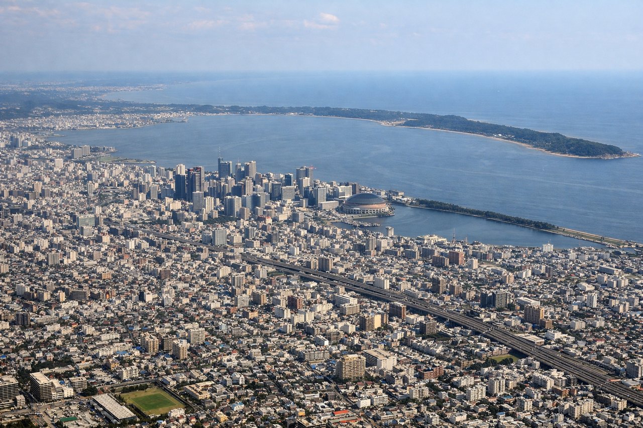
Landing at FUK
LEFTLeft-side seats offer views of the Fukuoka urban area and Hakata Bay during descent. As the aircraft approaches from the southeast, the left side reveals the city's sprawl, the bay's coastline, and the Genkai Sea beyond.
Will your flight be in sunlight?
Pick a date and time in the Sun Map to watch the sun move across your whole flight.
About This Route
Which side of the plane should I sit on flying from Yakushima (KUM) to Fukuoka (FUK)?
Sit on the Right side of the plane for the best views on flights from Yakushima to Fukuoka. Right-side seats provide the most compelling scenery for the majority of this short flight, with Yakushima's dramatic topography dominating the departure phase. While landing favors the left, the takeoff views are more visually distinctive.
What can I see during takeoff from Yakushima in Yakushima?
During takeoff from Yakushima (KUM), sit on the Right side for the best views. Right-side seats capture Yakushima's dramatic mountainous terrain and the Kuroshio Current waters immediately after departure. The island's steep ridges and forested slopes are most visible on the right as the aircraft climbs northwestward toward Fukuoka. Notable sights include: Yakushima's central mountain ridge (peaks around 1,900m), dense subtropical forest canopy, Kuroshio Current waters (darker blue offshore), nearby smaller islands of the Osumi Islands chain.
What can I see when landing at Fukuoka in Fukuoka?
When landing at Fukuoka (FUK), sit on the Left side for the best views. Left-side seats offer views of the Fukuoka urban area and Hakata Bay during descent. As the aircraft approaches from the southeast, the left side reveals the city's sprawl, the bay's coastline, and the Genkai Sea beyond. Notable sights include: Hakata Bay (distinctive curved coastline), Fukuoka city grid and urban development, Genkai Sea, Shikano Peninsula to the west.
How long is the flight from Yakushima to Fukuoka?
The flight from Yakushima (KUM) to Fukuoka (FUK) takes about 50 minutes. The shortest flight path between them is 221 miles (356 km); winds and air traffic control usually add a few percent.
What does the Yakushima to Fukuoka flight path pass over?
The flight path crosses the Kyushu Channel, passing over open water with the Osumi Islands visible to the west. The Satsuma Peninsula's western coast becomes visible as the aircraft approaches Fukuoka from the southeast. No major mountain ranges are crossed, but the transition from island terrain to coastal plains is notable.