La Paz to Mexico City is 792 miles (1,274 km), a flight of about 2 hours 15 minutes.
While takeoff offers excellent coastal and desert views on the right, the landing approach provides more dramatic and sustained visual interest with the Valley of Mexico's scale, surrounding mountains, and city landmarks. Left-side seats capture the most distinctive features of the destination.
Flight Path
The flight path crosses central Mexico at cruise altitude (typically 28,000-32,000 feet). Notable features include the Sierra Madre Occidental mountain range running north-south on the left (west) side of the route, the high desert plateau of central Mexico in the middle distance, and occasional views of smaller mountain ranges and valleys. The terrain gradually transitions from Baja's sparse desert to Mexico's more vegetated central highlands. At cruise altitude, individual landmarks become small, but the broad mountain ranges and basin topography remain visible on clear days. The approach into Mexico City descends through the Valley of Mexico, surrounded by volcanic peaks including Popocatépetl and Iztaccíhuatl (though these are typically obscured by haze or clouds during standard approach corridors).
Great circle distance and headings ›_(cropped).jpg?width=600)

Phase by phase
Takeoff from LAP
RIGHTLa Paz typically departs runway 01/19 depending on wind. Right-side seats offer views of the Sea of Cortez immediately after takeoff, with the Baja California peninsula's desert terrain and coastal features visible as the aircraft climbs southeastward toward Mexico City.
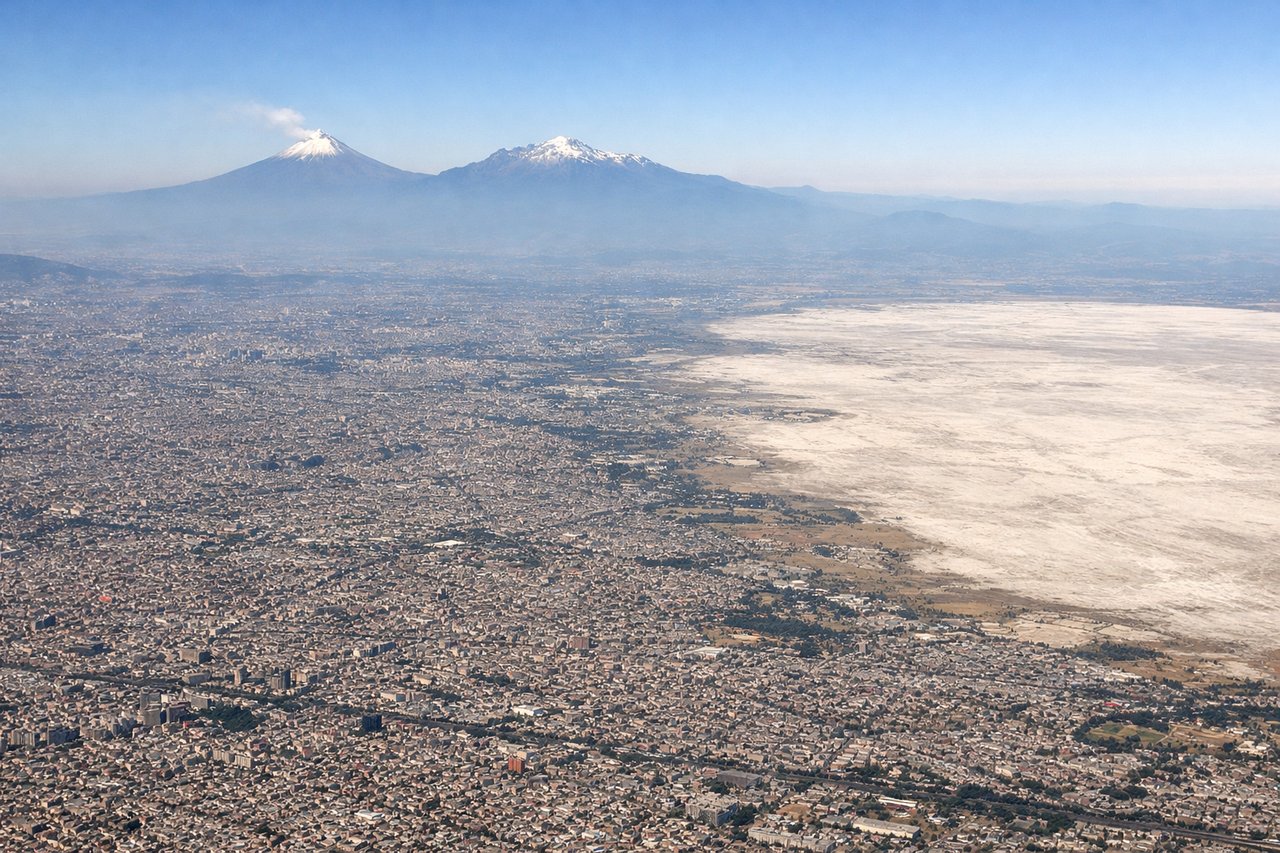
Landing at MEX
LEFTApproaching Mexico City from the northwest, aircraft descend over the Valley of Mexico with views of the surrounding mountain ranges. Left-side seats capture the Sierra Madre Occidental and the city's sprawl across the high-altitude basin, plus views of Chapultepec Park and the city center as you descend into Benito Juarez.
Landmarks on this routeAll landmarks →
Will your flight be in sunlight?
Pick a date and time in the Sun Map to watch the sun move across your whole flight.
About This Route
Which side of the plane should I sit on flying from General Manuel Marquez De Leon International (LAP) to Licenciado Benito Juarez International (MEX)?
Sit on the Left side of the plane for the best views on flights from La Paz to Mexico City. While takeoff offers excellent coastal and desert views on the right, the landing approach provides more dramatic and sustained visual interest with the Valley of Mexico's scale, surrounding mountains, and city landmarks. Left-side seats capture the most distinctive features of the destination.
What can I see during takeoff from General Manuel Marquez De Leon International in La Paz?
During takeoff from General Manuel Marquez De Leon International (LAP), sit on the Right side for the best views. La Paz typically departs runway 01/19 depending on wind. Right-side seats offer views of the Sea of Cortez immediately after takeoff, with the Baja California peninsula's desert terrain and coastal features visible as the aircraft climbs southeastward toward Mexico City. Notable sights include: Sea of Cortez (immediate eastern view), Baja California Sur desert plateau, Sierra de la Laguna mountain range to the south, Espiritu Santo Island in the bay.
What can I see when landing at Licenciado Benito Juarez International in Mexico City?
When landing at Licenciado Benito Juarez International (MEX), sit on the Left side for the best views. Approaching Mexico City from the northwest, aircraft descend over the Valley of Mexico with views of the surrounding mountain ranges. Left-side seats capture the Sierra Madre Occidental and the city's sprawl across the high-altitude basin, plus views of Chapultepec Park and the city center as you descend into Benito Juarez. Notable sights include: Valley of Mexico basin, Sierra Madre Occidental (north and west), Chapultepec Park and Paseo de la Reforma corridor, Lake Texcoco remnants and urban sprawl.
How long is the flight from La Paz to Mexico City?
The flight from General Manuel Marquez De Leon International (LAP) to Licenciado Benito Juarez International (MEX) takes about 2 hours 15 minutes. The shortest flight path between them is 792 miles (1,274 km); winds and air traffic control usually add a few percent.
What does the La Paz to Mexico City flight path pass over?
The flight path crosses central Mexico at cruise altitude (typically 28,000-32,000 feet). Notable features include the Sierra Madre Occidental mountain range running north-south on the left (west) side of the route, the high desert plateau of central Mexico in the middle distance, and occasional views of smaller mountain ranges and valleys. The terrain gradually transitions from Baja's sparse desert to Mexico's more vegetated central highlands. At cruise altitude, individual landmarks become small, but the broad mountain ranges and basin topography remain visible on clear days. The approach into Mexico City descends through the Valley of Mexico, surrounded by volcanic peaks including Popocatépetl and Iztaccíhuatl (though these are typically obscured by haze or clouds during standard approach corridors).