Los Angeles to Anchorage is 2,342 miles (3,768 km), a flight of about 5 hours 15 minutes.
Right side wins at takeoff but left side delivers the more dramatic landing sequence into Anchorage with Cook Inlet and the Chugach Mountains. Over the full flight, the left side also tracks closer to the British Columbia and Southeast Alaska coastline during cruise, offering occasional views of the Coast Mountains and glaciated terrain as you approach Alaska.
Flight Path
The route tracks northwest over Central California, then crosses the Cascade Range over Oregon or Washington, passes over British Columbia with the Coast Mountains and their heavily glaciated peaks visible below, crosses the Gulf of Alaska approaches via the Alexander Archipelago and Southeast Alaska panhandle, and descends over the Kenai Peninsula and Cook Inlet into Anchorage. On clear days, significant glaciation is visible over the BC and Southeast Alaska Coast Mountains.
Great circle distance and headings ›.jpg?width=600)

Phase by phase
Takeoff from LAX
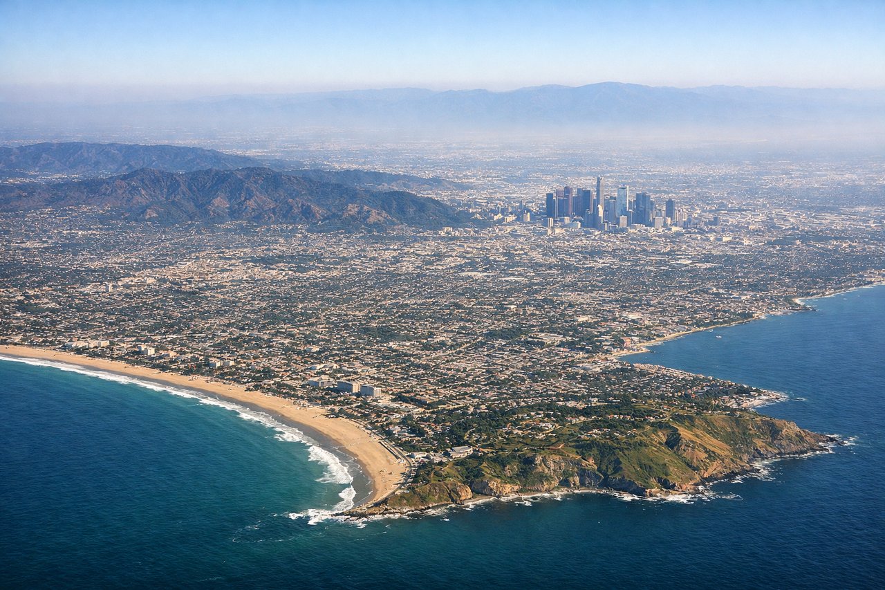
RIGHTLAX typically departs westbound over the ocean on runways 24L/24R, then turns north. The right side gives you the Santa Monica Bay coastline, the Palos Verdes Peninsula, and then as you bank north, the downtown LA skyline and the San Gabriel Mountains come into view. Left side faces open Pacific with little to see.
Landing at EDF
LEFTElmendorf AFB sits on the north side of Anchorage. Arrivals typically come in from the south or southeast. The left side gives you Cook Inlet, the Alaska Range including Denali on the distant horizon on clear days, and the Chugach Mountains flanking the city to the east. Right side faces inland terrain with less dramatic water views.
Landmarks on this routeAll landmarks →
Will your flight be in sunlight?
Pick a date and time in the Sun Map to watch the sun move across your whole flight.
About This Route
Which side of the plane should I sit on flying from Los Angeles International (LAX) to Elmendorf Afb (EDF)?
Sit on the Left side of the plane for the best views on flights from Los Angeles to Anchorage. Right side wins at takeoff but left side delivers the more dramatic landing sequence into Anchorage with Cook Inlet and the Chugach Mountains. Over the full flight, the left side also tracks closer to the British Columbia and Southeast Alaska coastline during cruise, offering occasional views of the Coast Mountains and glaciated terrain as you approach Alaska.
What can I see during takeoff from Los Angeles International in Los Angeles?
During takeoff from Los Angeles International (LAX), sit on the Right side for the best views. LAX typically departs westbound over the ocean on runways 24L/24R, then turns north. The right side gives you the Santa Monica Bay coastline, the Palos Verdes Peninsula, and then as you bank north, the downtown LA skyline and the San Gabriel Mountains come into view. Left side faces open Pacific with little to see. Notable sights include: Santa Monica Bay, Palos Verdes Peninsula, Downtown Los Angeles skyline, San Gabriel Mountains.
What can I see when landing at Elmendorf Afb in Anchorage?
When landing at Elmendorf Afb (EDF), sit on the Left side for the best views. Elmendorf AFB sits on the north side of Anchorage. Arrivals typically come in from the south or southeast. The left side gives you Cook Inlet, the Alaska Range including Denali on the distant horizon on clear days, and the Chugach Mountains flanking the city to the east. Right side faces inland terrain with less dramatic water views. Notable sights include: Cook Inlet, Chugach Mountains, Knik Arm, Anchorage city grid.
How long is the flight from Los Angeles to Anchorage?
The flight from Los Angeles International (LAX) to Elmendorf Afb (EDF) takes about 5 hours 15 minutes. The shortest flight path between them is 2,342 miles (3,768 km); winds and air traffic control usually add a few percent.
What does the Los Angeles to Anchorage flight path pass over?
The route tracks northwest over Central California, then crosses the Cascade Range over Oregon or Washington, passes over British Columbia with the Coast Mountains and their heavily glaciated peaks visible below, crosses the Gulf of Alaska approaches via the Alexander Archipelago and Southeast Alaska panhandle, and descends over the Kenai Peninsula and Cook Inlet into Anchorage. On clear days, significant glaciation is visible over the BC and Southeast Alaska Coast Mountains.