The right side captures the most dramatic and varied scenery: the LA skyline and San Gabriel Mountains at departure, glimpses of the Grand Canyon region and high desert during cruise, and the Blue Ridge Mountains and Shenandoah Valley on arrival into Dulles. The left side offers mostly flat desert, plains, and farmland with fewer standout features.
Flight Path
Mojave Desert, Grand Canyon region near the Arizona-Utah border, high plains of eastern New Mexico and the Texas Panhandle, Ozark Plateau, and the Appalachian Mountains before descent into Virginia
Great circle distance and headings ›.jpg?width=600)
.jpeg?width=600)
.jpg?width=600)
.jpg?width=600)

.jpeg?width=600)
Phase by phase
Takeoff from LAX
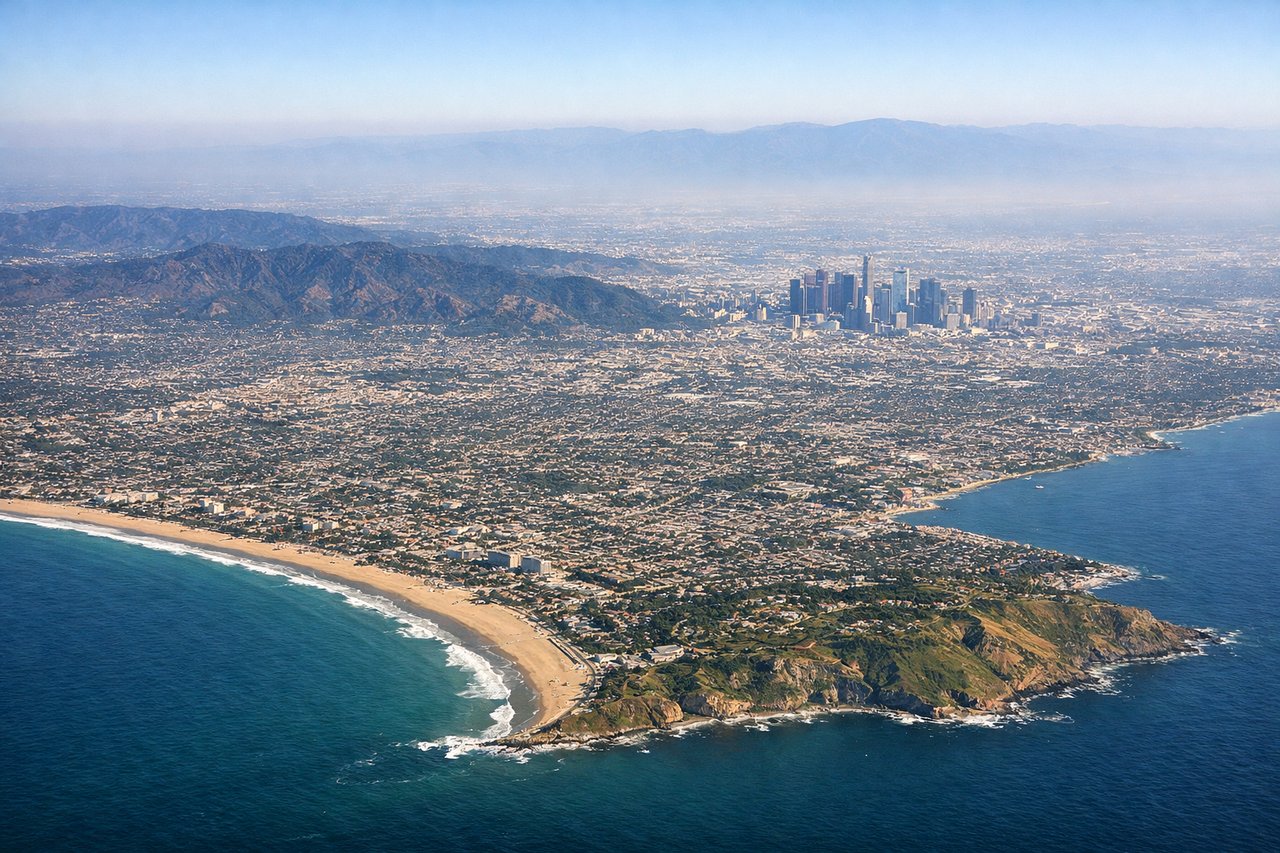
RIGHTEastbound departures off LAX's west-flow runways swing north over the Los Angeles basin before turning east, putting downtown LA's skyline, the Hollywood Hills, and the San Gabriel Mountains on the right side of the aircraft. The left side mostly shows the flat South Bay and Pacific horizon receding behind.
Landing at IAD
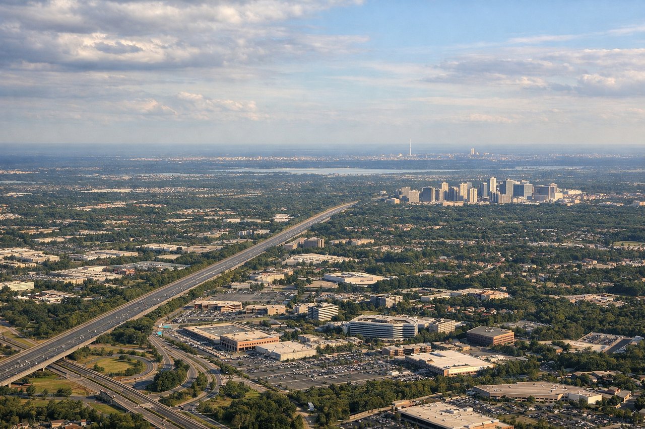
RIGHTOn the typical west-side approach into Dulles, the descent path crosses the Blue Ridge Mountains and the Shenandoah Valley before leveling out over the rolling Piedmont of northern Virginia, visible mainly on the right side of the cabin. The left side instead shows flatter farmland with fewer distinct landmarks.
Landmarks on this routeAll landmarks →
Will your flight be in sunlight?
See exactly which side of the plane gets sun and shade at your departure time.
About This Route
Which side of the plane should I sit on flying from Los Angeles International (LAX) to Washington Dulles International (IAD)?
Sit on the Right side of the plane for the best views on flights from Los Angeles to Washington. The right side captures the most dramatic and varied scenery: the LA skyline and San Gabriel Mountains at departure, glimpses of the Grand Canyon region and high desert during cruise, and the Blue Ridge Mountains and Shenandoah Valley on arrival into Dulles. The left side offers mostly flat desert, plains, and farmland with fewer standout features.
What can I see during takeoff from Los Angeles International in Los Angeles?
During takeoff from Los Angeles International (LAX), sit on the Right side for the best views. Eastbound departures off LAX's west-flow runways swing north over the Los Angeles basin before turning east, putting downtown LA's skyline, the Hollywood Hills, and the San Gabriel Mountains on the right side of the aircraft. The left side mostly shows the flat South Bay and Pacific horizon receding behind. Notable sights include: Downtown Los Angeles skyline, Hollywood Hills, San Gabriel Mountains, Santa Monica Bay coastline.
What can I see when landing at Washington Dulles International in Washington?
When landing at Washington Dulles International (IAD), sit on the Right side for the best views. On the typical west-side approach into Dulles, the descent path crosses the Blue Ridge Mountains and the Shenandoah Valley before leveling out over the rolling Piedmont of northern Virginia, visible mainly on the right side of the cabin. The left side instead shows flatter farmland with fewer distinct landmarks. Notable sights include: Blue Ridge Mountains, Shenandoah Valley, Northern Virginia Piedmont farmland, Potomac River tributaries.
How long is the flight from Los Angeles to Washington?
The flight from Los Angeles International (LAX) to Washington Dulles International (IAD) takes 4h50m.
What does the Los Angeles to Washington flight path pass over?
Mojave Desert, Grand Canyon region near the Arizona-Utah border, high plains of eastern New Mexico and the Texas Panhandle, Ozark Plateau, and the Appalachian Mountains before descent into Virginia