The left side captures the dramatic LA coastal departure and the Andean-influenced Lima approach, while the right side faces largely featureless open Pacific Ocean for most of the flight.
Flight Path
Pacific coastline of southern Mexico and Central America, Gulf of Panama, and the northern Peruvian coastal desert as the route parallels South America's western shore
Great circle distance and headings ›Phase by phase

Takeoff from LAX
LEFTIn LAX's typical west-flow departure, the aircraft climbs out over Santa Monica Bay then banks south, putting the Palos Verdes Peninsula, the LA basin skyline, and Catalina Island on the left side of the cabin. The right side only shows open Pacific horizon as the turn completes.
Landing at LIM
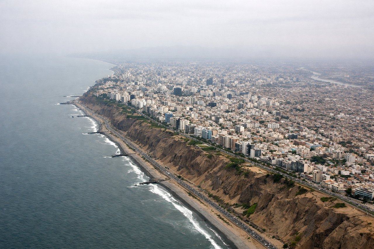
LEFTLima's runways operate almost exclusively to the south (16), so arriving flights descend from the north along the coast with the Andes foothills visible on the left and only open ocean on the right. The final turn onto approach keeps the desert coastal terrain and distant mountain ridges on the left side.
Landmarks on this routeAll landmarks →
Will your flight be in sunlight?
See exactly which side of the plane gets sun and shade at your departure time.
About This Route
Which side of the plane should I sit on flying from Los Angeles International (LAX) to Jorge Chávez International Airport (LIM)?
Sit on the Left side of the plane for the best views on flights from Los Angeles to Lima. The left side captures the dramatic LA coastal departure and the Andean-influenced Lima approach, while the right side faces largely featureless open Pacific Ocean for most of the flight.
What can I see during takeoff from Los Angeles International in Los Angeles?
During takeoff from Los Angeles International (LAX), sit on the Left side for the best views. In LAX's typical west-flow departure, the aircraft climbs out over Santa Monica Bay then banks south, putting the Palos Verdes Peninsula, the LA basin skyline, and Catalina Island on the left side of the cabin. The right side only shows open Pacific horizon as the turn completes. Notable sights include: Palos Verdes Peninsula, Santa Monica Bay, Catalina Island, Los Angeles basin skyline.
What can I see when landing at Jorge Chávez International Airport in Lima?
When landing at Jorge Chávez International Airport (LIM), sit on the Left side for the best views. Lima's runways operate almost exclusively to the south (16), so arriving flights descend from the north along the coast with the Andes foothills visible on the left and only open ocean on the right. The final turn onto approach keeps the desert coastal terrain and distant mountain ridges on the left side. Notable sights include: Andes foothills east of Lima, Rimac River valley, Lima's coastal desert cliffs, Pacific shoreline near Callao.
How long is the flight from Los Angeles to Lima?
The flight from Los Angeles International (LAX) to Jorge Chávez International Airport (LIM) takes 8h 30m.
What does the Los Angeles to Lima flight path pass over?
Pacific coastline of southern Mexico and Central America, Gulf of Panama, and the northern Peruvian coastal desert as the route parallels South America's western shore