The right side offers a more consistent scenic narrative: Pacific coastline and Catalina Island at takeoff, followed by long stretches of the Mexican and Central American Pacific coast during cruise, including glimpses of the Gulf of Tehuantepec and Nicaraguan coastline. The left side is only strongly scenic during the final approach into Costa Rica's volcanic highlands.
Flown LAX to LIR? Did we get it right?
Flight Path
Los Angeles to Liberia is 2,628 miles (4,230 km), a flight of about 5 hours 10 minutes.
Pacific coastline of mainland Mexico near Oaxaca, the Gulf of Tehuantepec, and the volcanic spine of Central America including Nicaragua's Lake Managua region
Great circle distance and headings ›Phase by phase
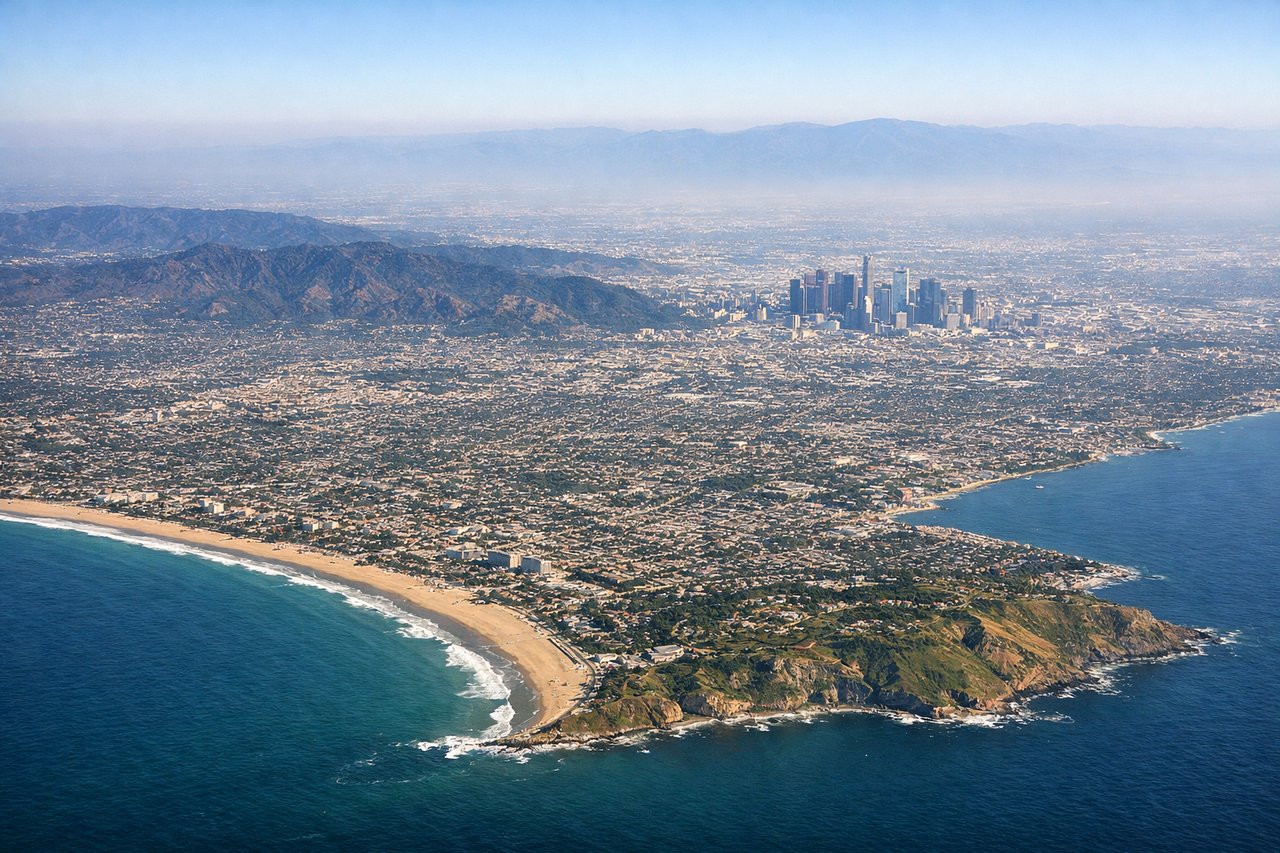
Takeoff from LAX
RIGHTIn LAX's typical west-flow departure, the aircraft climbs out over Santa Monica Bay before turning south, putting the Pacific coastline, Palos Verdes Peninsula, and Catalina Island on the right side. The left side mainly shows the flat LA basin and hazy San Gabriel foothills.
Landing at LIR
LEFTOn approach to LIR's Runway 07, the aircraft typically swings inland from the Gulf of Papagayo, bringing the volcanic cones of the Guanacaste range—Rincón de la Vieja and Miravalles—into view on the left side. This dry, rolling volcanic terrain is far more distinctive than the ocean glimpses on the right.
Will your flight be in sunlight?
Pick a date and time in the Sun Map to watch the sun move across your whole flight.
About This Route
Which side of the plane should I sit on flying from Los Angeles International (LAX) to Daniel Oduber Quiros International (LIR)?
Sit on the Right side of the plane for the best views on flights from Los Angeles to Liberia. The right side offers a more consistent scenic narrative: Pacific coastline and Catalina Island at takeoff, followed by long stretches of the Mexican and Central American Pacific coast during cruise, including glimpses of the Gulf of Tehuantepec and Nicaraguan coastline. The left side is only strongly scenic during the final approach into Costa Rica's volcanic highlands.
What can I see during takeoff from Los Angeles International in Los Angeles?
During takeoff from Los Angeles International (LAX), sit on the Right side for the best views. In LAX's typical west-flow departure, the aircraft climbs out over Santa Monica Bay before turning south, putting the Pacific coastline, Palos Verdes Peninsula, and Catalina Island on the right side. The left side mainly shows the flat LA basin and hazy San Gabriel foothills. Notable sights include: Santa Monica Bay, Palos Verdes Peninsula, Catalina Island, Pacific coastline.
What can I see when landing at Daniel Oduber Quiros International in Liberia?
When landing at Daniel Oduber Quiros International (LIR), sit on the Left side for the best views. On approach to LIR's Runway 07, the aircraft typically swings inland from the Gulf of Papagayo, bringing the volcanic cones of the Guanacaste range—Rincón de la Vieja and Miravalles—into view on the left side. This dry, rolling volcanic terrain is far more distinctive than the ocean glimpses on the right. Notable sights include: Rincón de la Vieja Volcano, Miravalles Volcano, Guanacaste dry forest plains, Gulf of Papagayo.
How long is the flight from Los Angeles to Liberia?
The flight from Los Angeles International (LAX) to Daniel Oduber Quiros International (LIR) takes about 5 hours 10 minutes. The shortest flight path between them is 2,628 miles (4,230 km); winds and air traffic control usually add a few percent.
What does the Los Angeles to Liberia flight path pass over?
Pacific coastline of mainland Mexico near Oaxaca, the Gulf of Tehuantepec, and the volcanic spine of Central America including Nicaragua's Lake Managua region