Los Angeles to Manzanillo is 1,330 miles (2,141 km), a flight of about 2 hours 55 minutes.
The right side delivers the spectacular LAX departure over Santa Monica Bay and Catalina Island, and during the cruise southward along the Mexican Pacific coast you get continuous views of the Baja California coastline and the Pacific. The landing view on the left is excellent but shorter in duration, making right the better overall seat for the full journey.
Flight Path
The flight tracks roughly south-southeast over the Pacific, passing offshore of the Baja California Peninsula. Right-side passengers may see the rugged spine of the Baja mountains and coastal desert terrain from a distance. As the route crosses into Mexican mainland airspace, the Sierra Madre Occidental foothills become visible. The coastline of Jalisco and Colima states appears in the final descent, with dense tropical vegetation replacing the desert terrain of Baja.
Great circle distance and headings ›Phase by phase
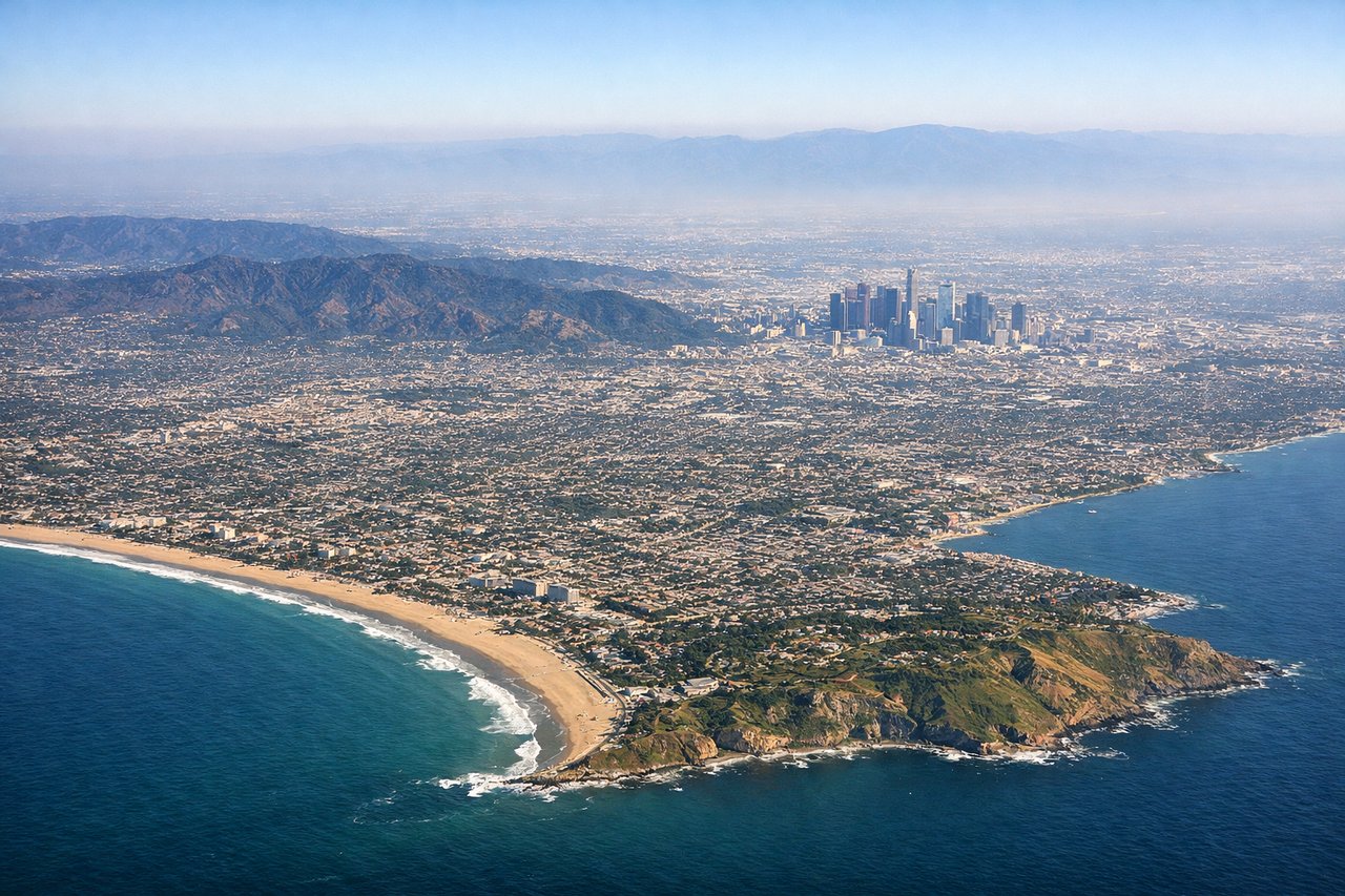
Takeoff from LAX
RIGHTLAX typically departs westward over the ocean on runways 24L/24R, then turns south. Right side gives you the Santa Monica Bay coastline, Palos Verdes Peninsula, and Catalina Island as the aircraft banks south. Left side faces inland toward the urban sprawl with less dramatic scenery.
Landing at ZLO
LEFTZLO sits on the Pacific coast and aircraft typically approach from the northwest or north, landing on runway 21 heading southwest. The left side faces east toward the Sierra Madre del Sur mountains and the lagoons of Manzanillo Bay, while the right side looks out over open ocean. The left gives you the dramatic bay, the twin lagoons of Cuyutlan and San Pedrito, and the jungle-covered mountains.
Landmarks on this routeAll landmarks →
Will your flight be in sunlight?
Pick a date and time in the Sun Map to watch the sun move across your whole flight.
About This Route
Which side of the plane should I sit on flying from Los Angeles International (LAX) to Playa De Oro International (ZLO)?
Sit on the Right side of the plane for the best views on flights from Los Angeles to Manzanillo. The right side delivers the spectacular LAX departure over Santa Monica Bay and Catalina Island, and during the cruise southward along the Mexican Pacific coast you get continuous views of the Baja California coastline and the Pacific. The landing view on the left is excellent but shorter in duration, making right the better overall seat for the full journey.
What can I see during takeoff from Los Angeles International in Los Angeles?
During takeoff from Los Angeles International (LAX), sit on the Right side for the best views. LAX typically departs westward over the ocean on runways 24L/24R, then turns south. Right side gives you the Santa Monica Bay coastline, Palos Verdes Peninsula, and Catalina Island as the aircraft banks south. Left side faces inland toward the urban sprawl with less dramatic scenery. Notable sights include: Santa Monica Bay, Palos Verdes Peninsula, Catalina Island (on clear days), Long Beach Harbor.
What can I see when landing at Playa De Oro International in Manzanillo?
When landing at Playa De Oro International (ZLO), sit on the Left side for the best views. ZLO sits on the Pacific coast and aircraft typically approach from the northwest or north, landing on runway 21 heading southwest. The left side faces east toward the Sierra Madre del Sur mountains and the lagoons of Manzanillo Bay, while the right side looks out over open ocean. The left gives you the dramatic bay, the twin lagoons of Cuyutlan and San Pedrito, and the jungle-covered mountains. Notable sights include: Manzanillo Bay, Laguna de Cuyutlan, Sierra Madre del Sur foothills, Santiago Peninsula.
How long is the flight from Los Angeles to Manzanillo?
The flight from Los Angeles International (LAX) to Playa De Oro International (ZLO) takes about 2 hours 55 minutes. The shortest flight path between them is 1,330 miles (2,141 km); winds and air traffic control usually add a few percent.
What does the Los Angeles to Manzanillo flight path pass over?
The flight tracks roughly south-southeast over the Pacific, passing offshore of the Baja California Peninsula. Right-side passengers may see the rugged spine of the Baja mountains and coastal desert terrain from a distance. As the route crosses into Mexican mainland airspace, the Sierra Madre Occidental foothills become visible. The coastline of Jalisco and Colima states appears in the final descent, with dense tropical vegetation replacing the desert terrain of Baja.