Luang Prabang to Hanoi is 252 miles (406 km), a flight of about 1 hour 15 minutes.
While right offers better takeoff views of the Mekong and karst terrain, left provides superior landing scenery with the Red River and Hanoi's dramatic urban landscape. The landing approach is longer and more visually rewarding, making left the better overall choice.
Flight Path
The flight path crosses the Vientiane Plain and follows the general corridor of the Mekong River northeastward. Notable midpoint features include the transition from Laotian limestone karst terrain to the flatter Vietnamese plains, scattered towns along the river valley (Vientiane visible to the left/south on departure), and the gradual shift from forested hills to agricultural lowlands as the aircraft approaches Hanoi. The terrain becomes progressively flatter and more densely populated moving northeast toward the Red River delta.
Great circle distance and headings ›Phase by phase
Takeoff from LPQ
RIGHTRight side captures the Mekong River valley and the dramatic terrain immediately north of Luang Prabang. The river's distinctive meanders and the surrounding limestone karst formations are prominent during the initial climb-out.
Landing at HAN
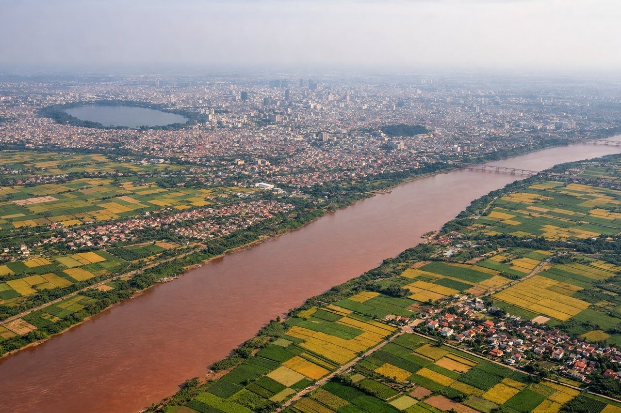
LEFTLeft side provides views of the Red River valley and Hanoi's urban sprawl during descent. The river's distinctive red-brown color and the transition from rural to dense urban landscape are visually striking on approach.
Landmarks on this routeAll landmarks →
Will your flight be in sunlight?
Pick a date and time in the Sun Map to watch the sun move across your whole flight.
About This Route
Which side of the plane should I sit on flying from Luang Prabang (LPQ) to Noibai International (HAN)?
Sit on the Left side of the plane for the best views on flights from Luang Prabang to Hanoi. While right offers better takeoff views of the Mekong and karst terrain, left provides superior landing scenery with the Red River and Hanoi's dramatic urban landscape. The landing approach is longer and more visually rewarding, making left the better overall choice.
What can I see during takeoff from Luang Prabang in Luang Prabang?
During takeoff from Luang Prabang (LPQ), sit on the Right side for the best views. Right side captures the Mekong River valley and the dramatic terrain immediately north of Luang Prabang. The river's distinctive meanders and the surrounding limestone karst formations are prominent during the initial climb-out. Notable sights include: Mekong River (winding through the valley below), limestone karst hills (north and northeast of airport), Luang Prabang city (visible briefly to the south), forested valleys extending northward.
What can I see when landing at Noibai International in Hanoi?
When landing at Noibai International (HAN), sit on the Left side for the best views. Left side provides views of the Red River valley and Hanoi's urban sprawl during descent. The river's distinctive red-brown color and the transition from rural to dense urban landscape are visually striking on approach. Notable sights include: Red River (visible as a wide, muddy-colored waterway), Hanoi city districts (expanding urban grid), surrounding agricultural plains (patchwork of rice paddies), limestone hills to the west.
How long is the flight from Luang Prabang to Hanoi?
The flight from Luang Prabang (LPQ) to Noibai International (HAN) takes about 1 hour 15 minutes. The shortest flight path between them is 252 miles (406 km); winds and air traffic control usually add a few percent.
What does the Luang Prabang to Hanoi flight path pass over?
The flight path crosses the Vientiane Plain and follows the general corridor of the Mekong River northeastward. Notable midpoint features include the transition from Laotian limestone karst terrain to the flatter Vietnamese plains, scattered towns along the river valley (Vientiane visible to the left/south on departure), and the gradual shift from forested hills to agricultural lowlands as the aircraft approaches Hanoi. The terrain becomes progressively flatter and more densely populated moving northeast toward the Red River delta.