Right side captures the most visually distinctive scenery: Tampa Bay and Gulf coastline on departure, then the flat inland transition across central Florida and Louisiana, with Galveston Bay visible on approach. Left side during takeoff shows only inland terrain.
Flown MCF to IAH? Did we get it right?
Flight Path
Tampa to Houston is 789 miles (1,269 km), a flight of about 2 hours 15 minutes.
Lake Okeechobee (visible as a large rectangular water body in south-central Florida), the transition from Florida's peninsula to the flat Louisiana coastal plain, and the Mississippi River delta region as you approach the Texas coast
Great circle distance and headings ›
Phase by phase
Takeoff from MCF
RIGHTRight side offers views of Tampa Bay and the Gulf of Mexico coastline immediately after departure. The aircraft climbs northwest from MacDill, so right-side windows capture the bay's distinctive shape and barrier islands before heading inland toward Houston.
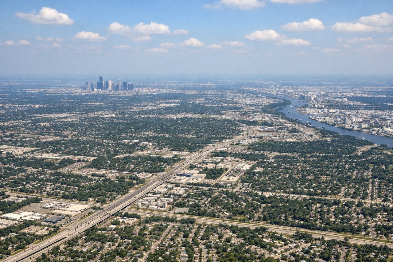
Landing at IAH
LEFTLeft side provides views of the Houston metropolitan area and Galveston Bay during descent. Aircraft approach IAH from the southeast, so left windows capture the sprawling city grid, Buffalo Bayou, and the bay's eastern shoreline as you descend toward the airport.
Will your flight be in sunlight?
Pick a date and time in the Sun Map to watch the sun move across your whole flight.
About This Route
Which side of the plane should I sit on flying from Macdill Afb (MCF) to George Bush Intcntl Houston (IAH)?
Sit on the Right side of the plane for the best views on flights from Tampa to Houston. Right side captures the most visually distinctive scenery: Tampa Bay and Gulf coastline on departure, then the flat inland transition across central Florida and Louisiana, with Galveston Bay visible on approach. Left side during takeoff shows only inland terrain.
What can I see during takeoff from Macdill Afb in Tampa?
During takeoff from Macdill Afb (MCF), sit on the Right side for the best views. Right side offers views of Tampa Bay and the Gulf of Mexico coastline immediately after departure. The aircraft climbs northwest from MacDill, so right-side windows capture the bay's distinctive shape and barrier islands before heading inland toward Houston. Notable sights include: Tampa Bay, Hillsborough Bay, Gulf of Mexico coastline, Clearwater and St. Petersburg barrier islands.
What can I see when landing at George Bush Intcntl Houston in Houston?
When landing at George Bush Intcntl Houston (IAH), sit on the Left side for the best views. Left side provides views of the Houston metropolitan area and Galveston Bay during descent. Aircraft approach IAH from the southeast, so left windows capture the sprawling city grid, Buffalo Bayou, and the bay's eastern shoreline as you descend toward the airport. Notable sights include: Houston city skyline, Buffalo Bayou, Galveston Bay, San Jacinto River.
How long is the flight from Tampa to Houston?
The flight from Macdill Afb (MCF) to George Bush Intcntl Houston (IAH) takes about 2 hours 15 minutes. The shortest flight path between them is 789 miles (1,269 km); winds and air traffic control usually add a few percent.
What does the Tampa to Houston flight path pass over?
Lake Okeechobee (visible as a large rectangular water body in south-central Florida), the transition from Florida's peninsula to the flat Louisiana coastal plain, and the Mississippi River delta region as you approach the Texas coast