The left side tracks the more dramatic western terrain for most of the flight — Hejaz mountains and Red Sea-adjacent terrain near departure, the Dead Sea rift and Levant coast at midpoint, and the Bosphorus and Istanbul skyline on arrival — while the right side mostly overlooks flat interior desert and Anatolian plateau farmland.
Flown MED to IST? Did we get it right?
Flight Path
Madinah to Istanbul is 1,316 miles (2,119 km), a flight of about 3 hours 50 minutes.
Jordan Rift Valley and the Dead Sea basin, the hills of the Golan/southern Levant, the Taurus Mountains fringe as the route crosses into Anatolia, and the broad Anatolian plateau leading toward Thrace
Great circle distance and headings ›

Phase by phase
Takeoff from MED
LEFTDeparting MED northbound, the Hejaz mountain escarpment and the volcanic lava fields (harrat) west of Madinah come into view on the left, giving the initial climb some real relief compared to the flat desert plains to the east.
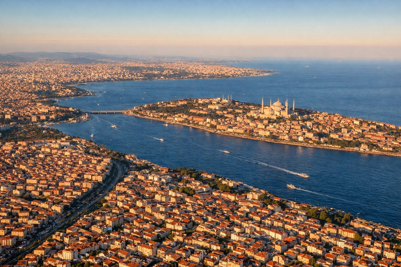
Landing at IST
LEFTOn approach into IST, especially with a southerly arrival over the Sea of Marmara, the left side offers views of the Marmara coastline, the Bosphorus strait, and Istanbul's dense urban skyline before touchdown, while the right side mostly shows inland Thracian farmland.
Will your flight be in sunlight?
Pick a date and time in the Sun Map to watch the sun move across your whole flight.
About This Route
Which side of the plane should I sit on flying from Prince Mohammad Bin Abdulaziz (MED) to İstanbul Airport (IST)?
Sit on the Left side of the plane for the best views on flights from Madinah to Istanbul. The left side tracks the more dramatic western terrain for most of the flight — Hejaz mountains and Red Sea-adjacent terrain near departure, the Dead Sea rift and Levant coast at midpoint, and the Bosphorus and Istanbul skyline on arrival — while the right side mostly overlooks flat interior desert and Anatolian plateau farmland.
What can I see during takeoff from Prince Mohammad Bin Abdulaziz in Madinah?
During takeoff from Prince Mohammad Bin Abdulaziz (MED), sit on the Left side for the best views. Departing MED northbound, the Hejaz mountain escarpment and the volcanic lava fields (harrat) west of Madinah come into view on the left, giving the initial climb some real relief compared to the flat desert plains to the east. Notable sights include: Madinah city and the Prophet's Mosque area, Hejaz escarpment, black harrat lava fields, fringes of the Red Sea coastal plain.
What can I see when landing at İstanbul Airport in Istanbul?
When landing at İstanbul Airport (IST), sit on the Left side for the best views. On approach into IST, especially with a southerly arrival over the Sea of Marmara, the left side offers views of the Marmara coastline, the Bosphorus strait, and Istanbul's dense urban skyline before touchdown, while the right side mostly shows inland Thracian farmland. Notable sights include: Sea of Marmara, Bosphorus strait, Istanbul city skyline, Prince Islands.
How long is the flight from Madinah to Istanbul?
The flight from Prince Mohammad Bin Abdulaziz (MED) to İstanbul Airport (IST) takes about 3 hours 50 minutes. The shortest flight path between them is 1,316 miles (2,119 km); winds and air traffic control usually add a few percent.
What does the Madinah to Istanbul flight path pass over?
Jordan Rift Valley and the Dead Sea basin, the hills of the Golan/southern Levant, the Taurus Mountains fringe as the route crosses into Anatolia, and the broad Anatolian plateau leading toward Thrace