Mosjoen to Panama City is 5,721 miles (9,206 km), a flight of about 13 hours 30 minutes.
While the takeoff offers Scandinavian fjord scenery, the landing approach over the Panama Canal and Gatun Lake provides more dramatic and visually distinctive features. The canal's engineering and the contrast between rainforest and water create more compelling viewing than the departure sequence.
Flight Path
The flight path crosses the Atlantic Ocean, passing over the British Isles and western Europe before heading southwest toward the Iberian Peninsula and across the Atlantic. Notable features include the North Sea, the Bay of Biscay, the Azores region (if visible), and the Caribbean approach. The majority of the flight is over open ocean with limited ground features visible except during the initial European departure and final Central American approach phases.
Great circle distance and headings ›


Phase by phase
Takeoff from MJF
LEFTLeft side offers views of the Scandinavian coastline and fjord systems as the aircraft climbs northwestward over the Norwegian Sea. The Trøndelag region's dramatic fjords and islands are clearly visible during initial climb.
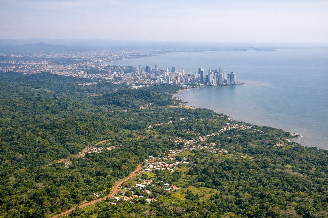
Landing at PTY
RIGHTRight side provides excellent views during descent into Panama City. The approach typically brings the aircraft over the Caribbean coast, revealing the Panama Canal, Gatun Lake, and the Darién region's dense rainforest before reaching Tocumen.
Landmarks on this routeAll landmarks →
Will your flight be in sunlight?
Pick a date and time in the Sun Map to watch the sun move across your whole flight.
About This Route
Which side of the plane should I sit on flying from Kjaerstad (MJF) to Tocumen International (PTY)?
Sit on the Right side of the plane for the best views on flights from Mosjoen to Panama City. While the takeoff offers Scandinavian fjord scenery, the landing approach over the Panama Canal and Gatun Lake provides more dramatic and visually distinctive features. The canal's engineering and the contrast between rainforest and water create more compelling viewing than the departure sequence.
What can I see during takeoff from Kjaerstad in Mosjoen?
During takeoff from Kjaerstad (MJF), sit on the Left side for the best views. Left side offers views of the Scandinavian coastline and fjord systems as the aircraft climbs northwestward over the Norwegian Sea. The Trøndelag region's dramatic fjords and islands are clearly visible during initial climb. Notable sights include: Trondheimsfjord, Froan archipelago, Norwegian coastline, North Sea.
What can I see when landing at Tocumen International in Panama City?
When landing at Tocumen International (PTY), sit on the Right side for the best views. Right side provides excellent views during descent into Panama City. The approach typically brings the aircraft over the Caribbean coast, revealing the Panama Canal, Gatun Lake, and the Darién region's dense rainforest before reaching Tocumen. Notable sights include: Panama Canal, Gatun Lake, Caribbean coastline, Darién rainforest.
How long is the flight from Mosjoen to Panama City?
The flight from Kjaerstad (MJF) to Tocumen International (PTY) takes about 13 hours 30 minutes. The shortest flight path between them is 5,721 miles (9,206 km); winds and air traffic control usually add a few percent.
What does the Mosjoen to Panama City flight path pass over?
The flight path crosses the Atlantic Ocean, passing over the British Isles and western Europe before heading southwest toward the Iberian Peninsula and across the Atlantic. Notable features include the North Sea, the Bay of Biscay, the Azores region (if visible), and the Caribbean approach. The majority of the flight is over open ocean with limited ground features visible except during the initial European departure and final Central American approach phases.