Masterton to Boston is 9,088 miles (14,625 km), a flight of about 17 hours 30 minutes.
While landing views favor the left, the takeoff from Masterton offers more dramatic and distinctive scenery with the Rimutaka Range and Wairarapa Valley. The right side captures the most visually striking portion of this long transpacific route's beginning.
Flight Path
This route crosses the Pacific Ocean for roughly 8,000+ nautical miles. Notable features include: the Cook Strait region during departure, the Pacific basin (largely featureless ocean), potential views of Hawaii or other Pacific island chains depending on routing, the North American west coast (California or Oregon coastline), the Sierra Nevada and Rocky Mountain ranges during the transcontinental segment, and the Appalachian Mountains before descent into Boston. Most of the flight occurs over open ocean with limited scenic landmarks.
Great circle distance and headings ›
.jpeg?width=600)
.jpg?width=600)
Phase by phase
Takeoff from MRO
RIGHTRight-side seats offer views of the Rimutaka Range and Wairarapa Valley during the initial climb-out from Masterton. The aircraft departs northeast, and right-side windows capture the dramatic escarpment and rolling farmland that define the region's topography.
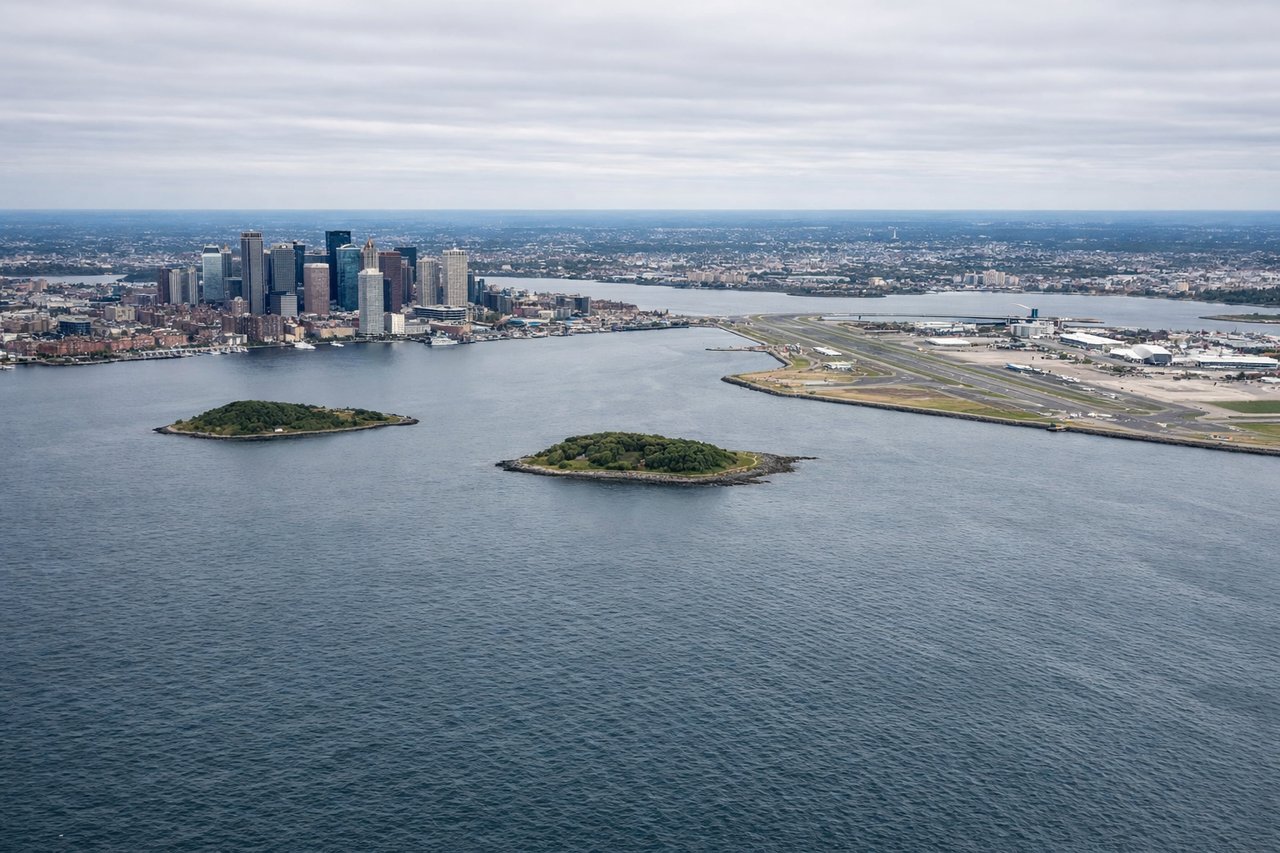
Landing at BOS
LEFTLeft-side seats provide excellent views during the final approach into Boston. The aircraft descends over the Atlantic coast, and left-side windows capture the Massachusetts coastline, Boston Harbor, and the distinctive urban grid of downtown Boston before touchdown.
Landmarks on this routeAll landmarks →
Will your flight be in sunlight?
Pick a date and time in the Sun Map to watch the sun move across your whole flight.
About This Route
Which side of the plane should I sit on flying from Masterton (MRO) to General Edward Lawrence Logan International (BOS)?
Sit on the Right side of the plane for the best views on flights from Masterton to Boston. While landing views favor the left, the takeoff from Masterton offers more dramatic and distinctive scenery with the Rimutaka Range and Wairarapa Valley. The right side captures the most visually striking portion of this long transpacific route's beginning.
What can I see during takeoff from Masterton in Masterton?
During takeoff from Masterton (MRO), sit on the Right side for the best views. Right-side seats offer views of the Rimutaka Range and Wairarapa Valley during the initial climb-out from Masterton. The aircraft departs northeast, and right-side windows capture the dramatic escarpment and rolling farmland that define the region's topography. Notable sights include: Rimutaka Range, Wairarapa Valley, Lake Wairarapa, Masterton urban area.
What can I see when landing at General Edward Lawrence Logan International in Boston?
When landing at General Edward Lawrence Logan International (BOS), sit on the Left side for the best views. Left-side seats provide excellent views during the final approach into Boston. The aircraft descends over the Atlantic coast, and left-side windows capture the Massachusetts coastline, Boston Harbor, and the distinctive urban grid of downtown Boston before touchdown. Notable sights include: Boston Harbor, Atlantic coastline, Charles River, downtown Boston skyline.
How long is the flight from Masterton to Boston?
The flight from Masterton (MRO) to General Edward Lawrence Logan International (BOS) takes about 17 hours 30 minutes. The shortest flight path between them is 9,088 miles (14,625 km); winds and air traffic control usually add a few percent.
What does the Masterton to Boston flight path pass over?
This route crosses the Pacific Ocean for roughly 8,000+ nautical miles. Notable features include: the Cook Strait region during departure, the Pacific basin (largely featureless ocean), potential views of Hawaii or other Pacific island chains depending on routing, the North American west coast (California or Oregon coastline), the Sierra Nevada and Rocky Mountain ranges during the transcontinental segment, and the Appalachian Mountains before descent into Boston. Most of the flight occurs over open ocean with limited scenic landmarks.