While the takeoff side favors the right with a brief Twin Cities skyline view, the left side wins the flight overall because it captures the Canadian Rockies during cruise near the Alberta-BC border and the dramatic Chugach Mountains and Turnagain Arm on final approach into Anchorage.
Flown MSP to ANC? Did we get it right?
Flight Path
Minneapolis to Anchorage is 2,512 miles (4,042 km), a flight of about 4 hours 45 minutes.
The route's midpoint falls over the northern Rocky Mountain Trench near the Alberta-British Columbia border, with forested ridgelines and the northern Canadian Rockies visible below before the terrain gives way to the boreal wilderness of the southern Yukon.
Great circle distance and headings ›


Phase by phase
Takeoff from MSP
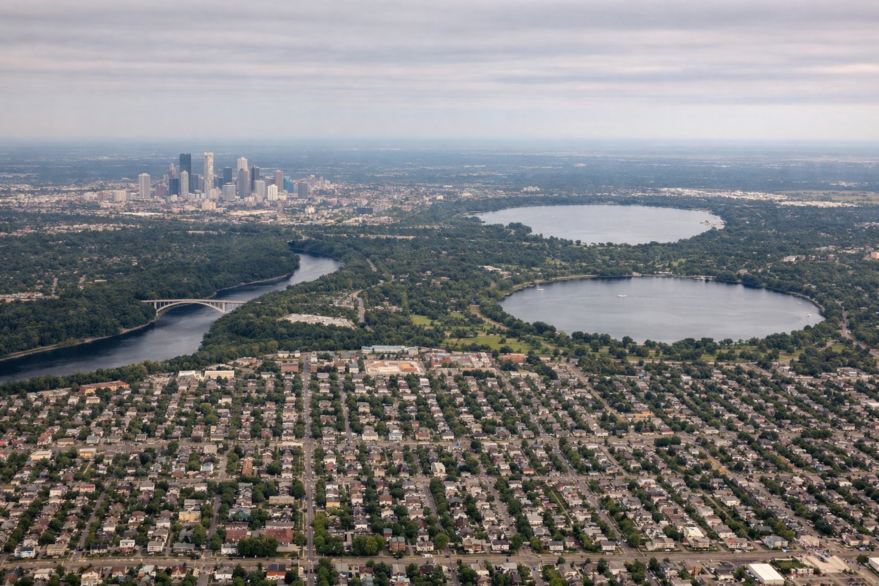
RIGHTDeparting MSP toward the northwest, the right side faces back toward St. Paul's downtown skyline and the Mississippi River bluffs before the plane climbs over the flat lake-dotted Minnesota countryside. The left side mostly shows flat farmland and suburban sprawl with fewer distinct landmarks.
Landing at ANC
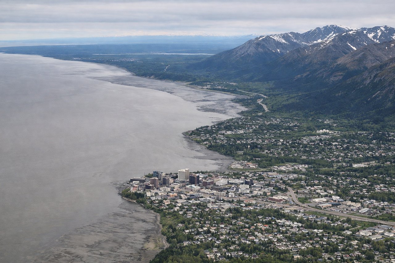
LEFTOn the descent into Anchorage from the northeast, the aircraft passes close to the Chugach Mountains and Turnagain Arm, which dominate the left side of the cabin as the plane lines up for landing. The right side faces toward the Susitna Valley and Cook Inlet, with Denali visible only as a distant, often hazy silhouette far to the north.
Will your flight be in sunlight?
Pick a date and time in the Sun Map to watch the sun move across your whole flight.
About This Route
Which side of the plane should I sit on flying from Minneapolis St Paul International (MSP) to Ted Stevens Anchorage International (ANC)?
Sit on the Left side of the plane for the best views on flights from Minneapolis to Anchorage. While the takeoff side favors the right with a brief Twin Cities skyline view, the left side wins the flight overall because it captures the Canadian Rockies during cruise near the Alberta-BC border and the dramatic Chugach Mountains and Turnagain Arm on final approach into Anchorage.
What can I see during takeoff from Minneapolis St Paul International in Minneapolis?
During takeoff from Minneapolis St Paul International (MSP), sit on the Right side for the best views. Departing MSP toward the northwest, the right side faces back toward St. Paul's downtown skyline and the Mississippi River bluffs before the plane climbs over the flat lake-dotted Minnesota countryside. The left side mostly shows flat farmland and suburban sprawl with fewer distinct landmarks. Notable sights include: Downtown St. Paul, Mississippi River, Minnesota lake country, Twin Cities suburbs.
What can I see when landing at Ted Stevens Anchorage International in Anchorage?
When landing at Ted Stevens Anchorage International (ANC), sit on the Left side for the best views. On the descent into Anchorage from the northeast, the aircraft passes close to the Chugach Mountains and Turnagain Arm, which dominate the left side of the cabin as the plane lines up for landing. The right side faces toward the Susitna Valley and Cook Inlet, with Denali visible only as a distant, often hazy silhouette far to the north. Notable sights include: Chugach Mountains, Turnagain Arm, Cook Inlet, Knik Arm.
How long is the flight from Minneapolis to Anchorage?
The flight from Minneapolis St Paul International (MSP) to Ted Stevens Anchorage International (ANC) takes about 4 hours 45 minutes. The shortest flight path between them is 2,512 miles (4,042 km); winds and air traffic control usually add a few percent.
What does the Minneapolis to Anchorage flight path pass over?
The route's midpoint falls over the northern Rocky Mountain Trench near the Alberta-British Columbia border, with forested ridgelines and the northern Canadian Rockies visible below before the terrain gives way to the boreal wilderness of the southern Yukon.