While takeoff favors the right for Minneapolis views, the landing approach on left side over Port Everglades and the Atlantic coastline is more visually distinctive and memorable. The contrast between ocean, port infrastructure, and developed beachfront outweighs the takeoff advantage.
Flown MSP to FLL? Did we get it right?
Flight Path
Minneapolis to Fort Lauderdale is 1,489 miles (2,396 km), a flight of about 3 hours 15 minutes.
The flight path crosses the Ohio River valley (visible around 1 hour into flight), the Appalachian foothills (eastern Tennessee/Kentucky), and the Great Smoky Mountains region. Around the 2-hour mark, you'll transition over Georgia and into the coastal plain. The Atlantic coastline becomes visible roughly 30 minutes before landing, with the Florida peninsula's distinctive shape becoming apparent. Weather permitting, you may see the Chattahoochee River valley and various reservoirs in the southeastern states during cruise altitude.
Great circle distance and headings ›


Phase by phase

Takeoff from MSP
RIGHTRight side captures the Mississippi River valley and downtown Minneapolis skyline during climb-out. MSP typically departs runways 04/22 or 09/27; regardless of direction, the right side offers the clearest view of the river's distinctive meandering pattern and urban core as you gain altitude.
Landing at FLL
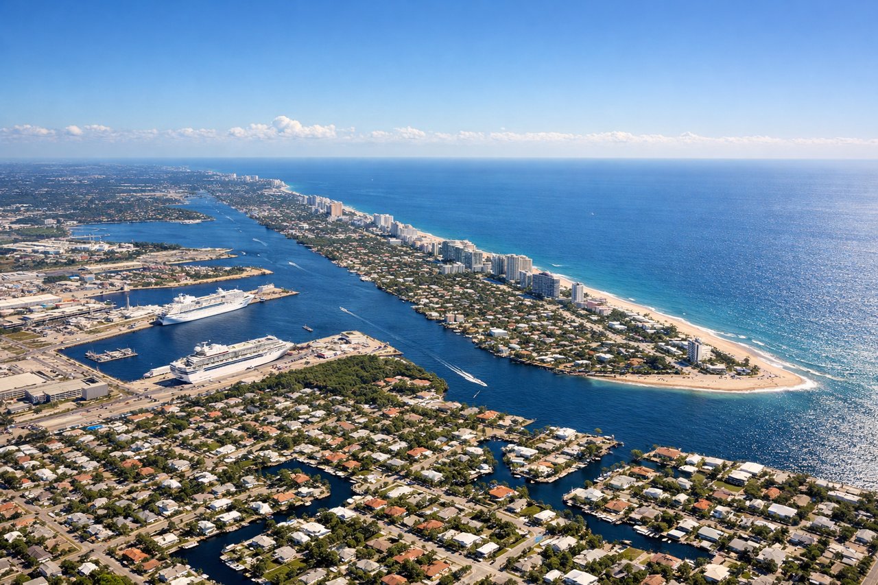
LEFTLeft side provides views of the Atlantic coastline, Port Everglades, and the Intracoastal Waterway during approach. FLL typically lands on runways 09/27; on left side you'll see the distinctive port infrastructure, cruise ship terminals, and the contrast between developed beachfront and open water.
Will your flight be in sunlight?
Pick a date and time in the Sun Map to watch the sun move across your whole flight.
About This Route
Which side of the plane should I sit on flying from Minneapolis St Paul International (MSP) to Fort Lauderdale Hollywood International (FLL)?
Sit on the Left side of the plane for the best views on flights from Minneapolis to Fort Lauderdale. While takeoff favors the right for Minneapolis views, the landing approach on left side over Port Everglades and the Atlantic coastline is more visually distinctive and memorable. The contrast between ocean, port infrastructure, and developed beachfront outweighs the takeoff advantage.
What can I see during takeoff from Minneapolis St Paul International in Minneapolis?
During takeoff from Minneapolis St Paul International (MSP), sit on the Right side for the best views. Right side captures the Mississippi River valley and downtown Minneapolis skyline during climb-out. MSP typically departs runways 04/22 or 09/27; regardless of direction, the right side offers the clearest view of the river's distinctive meandering pattern and urban core as you gain altitude. Notable sights include: Mississippi River (serpentine curves through Minneapolis), downtown Minneapolis skyline, Minnesota River confluence, Chain of Lakes (visible as dark water bodies southwest of downtown).
What can I see when landing at Fort Lauderdale Hollywood International in Fort Lauderdale?
When landing at Fort Lauderdale Hollywood International (FLL), sit on the Left side for the best views. Left side provides views of the Atlantic coastline, Port Everglades, and the Intracoastal Waterway during approach. FLL typically lands on runways 09/27; on left side you'll see the distinctive port infrastructure, cruise ship terminals, and the contrast between developed beachfront and open water. Notable sights include: Port Everglades (cruise ship terminals and cargo docks), Atlantic Ocean, Intracoastal Waterway (parallel to coast), Fort Lauderdale Beach and developed shoreline.
How long is the flight from Minneapolis to Fort Lauderdale?
The flight from Minneapolis St Paul International (MSP) to Fort Lauderdale Hollywood International (FLL) takes about 3 hours 15 minutes. The shortest flight path between them is 1,489 miles (2,396 km); winds and air traffic control usually add a few percent.
What does the Minneapolis to Fort Lauderdale flight path pass over?
The flight path crosses the Ohio River valley (visible around 1 hour into flight), the Appalachian foothills (eastern Tennessee/Kentucky), and the Great Smoky Mountains region. Around the 2-hour mark, you'll transition over Georgia and into the coastal plain. The Atlantic coastline becomes visible roughly 30 minutes before landing, with the Florida peninsula's distinctive shape becoming apparent. Weather permitting, you may see the Chattahoochee River valley and various reservoirs in the southeastern states during cruise altitude.