For most of the 13-hour flight the right side faces the mountainous, volcanic terrain of the route — the Alaska Range and Aleutians, then Kamchatka's volcanoes, the Kuril Islands, and Hokkaido/Honshu's coastline — culminating in a dramatic Tokyo Bay arrival with possible Fuji views. The left side spends most of the flight over open ocean with little to see.
Flown MSP to HND? Did we get it right?
Flight Path
Minneapolis to Tokyo is 5,967 miles (9,604 km), a flight of about 13 hours 5 minutes.
Gulf of Alaska and Aleutian chain, the Bering Sea, and the volcanic peaks of Russia's Kamchatka Peninsula
Great circle distance and headings ›


Phase by phase
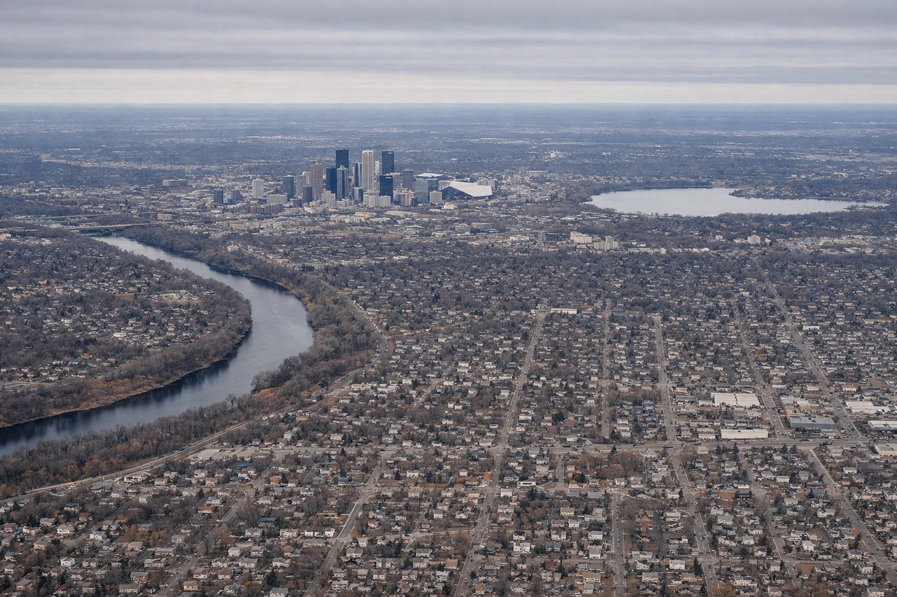
Takeoff from MSP
LEFTDeparting MSP to the northwest, the left side offers a good look at downtown Minneapolis's skyline, the Mississippi River, and the Chain of Lakes before the plane turns north over farmland. The right side mostly shows flat suburban sprawl and rural fields.
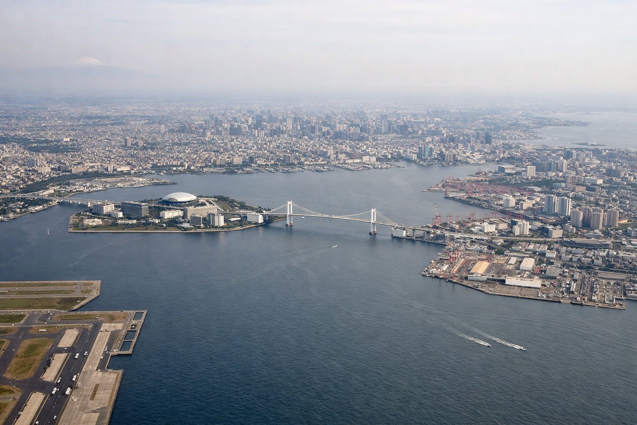
Landing at HND
RIGHTOn approach into Haneda, the flight path swings out over Tokyo Bay before turning onto final, putting the Tokyo skyline, the bay's reclaimed islands, and on clear days Mount Fuji on the right side. The left side mainly faces open water with fewer landmarks.
Will your flight be in sunlight?
Pick a date and time in the Sun Map to watch the sun move across your whole flight.
About This Route
Which side of the plane should I sit on flying from Minneapolis St Paul International (MSP) to Tokyo International (HND)?
Sit on the Right side of the plane for the best views on flights from Minneapolis to Tokyo. For most of the 13-hour flight the right side faces the mountainous, volcanic terrain of the route — the Alaska Range and Aleutians, then Kamchatka's volcanoes, the Kuril Islands, and Hokkaido/Honshu's coastline — culminating in a dramatic Tokyo Bay arrival with possible Fuji views. The left side spends most of the flight over open ocean with little to see.
What can I see during takeoff from Minneapolis St Paul International in Minneapolis?
During takeoff from Minneapolis St Paul International (MSP), sit on the Left side for the best views. Departing MSP to the northwest, the left side offers a good look at downtown Minneapolis's skyline, the Mississippi River, and the Chain of Lakes before the plane turns north over farmland. The right side mostly shows flat suburban sprawl and rural fields. Notable sights include: Downtown Minneapolis skyline, Mississippi River, Lake Calhoun/Bde Maka Ska and the Chain of Lakes, St. Paul in the distance.
What can I see when landing at Tokyo International in Tokyo?
When landing at Tokyo International (HND), sit on the Right side for the best views. On approach into Haneda, the flight path swings out over Tokyo Bay before turning onto final, putting the Tokyo skyline, the bay's reclaimed islands, and on clear days Mount Fuji on the right side. The left side mainly faces open water with fewer landmarks. Notable sights include: Tokyo Bay, Haneda's man-made runway islands, Odaiba and the Tokyo skyline, Mount Fuji on the horizon.
How long is the flight from Minneapolis to Tokyo?
The flight from Minneapolis St Paul International (MSP) to Tokyo International (HND) takes about 13 hours 5 minutes. The shortest flight path between them is 5,967 miles (9,604 km); winds and air traffic control usually add a few percent.
What does the Minneapolis to Tokyo flight path pass over?
Gulf of Alaska and Aleutian chain, the Bering Sea, and the volcanic peaks of Russia's Kamchatka Peninsula