The left side strings together the best moments of the whole flight: the Twin Cities and Mississippi River at departure, a glimpse of the Great Salt Lake and Wasatch Range over Utah, Nevada's desert basins, and finally the iconic Diamond Head and Waikiki approach into Honolulu — versus mostly plain farmland and open ocean on the right.
Flown MSP to HNL? Did we get it right?
Flight Path
Minneapolis to Honolulu is 3,967 miles (6,384 km), a flight of about 8 hours 15 minutes.
The great-circle path clips southeastern Idaho near the Great Salt Lake and Wasatch Range, crosses Nevada's Great Basin desert, and passes near the Sierra Nevada/southern Cascades (Mount Shasta area) in Northern California before a long, largely featureless Pacific Ocean crossing to the Hawaiian Islands.
Great circle distance and headings ›


Phase by phase
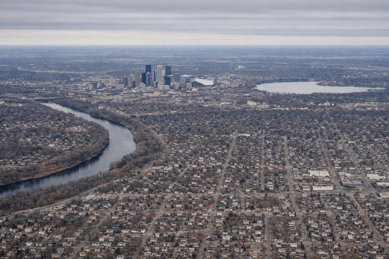
Takeoff from MSP
LEFTWestbound departures out of MSP typically bank south over the Twin Cities before settling on a westerly heading, putting downtown Minneapolis, the Mississippi River bends, and the metro's lake district in view on the left. The right side mostly shows featureless farmland north of the city.
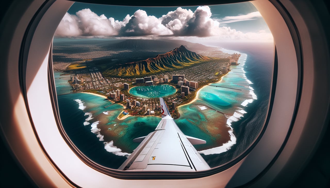
Landing at HNL
LEFTOn the descent into HNL, arriving flights commonly track along Oahu's south shore before turning for the reef runway, giving left-side passengers a clear look at Diamond Head crater, Waikiki's shoreline hotels, and downtown Honolulu. The right side during this leg mainly shows open ocean or the less distinctive windward Ko'olau slopes.
Will your flight be in sunlight?
Pick a date and time in the Sun Map to watch the sun move across your whole flight.
About This Route
Which side of the plane should I sit on flying from Minneapolis St Paul International (MSP) to Honolulu International (HNL)?
Sit on the Left side of the plane for the best views on flights from Minneapolis to Honolulu. The left side strings together the best moments of the whole flight: the Twin Cities and Mississippi River at departure, a glimpse of the Great Salt Lake and Wasatch Range over Utah, Nevada's desert basins, and finally the iconic Diamond Head and Waikiki approach into Honolulu — versus mostly plain farmland and open ocean on the right.
What can I see during takeoff from Minneapolis St Paul International in Minneapolis?
During takeoff from Minneapolis St Paul International (MSP), sit on the Left side for the best views. Westbound departures out of MSP typically bank south over the Twin Cities before settling on a westerly heading, putting downtown Minneapolis, the Mississippi River bends, and the metro's lake district in view on the left. The right side mostly shows featureless farmland north of the city. Notable sights include: Downtown Minneapolis skyline, Mississippi River, Lake Minnetonka and the Minneapolis lake chain, St. Paul riverfront.
What can I see when landing at Honolulu International in Honolulu?
When landing at Honolulu International (HNL), sit on the Left side for the best views. On the descent into HNL, arriving flights commonly track along Oahu's south shore before turning for the reef runway, giving left-side passengers a clear look at Diamond Head crater, Waikiki's shoreline hotels, and downtown Honolulu. The right side during this leg mainly shows open ocean or the less distinctive windward Ko'olau slopes. Notable sights include: Diamond Head crater, Waikiki Beach and hotel strip, downtown Honolulu skyline, Pearl Harbor.
How long is the flight from Minneapolis to Honolulu?
The flight from Minneapolis St Paul International (MSP) to Honolulu International (HNL) takes about 8 hours 15 minutes. The shortest flight path between them is 3,967 miles (6,384 km); winds and air traffic control usually add a few percent.
What does the Minneapolis to Honolulu flight path pass over?
The great-circle path clips southeastern Idaho near the Great Salt Lake and Wasatch Range, crosses Nevada's Great Basin desert, and passes near the Sierra Nevada/southern Cascades (Mount Shasta area) in Northern California before a long, largely featureless Pacific Ocean crossing to the Hawaiian Islands.