While takeoff offers good river views, the landing approach over the Strait of Georgia with the North Shore Mountains provides more dramatic and memorable scenery. The approach descent is the visual highlight of this route.
Flown MSP to YVR? Did we get it right?
Flight Path
Minneapolis to Vancouver is 1,432 miles (2,305 km), a flight of about 3 hours 45 minutes.
The flight path crosses northern Minnesota and passes over or near the Canadian Shield terrain, then transitions into British Columbia's interior plateau. Notable midpoint features include the transition from prairie to boreal forest around the Minnesota-Canada border, the Canadian Shield's lakes and forests (visible but less dramatic at cruise altitude), and the Rocky Mountain foothills appearing on the western horizon during the final descent phase into Vancouver. The route generally follows a northwest bearing, crossing relatively flat to gently rolling terrain for most of the journey before mountains become prominent in the final 45 minutes.
Great circle distance and headings ›


Phase by phase
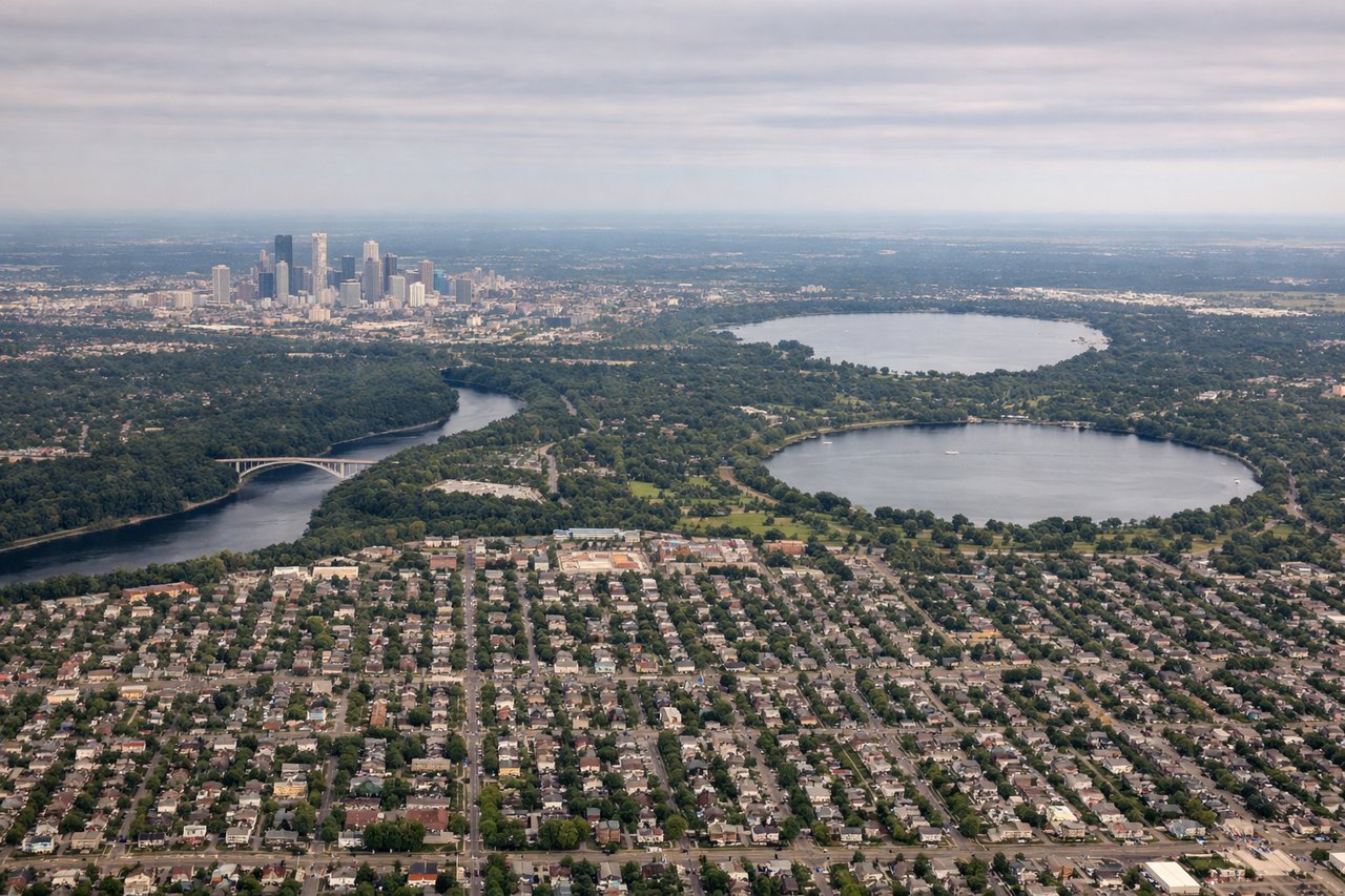
Takeoff from MSP
RIGHTRight-side seats capture the Mississippi River valley and urban Minneapolis sprawl during northwestbound climb. MSP typically departs runways 04L/04R or 09L/09R; northwest departures show the river's distinctive meanders and the city grid expanding below.
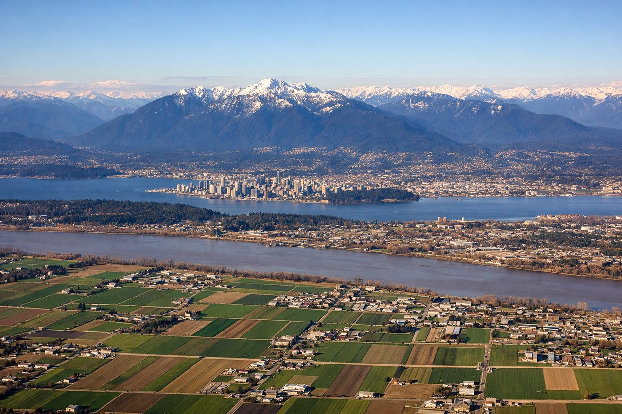
Landing at YVR
LEFTLeft seats offer the best approach views of the North Shore mountains and Strait of Georgia. YVR typically lands on runways 08L/08R or 26L/26R; eastbound approaches descending over water show the Coast Mountains rising dramatically and Vancouver's geography.
Will your flight be in sunlight?
Pick a date and time in the Sun Map to watch the sun move across your whole flight.
About This Route
Which side of the plane should I sit on flying from Minneapolis St Paul International (MSP) to Vancouver International (YVR)?
Sit on the Left side of the plane for the best views on flights from Minneapolis to Vancouver. While takeoff offers good river views, the landing approach over the Strait of Georgia with the North Shore Mountains provides more dramatic and memorable scenery. The approach descent is the visual highlight of this route.
What can I see during takeoff from Minneapolis St Paul International in Minneapolis?
During takeoff from Minneapolis St Paul International (MSP), sit on the Right side for the best views. Right-side seats capture the Mississippi River valley and urban Minneapolis sprawl during northwestbound climb. MSP typically departs runways 04L/04R or 09L/09R; northwest departures show the river's distinctive meanders and the city grid expanding below. Notable sights include: Mississippi River (meandering through downtown Minneapolis), Minneapolis-St. Paul urban corridor, Minnesota River confluence, Chain of Lakes district.
What can I see when landing at Vancouver International in Vancouver?
When landing at Vancouver International (YVR), sit on the Left side for the best views. Left seats offer the best approach views of the North Shore mountains and Strait of Georgia. YVR typically lands on runways 08L/08R or 26L/26R; eastbound approaches descending over water show the Coast Mountains rising dramatically and Vancouver's geography. Notable sights include: North Shore Mountains (Grouse, Seymour, Cypress peaks), Strait of Georgia, Vancouver Island distant horizon, Burrard Inlet.
How long is the flight from Minneapolis to Vancouver?
The flight from Minneapolis St Paul International (MSP) to Vancouver International (YVR) takes about 3 hours 45 minutes. The shortest flight path between them is 1,432 miles (2,305 km); winds and air traffic control usually add a few percent.
What does the Minneapolis to Vancouver flight path pass over?
The flight path crosses northern Minnesota and passes over or near the Canadian Shield terrain, then transitions into British Columbia's interior plateau. Notable midpoint features include the transition from prairie to boreal forest around the Minnesota-Canada border, the Canadian Shield's lakes and forests (visible but less dramatic at cruise altitude), and the Rocky Mountain foothills appearing on the western horizon during the final descent phase into Vancouver. The route generally follows a northwest bearing, crossing relatively flat to gently rolling terrain for most of the journey before mountains become prominent in the final 45 minutes.