Grant County Airport to Minneapolis is 1,256 miles (2,021 km), a flight of about 2 hours 55 minutes.
While takeoff favors right seats on eastbound departures, the landing approach to MSP strongly favors left seats for the Minnesota River valley and downtown Minneapolis views. Left side wins overall for the more dramatic final approach scenery.
Flight Path
The flight crosses central Washington and Idaho, passing south of the Spokane area. Notable midpoint features include the Columbia Plateau (agricultural terrain), the transition into the Palouse region (rolling hills), and eventually the Mississippi River valley as you approach Minnesota. The Cascade Range remains visible to the north for the first portion of the flight. No major mountain ranges are directly on the route, but the terrain gradually transitions from semi-arid plateau to more verdant Midwest agricultural land.
Great circle distance and headings ›.jpg?width=600)

Phase by phase
Takeoff from MWH
RIGHTMWH typically departs runway 27 (westbound) or 09 (eastbound). Right-side seats on an eastbound departure (runway 09) offer views of the Columbia River plateau terrain and the Cascade Range foothills to the east. Westbound departures favor left seats, but eastbound is more common for Minneapolis routing.
Landing at MSP
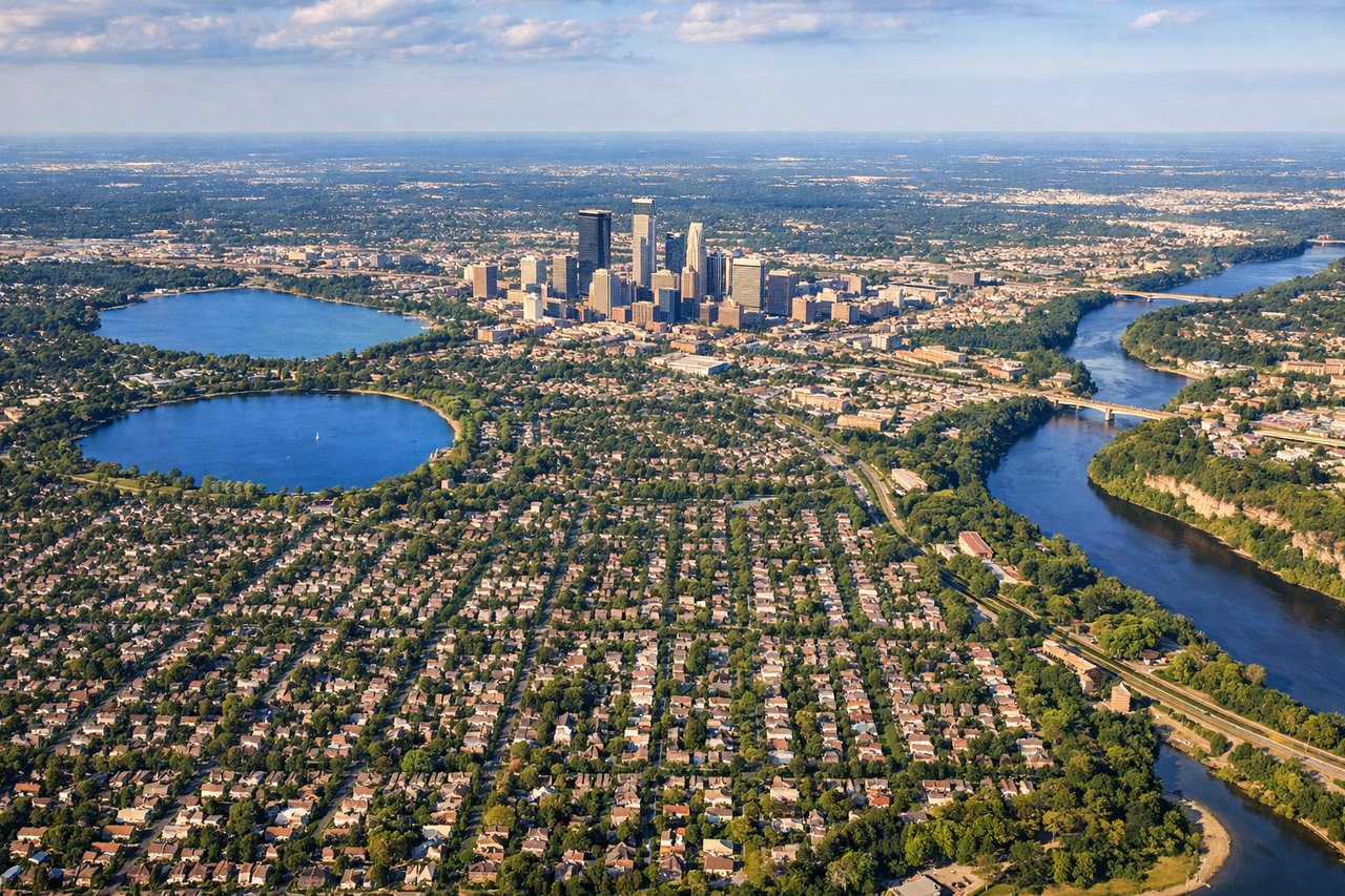
LEFTApproaching MSP typically uses runways 04R/04L or 22L/22R depending on wind. For a descent from the west (typical from MWH), left-side seats on approach to runway 04L offer views of the Minnesota River valley, downtown Minneapolis skyline, and the urban sprawl. Right seats see mostly suburban terrain.
Landmarks on this routeAll landmarks →
Will your flight be in sunlight?
Pick a date and time in the Sun Map to watch the sun move across your whole flight.
About This Route
Which side of the plane should I sit on flying from Grant Co International (MWH) to Minneapolis St Paul International (MSP)?
Sit on the Left side of the plane for the best views on flights from Grant County Airport to Minneapolis. While takeoff favors right seats on eastbound departures, the landing approach to MSP strongly favors left seats for the Minnesota River valley and downtown Minneapolis views. Left side wins overall for the more dramatic final approach scenery.
What can I see during takeoff from Grant Co International in Grant County Airport?
During takeoff from Grant Co International (MWH), sit on the Right side for the best views. MWH typically departs runway 27 (westbound) or 09 (eastbound). Right-side seats on an eastbound departure (runway 09) offer views of the Columbia River plateau terrain and the Cascade Range foothills to the east. Westbound departures favor left seats, but eastbound is more common for Minneapolis routing. Notable sights include: Columbia River (visible as a distinct linear water feature below), Cascade Range foothills (eastern horizon), Grant County agricultural plateau (patchwork fields in immediate climb-out), Wenatchee area to the south.
What can I see when landing at Minneapolis St Paul International in Minneapolis?
When landing at Minneapolis St Paul International (MSP), sit on the Left side for the best views. Approaching MSP typically uses runways 04R/04L or 22L/22R depending on wind. For a descent from the west (typical from MWH), left-side seats on approach to runway 04L offer views of the Minnesota River valley, downtown Minneapolis skyline, and the urban sprawl. Right seats see mostly suburban terrain. Notable sights include: Minnesota River valley (distinctive meandering waterway), Minneapolis downtown skyline (cluster of tall buildings), Mississippi River (visible as it flows through the metro area), suburban Twin Cities development.
How long is the flight from Grant County Airport to Minneapolis?
The flight from Grant Co International (MWH) to Minneapolis St Paul International (MSP) takes about 2 hours 55 minutes. The shortest flight path between them is 1,256 miles (2,021 km); winds and air traffic control usually add a few percent.
What does the Grant County Airport to Minneapolis flight path pass over?
The flight crosses central Washington and Idaho, passing south of the Spokane area. Notable midpoint features include the Columbia Plateau (agricultural terrain), the transition into the Palouse region (rolling hills), and eventually the Mississippi River valley as you approach Minnesota. The Cascade Range remains visible to the north for the first portion of the flight. No major mountain ranges are directly on the route, but the terrain gradually transitions from semi-arid plateau to more verdant Midwest agricultural land.